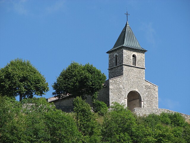
Contrevoz (Contrevoz)
- commune in Ain, France
Contrevoz is a small commune located in the Ain department of the Auvergne-Rhône-Alpes region in eastern France. While it may not be as widely known as some other hiking destinations, it offers a great opportunity to explore the natural beauty of the area.
Hiking Opportunities:
-
Scenic Trails: The region surrounding Contrevoz features a variety of landscapes, including rolling hills, forests, and agricultural fields. The trails often provide stunning views of the Bugey Mountains and the surrounding countryside.
-
Local Flora and Fauna: While hiking in Contrevoz, you'll have the chance to see diverse plant life and wildlife typical of the region. Keep an eye out for various bird species and other wildlife as you traverse the trails.
-
Cultural Points of Interest: Besides natural beauty, the area may have historical and cultural sites worth visiting. Look for local churches, farms, or other points of interest that can add to your hiking experience.
-
Accessibility: The trails around Contrevoz can cater to various skill levels, from family-friendly walks to more challenging hikes for experienced trekkers. Always check local maps or resources to choose the appropriate trail for your fitness level and experience.
-
Weather Considerations: The weather can vary greatly depending on the season, so it’s important to check forecasts and ensure you’re properly equipped for changing conditions. Spring and fall often offer the best hiking weather, while summer can be quite warm.
Tips for Hiking in Contrevoz:
- Gear Up: Wear appropriate footwear and clothing for hiking. Good hiking boots, breathable clothing, and enough layers for temperature changes are essential.
- Hydration: Carry plenty of water, especially during warmer months, and consider snacks or energy bars to keep your energy up during longer hikes.
- Trail Maps: Use local maps or hiking apps to navigate the trails and ensure you stay on course.
- Respect Nature: Always follow Leave No Trace principles to preserve the natural beauty of the area. This includes packing out all trash and sticking to established trails.
Whether you're looking for a leisurely walk or a more challenging hike, Contrevoz and its surrounding areas can provide a refreshing outdoor experience. Enjoy your hiking adventure!
- Country:

- Postal Code: 01300
- Coordinates: 45° 48' 22" N, 5° 37' 42" E


- GPS tracks (wikiloc): [Link]
- Area: 14.18 sq km
- Population: 503
- Web site: http://www.contrevoz.fr
- Wikipedia en: wiki(en)
- Wikipedia: wiki(fr)
- Wikidata storage: Wikidata: Q739814
- Wikipedia Commons Category: [Link]
- Wikipedia Commons Maps Category: [Link]
- Freebase ID: [/m/03cz125]
- Freebase ID: [/m/03cz125]
- Freebase ID: [/m/03cz125]
- GeoNames ID: Alt: [6424494]
- GeoNames ID: Alt: [6424494]
- GeoNames ID: Alt: [6424494]
- SIREN number: [210101168]
- SIREN number: [210101168]
- SIREN number: [210101168]
- INSEE municipality code: 01116
- INSEE municipality code: 01116
- INSEE municipality code: 01116
Shares border with regions:


Andert-et-Condon
- commune in Ain, France
Andert-et-Condon is a charming commune located in the Auvergne-Rhône-Alpes region of France, nestled in the natural beauty of the French countryside. While this area may not be as widely recognized as some of the more famous hiking spots in the Alps or the Pyrenees, it offers a unique and tranquil hiking experience for those looking to explore rural France....
- Country:

- Postal Code: 01300
- Coordinates: 45° 47' 41" N, 5° 39' 19" E


- GPS tracks (wikiloc): [Link]
- Area: 6.94 sq km
- Population: 342

Saint-Germain-les-Paroisses
- commune in Ain, France
 Hiking in Saint-Germain-les-Paroisses
Saint-Germain-les-Paroisses is a picturesque commune located in the Auvergne-Rhône-Alpes region of France. While it may not be one of the most famous hiking destinations, it offers a charming landscape that can be explored through various trails suitable for hiking enthusiasts....
- Country:

- Postal Code: 01300
- Coordinates: 45° 46' 25" N, 5° 37' 5" E


- GPS tracks (wikiloc): [Link]
- Area: 16.27 sq km
- Population: 426
- Web site: [Link]

Cheignieu-la-Balme
- commune in Ain, France
Cheignieu-la-Balme is a charming commune located in the Ain department of the Auvergne-Rhône-Alpes region in southeastern France. The area is known for its picturesque landscapes, rolling hills, forests, and proximity to the Rhône River, making it a wonderful place for hiking enthusiasts....
- Country:

- Postal Code: 01510
- Coordinates: 45° 49' 38" N, 5° 36' 28" E


- GPS tracks (wikiloc): [Link]
- Area: 6.26 sq km
- Population: 139

Innimond
- commune in Ain, France
Innimond is a beautiful area for hiking, characterized by its stunning natural scenery and diverse terrain. Although specific trail details may vary, here are some general tips and information about hiking in the Innimond region:...
- Country:

- Postal Code: 01680
- Coordinates: 45° 46' 58" N, 5° 34' 21" E


- GPS tracks (wikiloc): [Link]
- Area: 13.44 sq km
- Population: 106

Pugieu
- former commune in Ain, France
Pugieu is a small village located in the Auvergne-Rhône-Alpes region of France, surrounded by beautiful natural scenery that makes it an appealing destination for hiking enthusiasts. While Pugieu itself may not be widely known for specific hiking trails, the surrounding areas, including the Jura Mountains and other nearby natural parks, offer a range of trails suited for various skill levels....
- Country:

- Postal Code: 01510
- Coordinates: 45° 49' 16" N, 5° 38' 57" E


- GPS tracks (wikiloc): [Link]
- Area: 4.85 sq km
- Population: 151