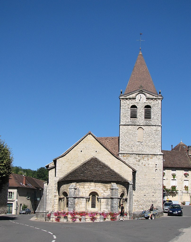
arrondissement of Belley (arrondissement de Belley)

- arrondissement of France
 Hiking in arrondissement of Belley
The Arrondissement of Belley, located in the beautiful Auvergne-Rhône-Alpes region of France, offers a variety of hiking opportunities characterized by stunning landscapes, charming villages, and rich natural biodiversity. Here are some highlights and tips for hiking in this region:
Trails and Natural Parks
-
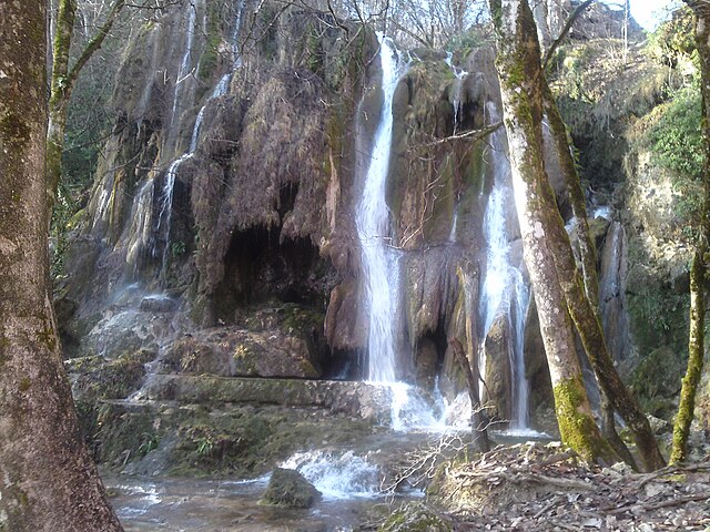
Parc Naturel Régional du Massif des Bauges: This regional park is just a short distance from Belley and features numerous trails through diverse landscapes, including mountains, forests, and lakes. Popular hikes include those around Lake Bourget, offering views of the lake and the surrounding mountains.
-
Mont du Chat: For more challenging hikes, Mont du Chat provides spectacular views over the Rhône Valley and Lake Bourget. The ascent can be steep but is rewarding, and there are various routes to the summit.
-
La Chartreuse Mountains: Located to the east of Belley, the Chartreuse Mountains offer spectacular trails that vary from easy to challenging. The terrain is a mix of forests, ridges, and impressive rock formations.
Recommendations
-
Difficulty Levels: There are hikes suitable for all levels, from easy walks ideal for families to strenuous trails for experienced hikers. Always check trail maps and difficulty levels before setting out.
-
Wildlife Watching: The region is home to a variety of wildlife, including deer, various bird species, and unique plant life. Take a moment to appreciate the natural beauty and local flora and fauna.
-
Local Guidance: Consider hiring a local guide or joining a hiking group if you are unfamiliar with the area. This can enhance the experience by providing insights into the local culture and environment.
-
Proper Gear: Ensure you have suitable hiking boots, weather-appropriate clothing, hydration packs, and food supplies, especially on longer hikes. Weather can change rapidly in mountainous areas, so be prepared.
Cultural Aspects
-
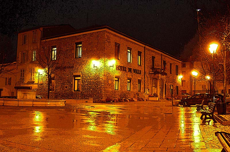
Villages and Heritage: Along your hikes, you can explore picturesque villages with traditional architecture, quaint shops, and local cuisine. Take the time to enjoy regional specialties such as cheeses and charcuterie.
-
Cultural Routes: Some trails include historical sites, including chapels and ruins, offering a glimpse into the region's history and culture.
Hiking in the Arrondissement of Belley provides a fantastic way to experience the natural beauty and cultural richness of the region. Always remember to practice Leave No Trace principles to help preserve this beautiful environment for future hikers!
- Country:

- Capital: Belley
- Coordinates: 45° 50' 0" N, 5° 40' 0" E


- GPS tracks (wikiloc): [Link]
- Population: 120134
- Wikipedia en: wiki(en)
- Wikipedia: wiki(fr)
- Wikidata storage: Wikidata: Q700647
- Freebase ID: [/m/095hfy]
- GeoNames ID: Alt: [3033623]
- INSEE arrondissement code: [011]
- GNS Unique Feature ID: -1411697
Includes regions:
canton of Lhuis
- canton of France (until March 2015)
Hiking in canton of Lhuis
Hiking in the Canton of Lhuis, which is located in the Ain department of the Auvergne-Rhône-Alpes region in southeastern France, offers beautiful landscapes and a variety of trails suitable for different skill levels. Here are some key points to consider when hiking in this area:...


canton of Hauteville-Lompnes
- canton of France
Hiking in canton of Hauteville-Lompnes
Hauteville-Lompnes is a charming commune located in the Ain department in the Auvergne-Rhône-Alpes region of France. It is situated in the picturesque Jura Mountains, which offer stunning landscapes and a variety of hiking opportunities....
- Country:
- Capital: Hauteville-Lompnes
- Coordinates: 45° 58' 45" N, 5° 36' 19" E
- GPS tracks (wikiloc): [Link]
- Area: 131.12 sq km
- Population: 22192

canton of Ambérieu-en-Bugey
- canton of France
Hiking in canton of Ambérieu-en-Bugey
The Canton of Ambérieu-en-Bugey, located in the Ain department of the Auvergne-Rhône-Alpes region in southeastern France, offers a variety of hiking opportunities suitable for all levels of outdoor enthusiasts. Here are some highlights and tips for hiking in this scenic area:...
- Country:
- Capital: Ambérieu-en-Bugey
- Coordinates: 45° 57' 47" N, 5° 21' 15" E
- GPS tracks (wikiloc): [Link]
- Population: 29969


canton of Belley
- canton of France
Hiking in canton of Belley
The Canton of Belley, located in the Ain department of the Auvergne-Rhône-Alpes region in southeastern France, offers a variety of beautiful hiking opportunities. This region is known for its stunning natural landscapes, with rolling hills, forests, and proximity to the Alps, making it a great destination for outdoor enthusiasts....
- Country:
- Capital: Belley
- Coordinates: 45° 45' 33" N, 5° 41' 21" E
- GPS tracks (wikiloc): [Link]
- Population: 24398

canton of Champagne-en-Valromey
- canton of France (until March 2015)
Hiking in canton of Champagne-en-Valromey
The Canton of Champagne-en-Valromey, located in the Auvergne-Rhône-Alpes region of France, offers a rich landscape for hiking enthusiasts. Nestled between the Jura mountains and the Rhône Valley, this area is characterized by its stunning natural beauty, charming villages, and diverse ecosystems. Here are some highlights of hiking in this region:...
- Country:
- Capital: Champagne-en-Valromey
- Coordinates: 45° 54' 16" N, 5° 40' 46" E
- GPS tracks (wikiloc): [Link]
- Area: 169.32 sq km
- Population: 5115


canton of Lagnieu
- canton of France
Hiking in canton of Lagnieu
The Canton of Lagnieu, located in the Ain department of the Auvergne-Rhône-Alpes region in southeastern France, offers a variety of hiking opportunities that cater to different skill levels and preferences. Here are some highlights of hiking in this picturesque area:...
- Country:
- Capital: Lagnieu
- Coordinates: 45° 54' 11" N, 5° 20' 52" E
- GPS tracks (wikiloc): [Link]
- Population: 33144

canton of Seyssel
- canton of France
Hiking in canton of Seyssel
The Canton of Seyssel, located in the Ain department of the Auvergne-Rhône-Alpes region in southeastern France, offers stunning landscapes and a variety of hiking opportunities. Set along the banks of the Rhône River and surrounded by the scenic Jura Mountains, this area is perfect for both novice and experienced hikers....
- Country:
- Capital: Seyssel
- Coordinates: 45° 58' 0" N, 5° 50' 0" E
- GPS tracks (wikiloc): [Link]
- Area: 100.71 sq km
- Population: 6499
canton of Virieu-le-Grand
- canton of France
Hiking in canton of Virieu-le-Grand
Virieu-le-Grand is located in the Ain department in the Auvergne-Rhône-Alpes region of France. The canton is known for its beautiful natural landscapes, making it an excellent destination for hiking enthusiasts....
- Country:
- Capital: Virieu-le-Grand
- Coordinates: 45° 50' 58" N, 5° 39' 6" E
- GPS tracks (wikiloc): [Link]

canton of Saint-Rambert-en-Bugey
- canton of France (until March 2015)
Hiking in canton of Saint-Rambert-en-Bugey
Hiking in the Canton of Saint-Rambert-en-Bugey offers a wonderful opportunity to explore the beautiful landscapes of the Auvergne-Rhône-Alpes region in France. Nestled within the natural beauty of the Bugey mountains, the area is characterized by diverse terrain, rich biodiversity, and scenic views....
- Country:
- Capital: Saint-Rambert-en-Bugey
- Coordinates: 45° 56' 49" N, 5° 26' 15" E
- GPS tracks (wikiloc): [Link]
- Area: 140.71 sq km
- Population: 4949