Cordemais (Cordemais)

- commune in Loire-Atlantique, France
- Country:

- Postal Code: 44360
- Coordinates: 47° 17' 25" N, 1° 52' 44" E


- GPS tracks (wikiloc): [Link]
- Area: 37.2 sq km
- Population: 3671
- Web site: http://www.cordemais.fr
- Wikipedia en: wiki(en)
- Wikipedia: wiki(fr)
- Wikidata storage: Wikidata: Q639618
- Wikipedia Commons Category: [Link]
- Freebase ID: [/m/03nwd1r]
- Freebase ID: [/m/03nwd1r]
- GeoNames ID: Alt: [3023697]
- GeoNames ID: Alt: [3023697]
- SIREN number: [214400459]
- SIREN number: [214400459]
- BnF ID: [15260214p]
- BnF ID: [15260214p]
- VIAF ID: Alt: [203328734]
- VIAF ID: Alt: [203328734]
- WOEID: [586968]
- WOEID: [586968]
- INSEE municipality code: 44045
- INSEE municipality code: 44045
Shares border with regions:

Le Temple-de-Bretagne
- commune in Loire-Atlantique, France
- Country:
- Postal Code: 44360
- Coordinates: 47° 19' 41" N, 1° 47' 24" E
- GPS tracks (wikiloc): [Link]
- Area: 1.6 sq km
- Population: 1889
- Web site: [Link]

Saint-Étienne-de-Montluc
- commune in Loire-Atlantique, France
- Country:
- Postal Code: 44360
- Coordinates: 47° 16' 35" N, 1° 46' 49" E
- GPS tracks (wikiloc): [Link]
- Area: 57.57 sq km
- Population: 6840
- Web site: [Link]


Le Pellerin
- commune in Loire-Atlantique, France
- Country:
- Postal Code: 44640
- Coordinates: 47° 11' 54" N, 1° 45' 14" E
- GPS tracks (wikiloc): [Link]
- Area: 30.65 sq km
- Population: 4964
- Web site: [Link]


Vigneux-de-Bretagne
- commune in Loire-Atlantique, France
- Country:
- Postal Code: 44360
- Coordinates: 47° 19' 32" N, 1° 44' 12" E
- GPS tracks (wikiloc): [Link]
- Area: 54.68 sq km
- Population: 5822
- Web site: [Link]

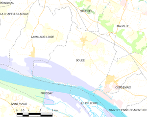
Bouée
- commune in Loire-Atlantique, France
- Country:
- Postal Code: 44260
- Coordinates: 47° 19' 15" N, 1° 54' 36" E
- GPS tracks (wikiloc): [Link]
- Area: 21.29 sq km
- Population: 937


Malville
- commune in Loire-Atlantique, France
- Country:
- Postal Code: 44260
- Coordinates: 47° 21' 40" N, 1° 51' 50" E
- GPS tracks (wikiloc): [Link]
- Area: 31.24 sq km
- Population: 3395