Coufouleux (Coufouleux)

- commune in Tarn, France
- Country:

- Postal Code: 81800
- Coordinates: 43° 49' 4" N, 1° 43' 51" E


- GPS tracks (wikiloc): [Link]
- Area: 27.16 sq km
- Population: 2787
- Web site: http://www.couffouleux.fr
- Wikipedia en: wiki(en)
- Wikipedia: wiki(fr)
- Wikidata storage: Wikidata: Q1614349
- Wikipedia Commons Category: [Link]
- Freebase ID: [/m/03npnh1]
- GeoNames ID: Alt: [3023309]
- SIREN number: [218100709]
- BnF ID: [15277376d]
- INSEE municipality code: 81070
Shares border with regions:

Rabastens
- commune in Tarn, France
- Country:
- Postal Code: 81800
- Coordinates: 43° 49' 20" N, 1° 43' 31" E
- GPS tracks (wikiloc): [Link]
- Area: 66.29 sq km
- Population: 5448
- Web site: [Link]

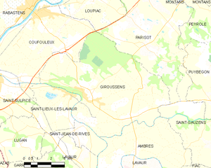
Giroussens
- commune in Tarn, France
- Country:
- Postal Code: 81500
- Coordinates: 43° 45' 44" N, 1° 46' 34" E
- GPS tracks (wikiloc): [Link]
- Area: 41.67 sq km
- Population: 1496
- Web site: [Link]


Saint-Lieux-lès-Lavaur
- commune in Tarn, France
- Country:
- Postal Code: 81500
- Coordinates: 43° 45' 55" N, 1° 45' 35" E
- GPS tracks (wikiloc): [Link]
- Area: 9.54 sq km
- Population: 1007
- Web site: [Link]
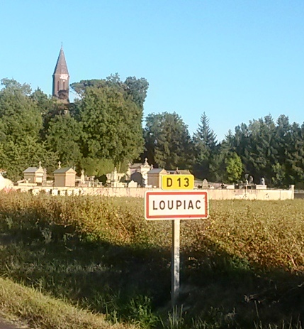

Loupiac
- commune in Tarn, France
- Country:
- Postal Code: 81800
- Coordinates: 43° 49' 40" N, 1° 46' 54" E
- GPS tracks (wikiloc): [Link]
- Area: 10.82 sq km
- Population: 398


Saint-Sulpice
- commune in Tarn, France
- Country:
- Postal Code: 81370
- Coordinates: 43° 46' 27" N, 1° 41' 11" E
- GPS tracks (wikiloc): [Link]
- AboveSeaLevel: 112 м m
- Area: 23.99 sq km
- Population: 8778
- Web site: [Link]