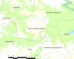
Cour-et-Buis (Cour-et-Buis)

- commune in Isère, France
 Hiking in Cour-et-Buis
Cour-et-Buis is a picturesque commune located in the Isère department in the Auvergne-Rhône-Alpes region of southeastern France. It offers beautiful natural landscapes, ideal for hiking enthusiasts. Here are some highlights about hiking in the area:
Scenic Trails
- Diverse Terrain: The region features a mix of wooded areas, gentle hills, and more challenging rocky outcrops, making it suitable for hikers of all levels.
- Beautiful Views: Many trails offer stunning panoramic views of the surrounding mountains and valleys, particularly the Vercors and Chartreuse ranges.
- Floral and Fauna: As you hike through the area, you can enjoy the local flora and fauna, including various wildflowers, trees, and possible sightings of wildlife.
Popular Hiking Routes
- Local Hiking Paths: Many marked trails connect Cour-et-Buis to nearby villages and scenic points. Look for local maps at tourist offices or online to find routes that suit your skill level.
- The Vercors Regional Natural Park: A short drive from Cour-et-Buis, the Vercors offers an extensive network of hiking trails, including routes that range from easy walks to more challenging treks.
Practical Considerations
- Best Time to Hike: Spring (April to June) and early fall (September to October) are ideal times for hiking in this region due to moderate temperatures and beautiful scenery.
- Gear: Depending on the trails, wear sturdy hiking boots and consider bringing trekking poles for uneven terrain. Always check the weather before heading out and dress in layers.
- Safety: Inform someone of your hiking plans, start early to avoid getting caught in the dark, and be prepared with enough water and snacks.
Local Amenities
- Accommodation: Nearby towns may provide options for lodging, from campsites to hotels.
- Refreshments: Look for local cafes and restaurants for meals and snacks after a day of hiking.
Conclusion
Cour-et-Buis is a hidden gem for hikers looking for beautiful scenery, varied terrain, and the opportunity to explore the stunning landscapes of the French Alps. Be sure to plan your hikes responsibly and enjoy the natural beauty this area has to offer!
- Country:

- Postal Code: 38122
- Coordinates: 45° 26' 25" N, 5° 0' 18" E


- GPS tracks (wikiloc): [Link]
- AboveSeaLevel: 462 м m
- Area: 13.73 sq km
- Population: 852
- Web site: http://www.couretbuis.fr
- Wikipedia en: wiki(en)
- Wikipedia: wiki(fr)
- Wikidata storage: Wikidata: Q1069854
- Wikipedia Commons Category: [Link]
- Freebase ID: [/m/03nvhhh]
- GeoNames ID: Alt: [6433180]
- SIREN number: [213801343]
- BnF ID: [15257957c]
- INSEE municipality code: 38134
Shares border with regions:

Saint-Julien-de-l'Herms
- commune in Isère, France
Hiking in Saint-Julien-de-l'Herms
Saint-Julien-de-l'Herms is a charming village located in the French Alps, known for its stunning natural landscapes and outdoor recreational opportunities....
- Country:
- Postal Code: 38122
- Coordinates: 45° 25' 57" N, 5° 5' 40" E
- GPS tracks (wikiloc): [Link]
- Area: 9.17 sq km
- Population: 144

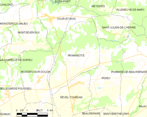
Primarette
- commune in Isère, France
Hiking in Primarette
It seems there might be a typo or misunderstanding regarding "Primarette." I am not familiar with a specific hiking location by that name. However, if you meant a different location, such as a national park, region, or trail, please clarify, and I’d be happy to provide information on hiking in that area!...
- Country:
- Postal Code: 38270
- Coordinates: 45° 24' 7" N, 5° 1' 49" E
- GPS tracks (wikiloc): [Link]
- Area: 21.76 sq km
- Population: 724
- Web site: [Link]


Montseveroux
- commune in Isère, France
Hiking in Montseveroux
Montseveroux is a beautiful area for hiking, located in the French Alps, specifically in the Isère department. The region is known for its stunning natural scenery, diverse landscapes, and the variety of trails suitable for different skill levels....
- Country:
- Postal Code: 38122
- Coordinates: 45° 25' 44" N, 4° 58' 15" E
- GPS tracks (wikiloc): [Link]
- Area: 16.48 sq km
- Population: 954
- Web site: [Link]


Meyssiez
- commune in Isère, France
Hiking in Meyssiez
Meyssiez is a small town located in the Auvergne-Rhône-Alpes region of France, surrounded by beautiful natural landscapes that make it a great spot for hiking enthusiasts. Here are some details about hiking in and around Meyssiez:...
- Country:
- Postal Code: 38440
- Coordinates: 45° 28' 13" N, 5° 3' 15" E
- GPS tracks (wikiloc): [Link]
- Area: 13.88 sq km
- Population: 619


Eyzin-Pinet
- commune in Isère, France
Hiking in Eyzin-Pinet
Eyzin-Pinet is a charming commune in the Isère department of France, located near the picturesque Rhône-Alpes region. While it may not be as famous as some other hiking destinations in the area, it offers beautiful landscapes and a chance to experience the natural beauty of the surrounding countryside....
- Country:
- Postal Code: 38780
- Coordinates: 45° 28' 23" N, 4° 59' 56" E
- GPS tracks (wikiloc): [Link]
- Area: 28.44 sq km
- Population: 2204
- Web site: [Link]