arrondissement of Vienne (arrondissement de Vienne)
- arrondissement of France
 Hiking in arrondissement of Vienne
The Arrondissement of Vienne, located in the Isère department in the Auvergne-Rhône-Alpes region of southeastern France, offers a variety of hiking opportunities that cater to both novice and experienced hikers. The area is characterized by its diverse landscapes, ranging from rolling hills to stunning mountain views, and numerous trails that provide access to natural beauty and historical sites.
Key Hiking Areas:
-
Chartreuse Mountains: Just a short distance from Vienne, the Chartreuse Mountains provide numerous trails with breathtaking views, particularly around the famous Grand Som mountain. Trails like the "Chemin des Crêtes" offer panoramic vistas and are popular among trekkers.
-
Pilat Regional Natural Park: Southeast of Vienne, Pilat Park features a variety of hiking routes through forests, ridges, and valleys. The area is known for its rich flora and fauna. The "Parcours de la Table d'Orientation" is a great trail that highlights the region's scenic views.
-
The Rhône River: Along the banks of the Rhône river, there are easier hiking paths suitable for family outings. These trails provide lovely views of the river and surrounding countryside, making them perfect for leisurely walks.
Popular Trails:
- Les Coteaux de Vienne: This trail takes you through the vineyards and hillsides overlooking Vienne, offering cultural landmarks and scenic beauty along the way.
- Le Sentier des Gorges de la Bourne: A stunning route that leads through gorges with opportunities to see local wildlife.
Tips for Hikers:
- Prepare for Varying Terrain: The trails can range from easy walks to more challenging hikes. Ensure you have appropriate footwear and check trail ratings.
- Weather Check: The weather can change rapidly in the mountains; always check forecasts and be prepared for rain or cooler temperatures.
- Hydration and Snacks: Bring enough water and snacks, especially if you plan a longer hike. There may be limited access to resources along the trails.
- Maps and Navigation: It's recommended to carry a map or a GPS device as some trails may not be well-marked. Local tourist offices can provide maps and guidance.
- Respect Nature: Follow the Leave No Trace principles to ensure the preservation of the natural environment for future hikers.
In conclusion, the Arrondissement of Vienne offers a rich hiking experience that blends the beauty of nature with cultural exploration. Whether you are looking for a challenging mountain path or a leisurely river stroll, you'll find ample opportunities to enjoy the great outdoors in this region.
- Country:

- Capital: Vienne
- Coordinates: 45° 30' 0" N, 5° 0' 0" E


- GPS tracks (wikiloc): [Link]
- Area: 1237 sq km
- Population: 210732
- Wikipedia en: wiki(en)
- Wikipedia: wiki(fr)
- Wikidata storage: Wikidata: Q702768
- Freebase ID: [/m/095hwp]
- GeoNames ID: Alt: [2969282]
- INSEE arrondissement code: [383]
- GNS Unique Feature ID: -1476208
Includes regions:

canton of Pont-de-Chéruy
- canton of France (until March 2015)
 Hiking in canton of Pont-de-Chéruy
Canton de Pont-de-Chéruy, located in the Isère department of the Auvergne-Rhône-Alpes region in southeastern France, offers various hiking opportunities amid beautiful landscapes. While it may not be as widely known as some larger national parks, it still has charm and scenic paths that are perfect for hiking enthusiasts....
- Country:

- Capital: Pont-de-Chéruy
- Coordinates: 45° 46' 8" N, 5° 9' 3" E


- GPS tracks (wikiloc): [Link]


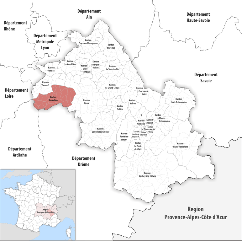
canton of Roussillon
- canton of France
 Hiking in canton of Roussillon
The Canton of Roussillon, located in the Vaucluse department of the Provence-Alpes-Côte d'Azur region in southeastern France, offers a beautiful and varied landscape for hiking enthusiasts. Known for its stunning natural beauty, cultural heritage, and picturesque villages, Roussillon is particularly famous for its ochre cliffs and vibrant colors, which create a unique setting for outdoor activities....
- Country:

- Capital: Roussillon
- Coordinates: 45° 23' 3" N, 4° 50' 0" E


- GPS tracks (wikiloc): [Link]
- Population: 46571

canton of Saint-Jean-de-Bournay
- canton of France
 Hiking in canton of Saint-Jean-de-Bournay
Canton de Saint-Jean-de-Bournay is a picturesque region located in the Isère department of southeastern France, offering a variety of hiking opportunities that cater to both casual walkers and more experienced hikers. The area is characterized by its rural landscapes, rolling hills, and scenic countryside, providing a serene backdrop for outdoor adventures....
- Country:

- Capital: Saint-Jean-de-Bournay
- Coordinates: 45° 30' 9" N, 5° 10' 22" E


- GPS tracks (wikiloc): [Link]

canton of Vienne-Nord
- canton of France
 Hiking in canton of Vienne-Nord
Canton de Vienne-Nord, located in the Isère department in the Auvergne-Rhône-Alpes region of France, is a great destination for hiking enthusiasts. The area features a picturesque landscape, including gentle hills, rivers, and forests. Here are some aspects to consider when planning a hiking adventure in this region:...

canton of La Côte-Saint-André
- canton of France (until March 2015)
 Hiking in canton of La Côte-Saint-André
Canton de La Côte-Saint-André, located in the Isère department of the Auvergne-Rhône-Alpes region in southeastern France, offers a variety of hiking opportunities amidst its beautiful landscapes. The area is characterized by rolling hills, lush forests, and scenic views of the surrounding mountains....
- Country:

- Capital: La Côte-Saint-André
- Coordinates: 45° 24' 24" N, 5° 13' 33" E


- GPS tracks (wikiloc): [Link]

canton of Heyrieux
- canton of France (until March 2015)
Canton d'Heyrieux, located in the Auvergne-Rhône-Alpes region of France, is a beautiful area for hiking enthusiasts. This canton is characterized by its diverse landscapes, including rolling hills, forests, and charming villages, making it a great destination for various hiking experiences....

canton of Beaurepaire
- canton of France (until March 2015)
 Hiking in canton of Beaurepaire
Canton de Beaurepaire, located in the Isère department in the Auvergne-Rhône-Alpes region of France, is a wonderful destination for hiking enthusiasts. This area boasts stunning natural landscapes, charming villages, and a rich cultural heritage, making it a great spot for outdoor adventures....
- Country:

- Capital: Beaurepaire
- Coordinates: 45° 23' 35" N, 5° 0' 53" E


- GPS tracks (wikiloc): [Link]

canton of Vienne-Sud
- canton of France (until March 2015)
 Hiking in canton of Vienne-Sud
Canton de Vienne-Sud, located in the department of Isère in the Auvergne-Rhône-Alpes region of France, offers diverse landscapes and a range of hiking opportunities for outdoor enthusiasts. Here are some highlights you can expect when hiking in this area:...