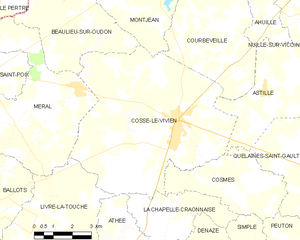
Courbeveille (Courbeveille)
- commune in Mayenne, France
- Country:

- Postal Code: 53230
- Coordinates: 47° 59' 34" N, 0° 53' 14" E


- GPS tracks (wikiloc): [Link]
- Area: 18.02 sq km
- Population: 635
- Web site: http://www.courbeveille.fr/
- Wikipedia en: wiki(en)
- Wikipedia: wiki(fr)
- Wikidata storage: Wikidata: Q662796
- Wikipedia Commons Category: [Link]
- Freebase ID: [/m/03qdd60]
- Freebase ID: [/m/03qdd60]
- GeoNames ID: Alt: [6449670]
- GeoNames ID: Alt: [6449670]
- SIREN number: [215300823]
- SIREN number: [215300823]
- BnF ID: [152638758]
- BnF ID: [152638758]
- INSEE municipality code: 53082
- INSEE municipality code: 53082
Shares border with regions:


Ahuillé
- commune in Mayenne, France
- Country:

- Postal Code: 53940
- Coordinates: 48° 1' 11" N, 0° 52' 14" E


- GPS tracks (wikiloc): [Link]
- Area: 29.87 sq km
- Population: 1806
- Web site: [Link]


Astillé
- commune in Mayenne, France
- Country:

- Postal Code: 53230
- Coordinates: 47° 57' 47" N, 0° 51' 6" E


- GPS tracks (wikiloc): [Link]
- Area: 20.73 sq km
- Population: 865
- Web site: [Link]


Montjean
- commune in Mayenne, France
- Country:

- Postal Code: 53320
- Coordinates: 48° 0' 22" N, 0° 57' 33" E


- GPS tracks (wikiloc): [Link]
- Area: 19.75 sq km
- Population: 1023


Cossé-le-Vivien
- commune in Mayenne, France
- Country:

- Postal Code: 53230
- Coordinates: 47° 56' 43" N, 0° 54' 42" E


- GPS tracks (wikiloc): [Link]
- Area: 44.41 sq km
- Population: 3057
- Web site: [Link]
