Montjean (Montjean)

- commune in Mayenne, France
- Country:

- Postal Code: 53320
- Coordinates: 48° 0' 22" N, 0° 57' 33" E


- GPS tracks (wikiloc): [Link]
- Area: 19.75 sq km
- Population: 1023
- Wikipedia en: wiki(en)
- Wikipedia: wiki(fr)
- Wikidata storage: Wikidata: Q548886
- Wikipedia Commons Category: [Link]
- Freebase ID: [/m/03qfbgn]
- GeoNames ID: Alt: [6454289]
- SIREN number: [215301581]
- BnF ID: [15263951j]
- INSEE municipality code: 53158
Shares border with regions:


Ahuillé
- commune in Mayenne, France
- Country:
- Postal Code: 53940
- Coordinates: 48° 1' 11" N, 0° 52' 14" E
- GPS tracks (wikiloc): [Link]
- Area: 29.87 sq km
- Population: 1806
- Web site: [Link]


Saint-Cyr-le-Gravelais
- commune in Mayenne, France
- Country:
- Postal Code: 53320
- Coordinates: 48° 2' 6" N, 1° 1' 38" E
- GPS tracks (wikiloc): [Link]
- Area: 19.82 sq km
- Population: 538


Courbeveille
- commune in Mayenne, France
- Country:
- Postal Code: 53230
- Coordinates: 47° 59' 34" N, 0° 53' 14" E
- GPS tracks (wikiloc): [Link]
- Area: 18.02 sq km
- Population: 635
- Web site: [Link]

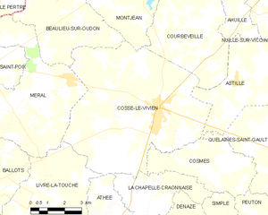
Cossé-le-Vivien
- commune in Mayenne, France
- Country:
- Postal Code: 53230
- Coordinates: 47° 56' 43" N, 0° 54' 42" E
- GPS tracks (wikiloc): [Link]
- Area: 44.41 sq km
- Population: 3057
- Web site: [Link]

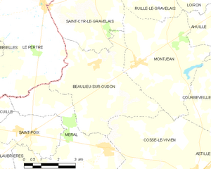
Beaulieu-sur-Oudon
- commune in Mayenne, France
- Country:
- Postal Code: 53320
- Coordinates: 48° 0' 15" N, 0° 59' 37" E
- GPS tracks (wikiloc): [Link]
- Area: 19.73 sq km
- Population: 488

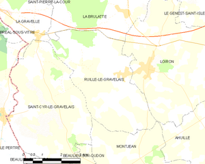
Ruillé-le-Gravelais
- former commune in Mayenne, France
- Country:
- Postal Code: 53320
- Coordinates: 48° 3' 21" N, 0° 57' 19" E
- GPS tracks (wikiloc): [Link]
- Area: 16.94 sq km
- Population: 951
- Web site: [Link]