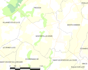
Courdemanche, Sarthe (Courdemanche)
- commune in Sarthe, France
- Country:

- Postal Code: 72150
- Coordinates: 47° 48' 52" N, 0° 33' 46" E


- GPS tracks (wikiloc): [Link]
- Area: 24.02 sq km
- Population: 616
- Wikipedia en: wiki(en)
- Wikipedia: wiki(fr)
- Wikidata storage: Wikidata: Q733914
- Wikipedia Commons Category: [Link]
- Freebase ID: [/m/03qk1v0]
- GeoNames ID: Alt: [6442549]
- SIREN number: [217201037]
- BnF ID: [15273659p]
- INSEE municipality code: 72103
Shares border with regions:

Lhomme
- commune in Sarthe, France
- Country:

- Postal Code: 72340
- Coordinates: 47° 44' 37" N, 0° 33' 32" E


- GPS tracks (wikiloc): [Link]
- Area: 18.32 sq km
- Population: 889
- Web site: [Link]


Saint-Georges-de-la-Couée
- commune in Sarthe, France
- Country:

- Postal Code: 72150
- Coordinates: 47° 50' 30" N, 0° 34' 54" E


- GPS tracks (wikiloc): [Link]
- Area: 11.68 sq km
- Population: 157


Montreuil-le-Henri
- commune in Sarthe, France
- Country:

- Postal Code: 72150
- Coordinates: 47° 52' 1" N, 0° 33' 54" E


- GPS tracks (wikiloc): [Link]
- Area: 14.39 sq km
- Population: 307


Saint-Pierre-du-Lorouër
- commune in Sarthe, France
- Country:

- Postal Code: 72150
- Coordinates: 47° 48' 20" N, 0° 31' 20" E


- GPS tracks (wikiloc): [Link]
- Area: 16.55 sq km
- Population: 376


Ruillé-sur-Loir
- former commune in Sarthe, France
- Country:

- Postal Code: 72340
- Coordinates: 47° 45' 2" N, 0° 37' 14" E


- GPS tracks (wikiloc): [Link]
- Area: 39.48 sq km
- Population: 1207


Le Grand-Lucé
- commune in Sarthe, France
- Country:

- Postal Code: 72150
- Coordinates: 47° 51' 54" N, 0° 28' 10" E


- GPS tracks (wikiloc): [Link]
- Area: 27.26 sq km
- Population: 1917


Saint-Vincent-du-Lorouër
- commune in Sarthe, France
- Country:

- Postal Code: 72150
- Coordinates: 47° 49' 32" N, 0° 29' 20" E


- GPS tracks (wikiloc): [Link]
- Area: 26.96 sq km
- Population: 876
