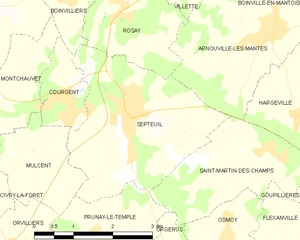
Courgent (Courgent)

- commune in Yvelines, France
- Country:

- Postal Code: 78790
- Coordinates: 48° 53' 29" N, 1° 39' 45" E


- GPS tracks (wikiloc): [Link]
- Area: 2.02 sq km
- Population: 388
- Wikipedia en: wiki(en)
- Wikipedia: wiki(fr)
- Wikidata storage: Wikidata: Q491155
- Wikipedia Commons Category: [Link]
- Freebase ID: [/m/03qf_hy]
- Freebase ID: [/m/03qf_hy]
- GeoNames ID: Alt: [3023031]
- GeoNames ID: Alt: [3023031]
- SIREN number: [217801851]
- SIREN number: [217801851]
- BnF ID: [15275937p]
- BnF ID: [15275937p]
- INSEE municipality code: 78185
- INSEE municipality code: 78185
Shares border with regions:

Septeuil
- commune in Yvelines, France
- Country:
- Postal Code: 78790
- Coordinates: 48° 53' 33" N, 1° 40' 53" E
- GPS tracks (wikiloc): [Link]
- Area: 9.4 sq km
- Population: 2341

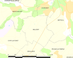
Mulcent
- commune in Yvelines, France
- Country:
- Postal Code: 78790
- Coordinates: 48° 52' 44" N, 1° 39' 6" E
- GPS tracks (wikiloc): [Link]
- Area: 3.54 sq km
- Population: 108


Boinvilliers
- commune in Yvelines, France
- Country:
- Postal Code: 78200
- Coordinates: 48° 55' 4" N, 1° 39' 38" E
- GPS tracks (wikiloc): [Link]
- Area: 3.59 sq km
- Population: 294


Montchauvet
- commune in Yvelines, France
- Country:
- Postal Code: 78790
- Coordinates: 48° 53' 29" N, 1° 37' 47" E
- GPS tracks (wikiloc): [Link]
- Area: 7.98 sq km
- Population: 273