Coussan (Coussan)

- commune in Hautes-Pyrénées, France
- Country:

- Postal Code: 65350
- Coordinates: 43° 14' 36" N, 0° 12' 24" E


- GPS tracks (wikiloc): [Link]
- Area: 3.12 sq km
- Population: 116
- Wikipedia en: wiki(en)
- Wikipedia: wiki(fr)
- Wikidata storage: Wikidata: Q1092950
- Wikipedia Commons Category: [Link]
- Freebase ID: [/m/03nv4qv]
- Freebase ID: [/m/03nv4qv]
- GeoNames ID: Alt: [6440701]
- GeoNames ID: Alt: [6440701]
- SIREN number: [216501536]
- SIREN number: [216501536]
- BnF ID: [152705330]
- BnF ID: [152705330]
- INSEE municipality code: 65153
- INSEE municipality code: 65153
Shares border with regions:

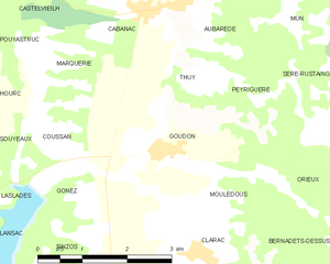
Goudon
- commune in Hautes-Pyrénées, France
- Country:
- Postal Code: 65190
- Coordinates: 43° 14' 35" N, 0° 13' 59" E
- GPS tracks (wikiloc): [Link]
- Area: 7.53 sq km
- Population: 233


Souyeaux
- commune in Hautes-Pyrénées, France
- Country:
- Postal Code: 65350
- Coordinates: 43° 14' 27" N, 0° 10' 28" E
- GPS tracks (wikiloc): [Link]
- Area: 6.02 sq km
- Population: 306


Marquerie
- commune in Hautes-Pyrénées, France
- Country:
- Postal Code: 65350
- Coordinates: 43° 15' 34" N, 0° 12' 10" E
- GPS tracks (wikiloc): [Link]
- Area: 3.46 sq km
- Population: 76


Laslades
- commune in Hautes-Pyrénées, France
- Country:
- Postal Code: 65350
- Coordinates: 43° 13' 41" N, 0° 10' 5" E
- GPS tracks (wikiloc): [Link]
- Area: 5.26 sq km
- Population: 363


Gonez
- commune in Hautes-Pyrénées, France
- Country:
- Postal Code: 65350
- Coordinates: 43° 13' 58" N, 0° 12' 49" E
- GPS tracks (wikiloc): [Link]
- Area: 1.08 sq km
- Population: 29

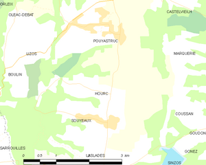
Hourc
- commune in Hautes-Pyrénées, France
- Country:
- Postal Code: 65350
- Coordinates: 43° 14' 58" N, 0° 10' 15" E
- GPS tracks (wikiloc): [Link]
- Area: 2 sq km
- Population: 111