Crèvecœur-le-Petit (Crèvecœur-le-Petit)

- commune in Oise, France
- Country:

- Postal Code: 60420
- Coordinates: 49° 34' 37" N, 2° 30' 13" E


- GPS tracks (wikiloc): [Link]
- Area: 3.33 sq km
- Population: 136
- Wikipedia en: wiki(en)
- Wikipedia: wiki(fr)
- Wikidata storage: Wikidata: Q742387
- Wikipedia Commons Category: [Link]
- Freebase ID: [/m/03qg4l5]
- GeoNames ID: Alt: [6615059]
- SIREN number: [216001784]
- BnF ID: [152674189]
- INSEE municipality code: 60179
Shares border with regions:

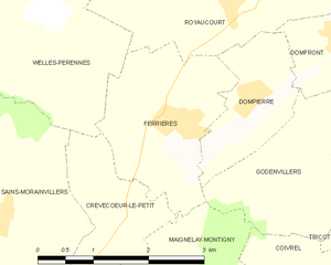
Ferrières
- commune in Oise, France
- Country:
- Postal Code: 60420
- Coordinates: 49° 35' 23" N, 2° 31' 8" E
- GPS tracks (wikiloc): [Link]
- Area: 4.81 sq km
- Population: 508
- Web site: [Link]


Sains-Morainvillers
- commune in Oise, France
- Country:
- Postal Code: 60420
- Coordinates: 49° 34' 25" N, 2° 28' 14" E
- GPS tracks (wikiloc): [Link]
- Area: 12.42 sq km
- Population: 278


Welles-Pérennes
- commune in Oise, France
- Country:
- Postal Code: 60420
- Coordinates: 49° 36' 29" N, 2° 29' 0" E
- GPS tracks (wikiloc): [Link]
- Area: 13.41 sq km
- Population: 260
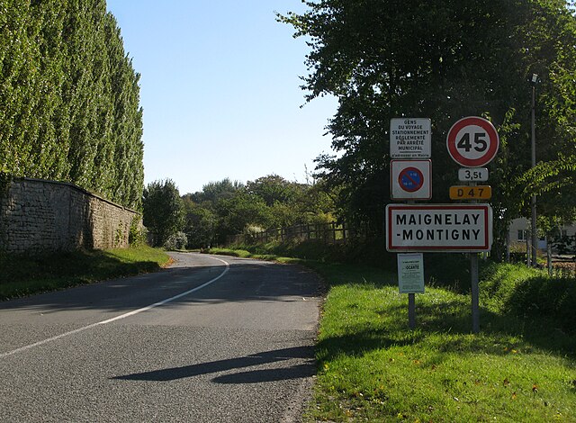

Maignelay-Montigny
- commune in Oise, France
- Country:
- Postal Code: 60420
- Coordinates: 49° 33' 8" N, 2° 31' 13" E
- GPS tracks (wikiloc): [Link]
- Area: 18.79 sq km
- Population: 2703
- Web site: [Link]