Crespadoro (Crespadoro)
.svg)
- Italian comune
 Hiking in Crespadoro
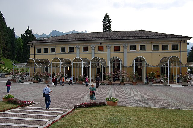
Crespadoro is a charming locality in the province of Vicenza, in the Veneto region of Italy. Nestled in the foothills of the Lessini Mountains, it offers picturesque landscapes, lush forests, and a network of hiking trails suitable for various skill levels. Here are some highlights and tips for hiking in Crespadoro:
Trails and Routes
-
Sentiero dei Piani di Crespadoro: This trail takes you through stunning panoramas and is perfect for both beginners and experienced hikers. It features gentle slopes and is well-marked.
-
Monte Cesen: For a more challenging hike, you can take the route to Monte Cesen, where the views from the summit are breathtaking. This hike can take several hours and is best suited for more experienced hikers.
-
Connect with Nature: Trails often pass through lush woodlands and open meadows, providing opportunities to see local wildlife and flora typical of the Veneto region.
Best Time to Hike
- Spring and Fall: These are ideal seasons for hiking as the weather is mild, and the landscapes are particularly beautiful. Wildflowers bloom in spring, while fall offers stunning autumn colors.
Tips for Hiking in Crespadoro
- Gear Up: Ensure you have the right hiking gear, including sturdy footwear, a backpack, and enough water and snacks.
- Local Guidance: Consider hiring a local guide or joining a hiking group for more insight into the area’s natural history and best trails.
- Respect Nature: Follow the Leave No Trace principles to respect the surrounding environment, and always stick to marked trails.
- Stay Informed: Check local weather conditions before heading out, and be aware of any trail advisories.
Nearby Attractions
After your hike, explore the local villages or try some traditional Venetian cuisine in Crespadoro. The area is rich in history and culture, making it a great destination for both outdoor activities and relaxation.
Hiking in Crespadoro offers a unique opportunity to experience the natural beauty of Italy while enjoying a peaceful environment away from the crowds. Enjoy your adventures!
- Country:

- Postal Code: 36070
- Local Dialing Code: 0444
- Licence Plate Code: VI
- Coordinates: 45° 37' 9" N, 11° 13' 34" E


- GPS tracks (wikiloc): [Link]
- AboveSeaLevel: 363 м m
- Area: 30.2 sq km
- Population: 1322
- Web site: http://www.comune.crespadoro.vi.it/
- Wikipedia en: wiki(en)
- Wikipedia: wiki(it)
- Wikidata storage: Wikidata: Q46300
- Wikipedia Commons Category: [Link]
- Freebase ID: [/m/0g8p1t]
- GeoNames ID: Alt: [6538261]
- OSM relation ID: [45554]
- WOEID: [714825]
- ISTAT ID: 024037
- Italian cadastre code: D156
Shares border with regions:


Ala
- Italian comune
Hiking in Ala
Ala, located in the Trentino region of northern Italy, is a great base for hiking enthusiasts. Nestled in the Vallagarina valley, it offers a variety of trails that range from easy walks to more challenging hikes, all set against the backdrop of stunning landscapes, vineyards, and historical sites....
- Country:
- Postal Code: 38061
- Local Dialing Code: 0464
- Licence Plate Code: TN
- Coordinates: 45° 45' 0" N, 11° 0' 0" E
- GPS tracks (wikiloc): [Link]
- AboveSeaLevel: 210 м m
- Area: 119.87 sq km
- Population: 8887
- Web site: [Link]

Recoaro Terme
- Italian comune
Hiking in Recoaro Terme
Recoaro Terme is a beautiful destination in the Veneto region of Italy, nestled in the foothills of the Alps. Known for its thermal springs and picturesque landscapes, it's a great spot for hiking enthusiasts of all levels. Here are some highlights for hiking in Recoaro Terme:...
- Country:
- Postal Code: 36076
- Local Dialing Code: 0445
- Licence Plate Code: VI
- Coordinates: 45° 42' 0" N, 11° 14' 0" E
- GPS tracks (wikiloc): [Link]
- AboveSeaLevel: 445 м m
- Area: 60.15 sq km
- Population: 6306
- Web site: [Link]
Altissimo
- Italian comune
Hiking in Altissimo
Altissimo, located in the Veneto region of Italy, is known for its stunning natural beauty and diverse hiking opportunities. It sits within the Lessini Mountains, which provide a picturesque backdrop for outdoor activities....
- Country:
- Postal Code: 36070
- Local Dialing Code: 0444
- Licence Plate Code: VI
- Coordinates: 45° 36' 53" N, 11° 15' 3" E
- GPS tracks (wikiloc): [Link]
- AboveSeaLevel: 115 м m
- Area: 15.09 sq km
- Population: 2227
- Web site: [Link]


Valdagno
- Italian comune
Hiking in Valdagno
Valdagno, located in the province of Vicenza in Italy's Veneto region, is an excellent base for hiking enthusiasts. The town is set in a picturesque valley surrounded by the rugged foothills of the Lessini Mountains and offers a variety of trails that cater to all levels of hikers....
- Country:
- Postal Code: 36074; 36078
- Local Dialing Code: 0445
- Licence Plate Code: VI
- Coordinates: 45° 39' 0" N, 11° 18' 0" E
- GPS tracks (wikiloc): [Link]
- AboveSeaLevel: 260 м m
- Area: 50.22 sq km
- Population: 26016
- Web site: [Link]


Vestenanova
- Italian comune
Hiking in Vestenanova
Vestenanova is a charming destination in Serbia that offers a mix of natural beauty and cultural heritage, making it an excellent spot for hiking. Here are some key points to consider if you’re planning a hiking trip in the area:...
- Country:
- Postal Code: 37030
- Local Dialing Code: 045
- Licence Plate Code: VR
- Coordinates: 45° 34' 0" N, 11° 14' 0" E
- GPS tracks (wikiloc): [Link]
- AboveSeaLevel: 515 м m
- Area: 24.18 sq km
- Population: 2569
- Web site: [Link]
Selva di Progno
- Italian comune
Hiking in Selva di Progno
Selva di Progno, located in the Veneto region of Italy, is a beautiful village nestled in the Lessinia Mountains. It offers a range of hiking opportunities suitable for various skill levels, making it an excellent destination for outdoor enthusiasts. Here’s what you should know about hiking in this picturesque area:...
- Country:
- Postal Code: 37030
- Local Dialing Code: 045
- Licence Plate Code: VR
- Coordinates: 45° 37' 0" N, 11° 8' 0" E
- GPS tracks (wikiloc): [Link]
- AboveSeaLevel: 570 м m
- Area: 41.34 sq km
- Population: 899
- Web site: [Link]