Cressa (Cressa)
- Italian comune
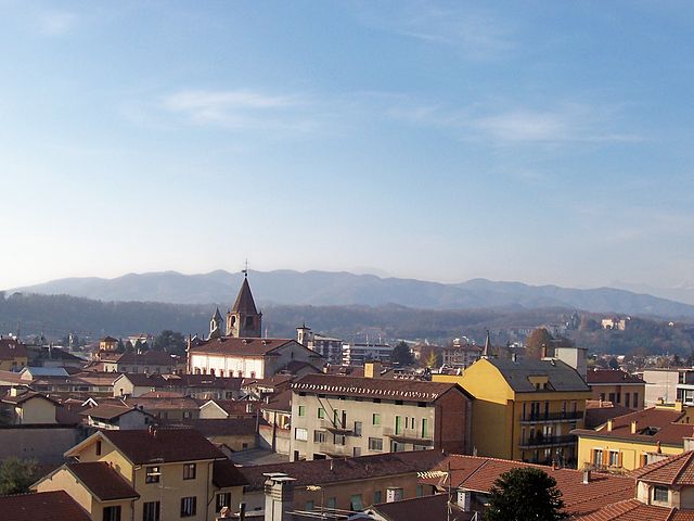
Cressa is a charming area located in the province of Novara in the Piedmont region of Italy. While it may not be as well-known for hiking as some other regions, it offers a beautiful countryside with trails that can be enjoyable for both beginners and experienced hikers.
Hiking Opportunities in Cressa
-
Scenic Trails: The region features various scenic trails that wind through rolling hills, vineyards, and fields. You can enjoy the picturesque landscapes typical of the Italian countryside.
-
Nature Walks: Many of the hiking routes in and around Cressa are more suited for leisurely nature walks. These paths can be perfect for family hikes or those looking to enjoy a peaceful day in nature.
-
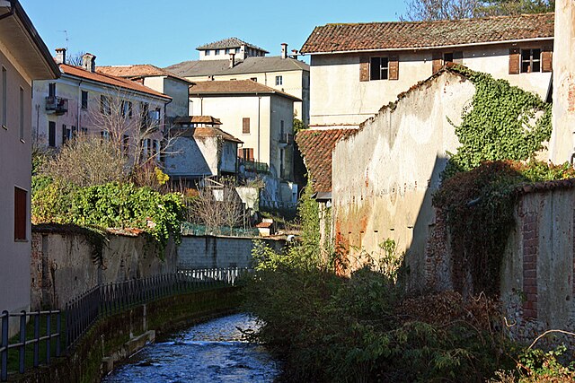
Cultural Hiking: Cressa and the surrounding areas have historical significance, including churches and old farmhouses. Some trails may lead you to these cultural landmarks, allowing you to appreciate both nature and history.
-
Local Wildlife: Hikers might encounter a variety of local wildlife, including birds, deer, and more, particularly in the less populated areas.
Tips for Hiking in Cressa
-
Weather Considerations: Check the weather before heading out, as conditions can change quickly in the countryside.
-
Footwear: Wear sturdy footwear appropriate for the terrain. Trails can vary in difficulty, so be prepared for uneven ground.
-
Hydration and Snacks: Bring plenty of water and some snacks, especially for longer hikes.
-
Navigation: While the trails may not be well-marked, offline maps or GPS apps can help you navigate the area.
-
Local Guidance: Consider reaching out to local hiking groups or guides for more information and to find the best routes suited to your interests and skill level.
Hiking in Cressa can provide a refreshing experience away from more crowded tourist destinations, allowing you to enjoy the tranquility of the Italian countryside. Always remember to follow Leave No Trace principles to preserve the natural beauty of the area. Happy hiking!
- Country:

- Postal Code: 28012
- Local Dialing Code: 0322
- Licence Plate Code: NO
- Coordinates: 45° 39' 0" N, 8° 31' 0" E


- GPS tracks (wikiloc): [Link]
- AboveSeaLevel: 267 м m
- Area: 7.1 sq km
- Population: 1612
- Web site: http://www.comune.cressa.no.it
- Wikipedia en: wiki(en)
- Wikipedia: wiki(it)
- Wikidata storage: Wikidata: Q22191
- Wikipedia Commons Category: [Link]
- Freebase ID: [/m/0g8sy3]
- GeoNames ID: Alt: [6537301]
- OSM relation ID: [45618]
- UN/LOCODE: [ITESS]
- ISTAT ID: 003055
- Italian cadastre code: D162
Shares border with regions:

Bogogno
- Italian comune
Bogogno, located in the Piedmont region of Italy, is renowned for its picturesque countryside and serene landscapes, making it a lovely spot for hiking enthusiasts. The area features rolling hills, lush greenery, and charming rural scenery....
- Country:

- Postal Code: 28010
- Local Dialing Code: 0322
- Licence Plate Code: NO
- Coordinates: 45° 40' 0" N, 8° 32' 0" E


- GPS tracks (wikiloc): [Link]
- AboveSeaLevel: 278 м m
- Area: 8.51 sq km
- Population: 1285
- Web site: [Link]

Borgomanero
- Italian comune
Borgomanero is a charming town located in the Piedmont region of Italy, near Lake Orta and the foothills of the Alps. The area offers a variety of hiking opportunities for outdoor enthusiasts, with trails that showcase stunning landscapes, rich biodiversity, and picturesque views....
- Country:

- Postal Code: 28021
- Local Dialing Code: 0322
- Licence Plate Code: NO
- Coordinates: 45° 42' 0" N, 8° 28' 0" E


- GPS tracks (wikiloc): [Link]
- AboveSeaLevel: 306 м m
- Area: 32.27 sq km
- Population: 21719
- Web site: [Link]

Fontaneto d'Agogna
- Italian comune
Fontaneto d'Agogna is a charming town located in the Novara province of Italy, nestled in the beautiful Piedmont region. The surrounding landscapes provide a variety of hiking opportunities that cater to different skill levels. Here are some key points to consider if you're planning a hike in this area:...
- Country:

- Postal Code: 28010
- Local Dialing Code: 0322
- Licence Plate Code: NO
- Coordinates: 45° 39' 0" N, 8° 29' 0" E


- GPS tracks (wikiloc): [Link]
- AboveSeaLevel: 260 м m
- Area: 21.17 sq km
- Population: 2660
- Web site: [Link]

Suno
- Italian comune
Suno is not widely recognized as a specific hiking destination, so it's possible you might be referring to a local or lesser-known area. However, if you're talking about hiking in general or a place similar to "Suno," I can provide some general guidance on what to look for in a hiking location and tips for your hikes....
- Country:

- Postal Code: 28019
- Local Dialing Code: 0322
- Licence Plate Code: NO
- Coordinates: 45° 38' 0" N, 8° 32' 0" E


- GPS tracks (wikiloc): [Link]
- AboveSeaLevel: 250 м m
- Area: 21.33 sq km
- Population: 2788
- Web site: [Link]
