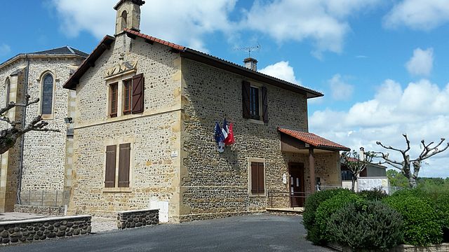
Cuguron (Cuguron)

- commune in Haute-Garonne, France
- Country:

- Postal Code: 31210
- Coordinates: 43° 6' 0" N, 0° 32' 26" E


- GPS tracks (wikiloc): [Link]
- Area: 7.07 sq km
- Population: 189
- Wikipedia en: wiki(en)
- Wikipedia: wiki(fr)
- Wikidata storage: Wikidata: Q1362207
- Wikipedia Commons Category: [Link]
- Freebase ID: [/m/03nsz3f]
- Freebase ID: [/m/03nsz3f]
- GeoNames ID: Alt: [6431538]
- GeoNames ID: Alt: [6431538]
- SIREN number: [213101587]
- SIREN number: [213101587]
- BnF ID: [15255154n]
- BnF ID: [15255154n]
- INSEE municipality code: 31158
- INSEE municipality code: 31158
Shares border with regions:
Villeneuve-Lécussan
- commune in Haute-Garonne, France
- Country:
- Postal Code: 31580
- Coordinates: 43° 9' 0" N, 0° 29' 55" E
- GPS tracks (wikiloc): [Link]
- Area: 16.1 sq km
- Population: 556


Saint-Paul
- commune in Hautes-Pyrénées, France
- Country:
- Postal Code: 65150
- Coordinates: 43° 4' 53" N, 0° 30' 20" E
- GPS tracks (wikiloc): [Link]
- AboveSeaLevel: 495 м m
- Area: 6.85 sq km
- Population: 315

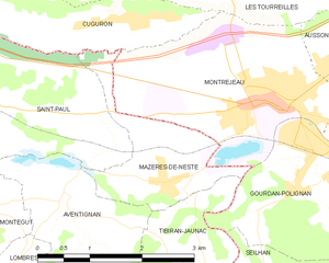
Mazères-de-Neste
- commune in Hautes-Pyrénées, France
- Country:
- Postal Code: 65660
- Coordinates: 43° 4' 17" N, 0° 32' 38" E
- GPS tracks (wikiloc): [Link]
- AboveSeaLevel: 456 м m
- Area: 3.36 sq km
- Population: 326


Saint-Laurent-de-Neste
- commune in Hautes-Pyrénées, France
- Country:
- Postal Code: 65150
- Coordinates: 43° 4' 39" N, 0° 28' 55" E
- GPS tracks (wikiloc): [Link]
- Area: 10.41 sq km
- Population: 921

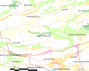
Les Tourreilles
- commune in Haute-Garonne, France
- Country:
- Postal Code: 31210
- Coordinates: 43° 6' 46" N, 0° 33' 7" E
- GPS tracks (wikiloc): [Link]
- AboveSeaLevel: 547 м m
- Area: 12.33 sq km
- Population: 385


Montréjeau
- commune in Haute-Garonne, France
- Country:
- Postal Code: 31210
- Coordinates: 43° 5' 5" N, 0° 34' 8" E
- GPS tracks (wikiloc): [Link]
- Area: 8.21 sq km
- Population: 2863
- Web site: [Link]

Franquevielle
- commune in Haute-Garonne, France
- Country:
- Postal Code: 31210
- Coordinates: 43° 8' 12" N, 0° 32' 1" E
- GPS tracks (wikiloc): [Link]
- Area: 10.88 sq km
- Population: 333