Culin (Culin)

- commune in Isère, France
 Hiking in Culin
Culin may not be widely recognized as a significant hiking destination, as there are numerous regions and trails around the world. Could you provide a bit more context or specify which Culin you're referring to? For instance, it could refer to a specific location or a local feature. If you're looking for general information on hiking tips, trail recommendations, or safety precautions, I would be happy to provide that!
- Country:

- Postal Code: 38300
- Coordinates: 45° 31' 27" N, 5° 15' 9" E


- GPS tracks (wikiloc): [Link]
- Area: 7.32 sq km
- Population: 733
- Web site: http://www.culin.fr
- Wikipedia en: wiki(en)
- Wikipedia: wiki(fr)
- Wikidata storage: Wikidata: Q1002967
- Wikipedia Commons Category: [Link]
- Freebase ID: [/m/03nvhn_]
- GeoNames ID: Alt: [6433184]
- SIREN number: [213801418]
- BnF ID: [15257964n]
- INSEE municipality code: 38141
Shares border with regions:


Saint-Agnin-sur-Bion
- commune in Isère, France
Hiking in Saint-Agnin-sur-Bion
Saint-Agnin-sur-Bion is a small commune located in the Auvergne-Rhône-Alpes region of France, known for its beautiful natural landscapes and opportunities for outdoor activities, including hiking....
- Country:
- Postal Code: 38300
- Coordinates: 45° 32' 26" N, 5° 14' 39" E
- GPS tracks (wikiloc): [Link]
- Area: 9.7 sq km
- Population: 993
- Web site: [Link]


Sainte-Anne-sur-Gervonde
- commune in Isère, France
Hiking in Sainte-Anne-sur-Gervonde
Sainte-Anne-sur-Gervonde, a picturesque municipality located in the Laurentian region of Quebec, Canada, offers several opportunities for hiking enthusiasts to explore its natural beauty. While there may not be established, well-known trails like those in larger parks, the area is characterized by its beautiful landscapes, forests, and lakes that can provide a range of outdoor experiences....
- Country:
- Postal Code: 38440
- Coordinates: 45° 29' 59" N, 5° 14' 0" E
- GPS tracks (wikiloc): [Link]
- Area: 7.67 sq km
- Population: 649
- Web site: [Link]


Les Éparres
- commune in Isère, France
Hiking in Les Éparres
Les Éparres, located in the southeastern region of France near the Vercors Massif, offers beautiful landscapes and a variety of hiking trails suitable for different skill levels. The area is characterized by its stunning views, diverse flora and fauna, and the unique geological features of the region....
- Country:
- Postal Code: 38300
- Coordinates: 45° 32' 1" N, 5° 17' 34" E
- GPS tracks (wikiloc): [Link]
- Area: 7.95 sq km
- Population: 987

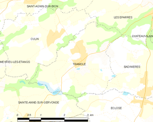
Tramolé
- commune in Isère, France
Hiking in Tramolé
Tramolé, located in the Italian region of Emilia-Romagna, is a fantastic destination for hiking enthusiasts, especially those looking for beautiful landscapes, tranquility, and a mix of nature and history. Although Tramolé itself is a small mountain area, it's surrounded by the larger Apennine range, offering numerous trails and opportunities for exploration....
- Country:
- Postal Code: 38300
- Coordinates: 45° 31' 8" N, 5° 16' 4" E
- GPS tracks (wikiloc): [Link]
- Area: 6.99 sq km
- Population: 673
- Web site: [Link]

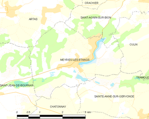
Meyrieu-les-Étangs
- commune in Isère, France
Hiking in Meyrieu-les-Étangs
Meyrieu-les-Étangs is a charming commune located in the Auvergne-Rhône-Alpes region of France. Nestled in a rural setting, it offers several opportunities for hiking enthusiasts to enjoy nature and exploration....
- Country:
- Postal Code: 38440
- Coordinates: 45° 30' 49" N, 5° 12' 0" E
- GPS tracks (wikiloc): [Link]
- AboveSeaLevel: 390 м m
- Area: 8.54 sq km
- Population: 969
- Web site: [Link]