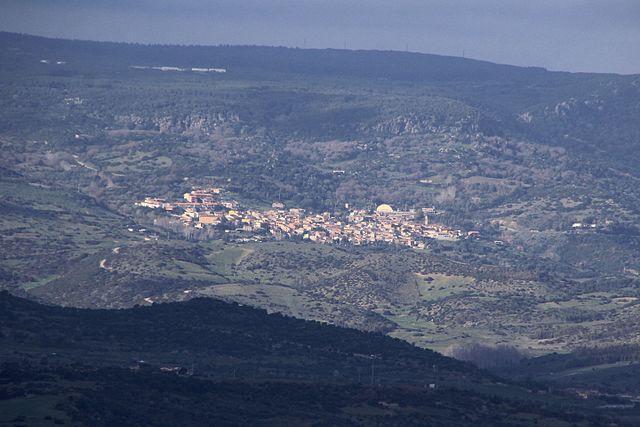
Curcuris (Curcuris)
%20-%202016.svg)
- Italian comune
 Hiking in Curcuris
Curcuris is a smaller, lesser-known location, so detailed hiking information might be limited compared to more popular hiking destinations. However, if you're looking for general guidelines and what you might typically find in such regions, here are some considerations:
-
Scenery and Terrain: Expect a mix of stunning natural landscapes, potentially featuring rolling hills, valleys, and perhaps some unique geological formations, if the area is rural or mountainous.
-
Trail Difficulty: When exploring a lesser-known region like Curcuris, trail difficulty can vary significantly. You might find easy, moderate, and challenging trails; it’s important to assess your fitness level and experience when choosing a path.
-
Preparation: Always check local resources for maps and trail conditions. Since Curcuris might not be as frequented by tourists, it's wise to carry enough water, snacks, and a first-aid kit. A good pair of hiking boots and weather-appropriate clothing are also essential.
-
Wildlife and Nature: Areas around smaller towns often have rich biodiversity. Be on the lookout for local flora and fauna and respect wildlife regulations, such as maintaining a safe distance from animals and not disturbing their habitats.
-
Guides and Tours: If available, consider hiring a local guide who can provide insights into the best hiking routes and help highlight any hidden gems in the area.
-
Respecting the Environment: As always, follow Leave No Trace principles to preserve the natural beauty of the area for future hikers.
If Curcuris has specific hiking areas or parks, I recommend checking local hiking forums, tourism websites, or visitor centers for the most reliable and up-to-date information!
- Country:

- Postal Code: 09090
- Local Dialing Code: 0783
- Licence Plate Code: OR
- Coordinates: 39° 44' 48" N, 8° 49' 51" E


- GPS tracks (wikiloc): [Link]
- AboveSeaLevel: 159 м m
- Area: 7.18 sq km
- Population: 307
- Web site: http://www.comune.curcuris.or.it
- Wikipedia en: wiki(en)
- Wikipedia: wiki(it)
- Wikidata storage: Wikidata: Q385660
- Wikipedia Commons Category: [Link]
- Freebase ID: [/m/0gr1hd]
- GeoNames ID: Alt: [6537984]
- OSM relation ID: [40069]
- ISTAT ID: 095077
- Italian cadastre code: D214
Shares border with regions:


Ales, Sardinia
- comune of Italy
Hiking in Ales, Sardinia
Ales is a charming town located in the province of Oristano in Sardinia, Italy. Although Ales itself might not be a well-known hiking destination compared to other parts of Sardinia, it serves as a great base for exploring the surrounding landscapes, which offer a variety of hiking opportunities....
- Country:
- Postal Code: 09091
- Local Dialing Code: 0783
- Licence Plate Code: OR
- Coordinates: 39° 46' 0" N, 8° 49' 0" E
- GPS tracks (wikiloc): [Link]
- AboveSeaLevel: 194 м m
- Area: 22.45 sq km
- Population: 1410
- Web site: [Link]
Gonnosnò
- Italian comune
Hiking in Gonnosnò
Gonnosnò, a picturesque town located in the province of Nuoro in Sardinia, Italy, offers a unique experience for hikers. The region features a varied landscape, including hills, forests, and proximity to the beautiful Gennargentu mountains, making it an appealing destination for both novice and experienced trekkers....
- Country:
- Postal Code: 09090
- Local Dialing Code: 0783
- Licence Plate Code: OR
- Coordinates: 39° 45' 38" N, 8° 52' 21" E
- GPS tracks (wikiloc): [Link]
- AboveSeaLevel: 195 м m
- Area: 15.46 sq km
- Population: 759
- Web site: [Link]

Morgongiori
- Italian comune
Hiking in Morgongiori
Morgongiori is a small village located in the province of Oristano in Sardinia, Italy. It’s known for its picturesque landscapes and proximity to the mountainous terrain of the region. Hiking in Morgongiori offers a unique opportunity to explore the natural beauty and cultural heritage of Sardinia....
- Country:
- Postal Code: 09090
- Local Dialing Code: 0783
- Licence Plate Code: OR
- Coordinates: 39° 44' 46" N, 8° 46' 14" E
- GPS tracks (wikiloc): [Link]
- AboveSeaLevel: 351 м m
- Area: 45.2 sq km
- Population: 716
- Web site: [Link]
Pompu
- Italian comune
Hiking in Pompu
It seems there may be a misunderstanding, as “Pompu” may refer to different locations or could be a less well-known site. If you're looking for hiking information about a specific area like Pompu in a certain country or region, please provide more details....
- Country:
- Postal Code: 09095
- Local Dialing Code: 0783
- Licence Plate Code: OR
- Coordinates: 39° 43' 29" N, 8° 47' 46" E
- GPS tracks (wikiloc): [Link]
- AboveSeaLevel: 147 м m
- Area: 5.32 sq km
- Population: 253
- Web site: [Link]


Simala
- Italian comune
Hiking in Simala
Simala, located in the town of Sibonga on the island of Cebu in the Philippines, is primarily known for its magnificent Simala Church, a beautiful structure with sweeping views of the surrounding landscape. While it is not widely known as a hiking destination, there are opportunities for outdoor activities and exploration in the surrounding areas....
- Country:
- Postal Code: 09090
- Local Dialing Code: 0783
- Licence Plate Code: OR
- Coordinates: 39° 43' 15" N, 8° 49' 41" E
- GPS tracks (wikiloc): [Link]
- AboveSeaLevel: 155 м m
- Area: 13.38 sq km
- Population: 315
- Web site: [Link]