Cuzion (Cuzion)

- commune in Indre, France
- Country:

- Postal Code: 36190
- Coordinates: 46° 28' 45" N, 1° 36' 23" E


- GPS tracks (wikiloc): [Link]
- Area: 18.45 sq km
- Population: 442
- Wikipedia en: wiki(en)
- Wikipedia: wiki(fr)
- Wikidata storage: Wikidata: Q626420
- Wikipedia Commons Category: [Link]
- Freebase ID: [/m/03nvbtm]
- GeoNames ID: Alt: [6448603]
- SIREN number: [213600620]
- BnF ID: [15257366p]
- INSEE municipality code: 36062
Shares border with regions:

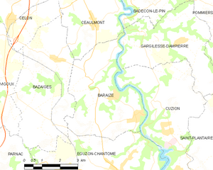
Baraize
- commune in Indre, France
- Country:
- Postal Code: 36270
- Coordinates: 46° 29' 19" N, 1° 33' 42" E
- GPS tracks (wikiloc): [Link]
- Area: 16.39 sq km
- Population: 339


Saint-Plantaire
- commune in Indre, France
- Country:
- Postal Code: 36190
- Coordinates: 46° 27' 26" N, 1° 40' 13" E
- GPS tracks (wikiloc): [Link]
- Area: 34.07 sq km
- Population: 584
- Web site: [Link]


Éguzon-Chantôme
- commune in Indre, France
- Country:
- Postal Code: 36270
- Coordinates: 46° 26' 32" N, 1° 34' 57" E
- GPS tracks (wikiloc): [Link]
- Area: 36.44 sq km
- Population: 1375


Gargilesse-Dampierre
- commune in Indre, France
- Country:
- Postal Code: 36190
- Coordinates: 46° 30' 49" N, 1° 35' 49" E
- GPS tracks (wikiloc): [Link]
- Area: 15.72 sq km
- Population: 299
- Web site: [Link]