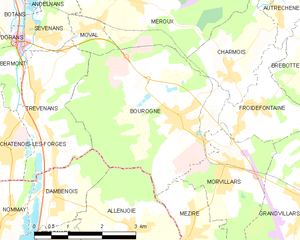
Dambenois (Dambenois)

- commune in Doubs, France
 Hiking in Dambenois
Dambenois, located in the Bourgogne-Franche-Comté region of France, offers picturesque landscapes and a variety of hiking opportunities. The area is characterized by its rolling hills, forests, and scenic views, making it an appealing destination for both casual walkers and more experienced hikers.
Hiking Trails
Here are a few highlights about hiking in Dambenois:
-
Diverse Terrain: The region features a mix of gentle slopes and more challenging trails, catering to hikers of all skill levels. You can find routes through dense forests, along rivers, and across open fields.
-
Marked Trails: Many trails are well marked, making navigation easier for those who might not be familiar with the area. It's advisable to carry a map or use a mobile app to track your route.
-
Nature Observation: The region is rich in biodiversity, offering opportunities for bird watching and wildlife observation. You might see deer, various bird species, and other local fauna along the trails.
-
Cultural Sites: Besides natural beauty, you may also encounter interesting historical and cultural sites along or near the trails, including old farms and local architecture that reflect the region's heritage.
-
Accessibility: Dambenois is accessible by car and close to larger towns, providing amenities like accommodations, cafes, and restaurants for hikers who may want to take a break.
Tips for Hiking in Dambenois
- Proper Footwear: Wear comfortable, sturdy hiking shoes as some trails may have uneven terrain.
- Weather Preparedness: Check the weather before heading out, as conditions can change rapidly. Dress in layers and bring rain gear if necessary.
- Stay Hydrated: Bring enough water and snacks, especially on longer hikes.
- Leave No Trace: Respect the natural environment by following Leave No Trace principles; carry out any trash and stay on designated paths.
- Local Regulations: Be aware of local guidelines or restrictions regarding wildlife and plant interaction, especially in protected areas.
Conclusion
Hiking in Dambenois can be a refreshing escape into nature, offering a blend of tranquility and adventure. Whether you’re looking for a peaceful stroll or a more vigorous trek, this area has something to offer for every hiking enthusiast. Always remember to plan ahead and enjoy exploring this beautiful region!
- Country:

- Postal Code: 25600
- Coordinates: 47° 32' 39" N, 6° 52' 4" E


- GPS tracks (wikiloc): [Link]
- Area: 3.28 sq km
- Population: 736
- Wikipedia en: wiki(en)
- Wikipedia: wiki(fr)
- Wikidata storage: Wikidata: Q835875
- Wikipedia Commons Category: [Link]
- Freebase ID: [/m/03mgsyq]
- Freebase ID: [/m/03mgsyq]
- GeoNames ID: Alt: [6612382]
- GeoNames ID: Alt: [6612382]
- SIREN number: [212501886]
- SIREN number: [212501886]
- BnF ID: [15252414h]
- BnF ID: [15252414h]
- INSEE municipality code: 25188
- INSEE municipality code: 25188
Shares border with regions:


Nommay
- commune in Doubs, France
Hiking in Nommay
Nommay is a charming commune located in the Doubs department of France, close to the Swiss border. While it may not be as well-known as some larger hiking destinations, it offers access to beautiful landscapes and trails in the surrounding regions, particularly given its proximity to the Jura Mountains and the Vosges....
- Country:
- Postal Code: 25600
- Coordinates: 47° 32' 17" N, 6° 50' 50" E
- GPS tracks (wikiloc): [Link]
- Area: 3.19 sq km
- Population: 1672

Bourogne
- commune in Territoire de Belfort, France
Hiking in Bourogne
Bourogne is a small commune located in the Bourgogne-Franche-Comté region of eastern France, known for its picturesque landscapes and nature surroundings. While it may not be as popular as some larger hiking destinations, there are still some beautiful trails and opportunities for exploration in and around Bourogne....
- Country:
- Postal Code: 90140
- Coordinates: 47° 33' 44" N, 6° 55' 4" E
- GPS tracks (wikiloc): [Link]
- Area: 13.71 sq km
- Population: 1924
- Web site: [Link]


Trévenans
- commune in Territoire de Belfort, France
Hiking in Trévenans
Trévenans is a small commune located in the Bourgogne-Franche-Comté region of France, near Montbéliard. While it may not be as widely recognized as other hiking destinations, it offers some beautiful natural scenery and opportunities for outdoor exploration....
- Country:
- Postal Code: 90400
- Coordinates: 47° 34' 15" N, 6° 51' 43" E
- GPS tracks (wikiloc): [Link]
- Area: 5.96 sq km
- Population: 1207