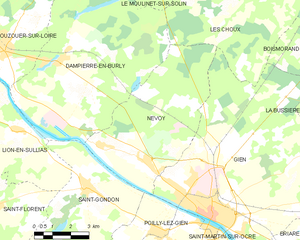
Dampierre-en-Burly (Dampierre-en-Burly)

- commune in Loiret, France
- Country:

- Postal Code: 45570
- Coordinates: 47° 45' 41" N, 2° 31' 7" E


- GPS tracks (wikiloc): [Link]
- Area: 47.44 sq km
- Population: 1423
- Web site: http://www.dampierre-en-burly.fr
- Wikipedia en: wiki(en)
- Wikipedia: wiki(fr)
- Wikidata storage: Wikidata: Q1167985
- Wikipedia Commons Category: [Link]
- Freebase ID: [/m/03nwgtg]
- GeoNames ID: Alt: [6617692]
- SIREN number: [214501223]
- BnF ID: [15260514h]
- VIAF ID: Alt: [248770080]
- PACTOLS thesaurus ID: [pcrtpxvDB43NZV]
- TGN ID: [1032896]
- INSEE municipality code: 45122
Shares border with regions:


Les Choux
- commune in Loiret, France
- Country:
- Postal Code: 45290
- Coordinates: 47° 47' 51" N, 2° 40' 35" E
- GPS tracks (wikiloc): [Link]
- Area: 33.36 sq km
- Population: 486


Ouzouer-sur-Loire
- commune in Loiret, France
- Country:
- Postal Code: 45570
- Coordinates: 47° 46' 0" N, 2° 28' 43" E
- GPS tracks (wikiloc): [Link]
- Area: 34.27 sq km
- Population: 2710
- Web site: [Link]

Nevoy
- commune in Loiret, France
- Country:
- Postal Code: 45500
- Coordinates: 47° 42' 48" N, 2° 34' 46" E
- GPS tracks (wikiloc): [Link]
- Area: 30.75 sq km
- Population: 1181
Le Moulinet-sur-Solin
- commune in Loiret, France
- Country:
- Postal Code: 45290
- Coordinates: 47° 50' 15" N, 2° 37' 33" E
- GPS tracks (wikiloc): [Link]
- Area: 19.37 sq km
- Population: 133


Montereau
- commune in Loiret, France
- Country:
- Postal Code: 45260
- Coordinates: 47° 51' 23" N, 2° 34' 21" E
- GPS tracks (wikiloc): [Link]
- Area: 50.12 sq km
- Population: 606


Lion-en-Sullias
- commune in Loiret, France
- Country:
- Postal Code: 45600
- Coordinates: 47° 43' 37" N, 2° 29' 23" E
- GPS tracks (wikiloc): [Link]
- Area: 24.49 sq km
- Population: 406
- Web site: [Link]


Saint-Gondon
- commune in Loiret, France
- Country:
- Postal Code: 45500
- Coordinates: 47° 41' 56" N, 2° 32' 29" E
- GPS tracks (wikiloc): [Link]
- Area: 22.4 sq km
- Population: 1116
- Web site: [Link]