Dampierre-en-Graçay (Dampierre-en-Graçay)

- commune in Cher, France
- Country:

- Postal Code: 18310
- Coordinates: 47° 10' 47" N, 1° 56' 34" E


- GPS tracks (wikiloc): [Link]
- Area: 9.38 sq km
- Population: 260
- Web site: http://www.dampierre-en-gracay.com/
- Wikipedia en: wiki(en)
- Wikipedia: wiki(fr)
- Wikidata storage: Wikidata: Q919736
- Wikipedia Commons Category: [Link]
- Freebase ID: [/m/03mfcq8]
- GeoNames ID: Alt: [6447474]
- SIREN number: [211800859]
- BnF ID: [15249431k]
- INSEE municipality code: 18085
Shares border with regions:


Nohant-en-Graçay
- commune in Cher, France
- Country:
- Postal Code: 18310
- Coordinates: 47° 8' 12" N, 1° 53' 38" E
- GPS tracks (wikiloc): [Link]
- Area: 23.78 sq km
- Population: 303
Saint-Georges-sur-la-Prée
- commune in Cher, France
- Country:
- Postal Code: 18100
- Coordinates: 47° 13' 33" N, 1° 56' 12" E
- GPS tracks (wikiloc): [Link]
- Area: 22.83 sq km
- Population: 640

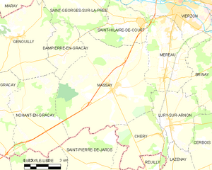
Massay
- commune in Cher, France
- Country:
- Postal Code: 18120
- Coordinates: 47° 9' 14" N, 1° 59' 34" E
- GPS tracks (wikiloc): [Link]
- Area: 47.94 sq km
- Population: 1404

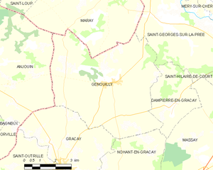
Genouilly
- commune in Cher, France
- Country:
- Postal Code: 18310
- Coordinates: 47° 11' 28" N, 1° 53' 8" E
- GPS tracks (wikiloc): [Link]
- Area: 34.66 sq km
- Population: 692