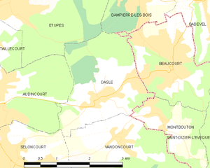
Dasle (Dasle)
- commune in Doubs, France
Dasle is not a widely recognized hiking destination, so it seems there may be a confusion with the name or a lesser-known local trail. If you meant a specific area or region, please provide more details, such as the country or state.
However, if you're looking for general advice on hiking or if you're interested in specific aspects like trail recommendations, safety tips, or preparation for hiking trips, I’d be happy to help! Just let me know what you're specifically interested in.
- Country:

- Postal Code: 25230
- Coordinates: 47° 28' 40" N, 6° 53' 39" E


- GPS tracks (wikiloc): [Link]
- Area: 5.67 sq km
- Population: 1420
- Wikipedia en: wiki(en)
- Wikipedia: wiki(fr)
- Wikidata storage: Wikidata: Q835879
- Wikipedia Commons Category: [Link]
- Freebase ID: [/m/03mgt1h]
- Freebase ID: [/m/03mgt1h]
- GeoNames ID: Alt: [6429750]
- GeoNames ID: Alt: [6429750]
- SIREN number: [212501969]
- SIREN number: [212501969]
- BnF ID: [152524224]
- BnF ID: [152524224]
- INSEE municipality code: 25196
- INSEE municipality code: 25196
Shares border with regions:

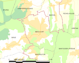
Beaucourt
- commune in Territoire de Belfort, France
Beaucourt is a small commune in the Territoire de Belfort department in the Bourgogne-Franche-Comté region of France. While it may not be as widely recognized for hiking as some other areas, there are opportunities for outdoor activities in and around Beaucourt. Here's what you can expect:...
- Country:

- Postal Code: 90500
- Coordinates: 47° 29' 10" N, 6° 55' 31" E


- GPS tracks (wikiloc): [Link]
- Area: 4.95 sq km
- Population: 5090
- Web site: [Link]


Dampierre-les-Bois
- commune in Doubs, France
Dampierre-les-Bois, located in the Doubs department in the Bourgogne-Franche-Comté region of eastern France, offers several opportunities for hiking enthusiasts. The area is characterized by its scenic landscapes, including rolling hills, forests, and meadows, which are ideal for both casual walkers and more serious hikers....
- Country:

- Postal Code: 25490
- Coordinates: 47° 30' 25" N, 6° 54' 43" E


- GPS tracks (wikiloc): [Link]
- Area: 4.72 sq km
- Population: 1659

Montbouton
- commune in Territoire de Belfort, France
Montbouton, while not prominently featured as a major hiking destination, is likely a local area that may offer beautiful trails and scenic views typical of many mountainous regions. To get the most from your hiking experience there, here are some general tips and information you might find useful:...
- Country:

- Postal Code: 90500
- Coordinates: 47° 28' 22" N, 6° 55' 9" E


- GPS tracks (wikiloc): [Link]
- Area: 2.81 sq km
- Population: 403

