Delut (Delut)

- commune in Meuse, France
- Country:

- Postal Code: 55150
- Coordinates: 49° 24' 30" N, 5° 25' 55" E


- GPS tracks (wikiloc): [Link]
- Area: 9.18 sq km
- Population: 131
- Wikipedia en: wiki(en)
- Wikipedia: wiki(fr)
- Wikidata storage: Wikidata: Q1096956
- Wikipedia Commons Category: [Link]
- Freebase ID: [/m/03qdqhv]
- GeoNames ID: Alt: [6436978]
- SIREN number: [215501495]
- BnF ID: [152648160]
- INSEE municipality code: 55149
Shares border with regions:

Dombras
- commune in Meuse, France
- Country:
- Postal Code: 55150
- Coordinates: 49° 23' 29" N, 5° 27' 32" E
- GPS tracks (wikiloc): [Link]
- Area: 11.27 sq km
- Population: 134


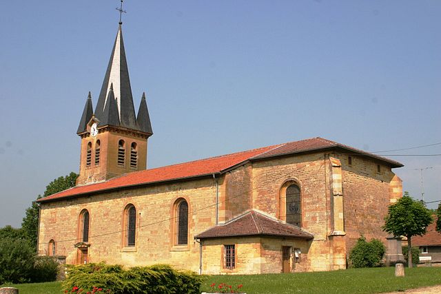
Jametz
- commune in Meuse, France
- Country:
- Postal Code: 55600
- Coordinates: 49° 25' 50" N, 5° 22' 53" E
- GPS tracks (wikiloc): [Link]
- Area: 17.44 sq km
- Population: 253


Vittarville
- commune in Meuse, France
- Country:
- Postal Code: 55150
- Coordinates: 49° 23' 39" N, 5° 24' 45" E
- GPS tracks (wikiloc): [Link]
- Area: 8.15 sq km
- Population: 75


Grand-Failly
- commune in Meurthe-et-Moselle, France
- Country:
- Postal Code: 54260
- Coordinates: 49° 25' 14" N, 5° 30' 52" E
- GPS tracks (wikiloc): [Link]
- Area: 21.87 sq km
- Population: 307


Marville
- commune in Meuse, France
- Country:
- Postal Code: 55600
- Coordinates: 49° 27' 8" N, 5° 27' 21" E
- GPS tracks (wikiloc): [Link]
- Area: 19.55 sq km
- Population: 502


Rupt-sur-Othain
- commune in Meuse, France
- Country:
- Postal Code: 55150
- Coordinates: 49° 25' 11" N, 5° 29' 34" E
- GPS tracks (wikiloc): [Link]
- Area: 5.53 sq km
- Population: 49

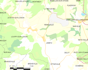
Remoiville
- commune in Meuse, France
- Country:
- Postal Code: 55600
- Coordinates: 49° 26' 36" N, 5° 21' 37" E
- GPS tracks (wikiloc): [Link]
- Area: 9.7 sq km
- Population: 134