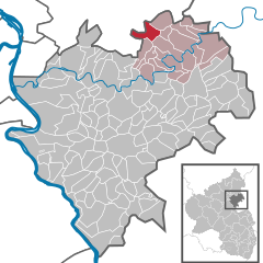
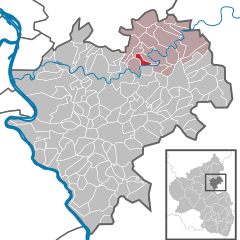
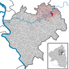
Verbandsgemeinde Diez (Verbandsgemeinde Diez)
- Verbandsgemeinde in Rhineland-Palatinate, Germany
 Hiking in Verbandsgemeinde Diez
Diez, located in the Verbandsgemeinde (municipal association) of the same name in the Rhineland-Palatinate region of Germany, offers a variety of hiking opportunities that showcase the natural beauty and cultural heritage of the area. The region is characterized by picturesque landscapes, hills, and forests, making it a great destination for both casual walkers and avid hikers.
Hiking Highlights in Diez:
-
Trails and Routes:
- Nister Trail (Nistersteig): A popular hiking trail that offers stunning views and varied terrain. The trail winds through forests and along the river Nister, making it a serene experience.
- Lahn Valley Trail: This route follows the scenic Lahn River, providing beautiful riverside views and chances to explore the charming towns along the way.
-
Natural Attractions:
- The area is rich in natural beauty, with lush vegetation, wildlife, and diverse landscapes. The surrounding hills provide a great backdrop for hiking excursions.
- Nearby nature reserves and parks, such as the Nassau Nature Park, enhance hiking experiences with unique flora and fauna.
-
Cultural Sites:
- Hiking in Diez also allows you to explore its historical sites, including the impressive Diez Castle (Burg Diez), which offers a glimpse into the region's history and architecture.
- Many trails can lead you past traditional villages and local landmarks, enriching your hiking experience with cultural insights.
-
Local Amenities:
- The town of Diez has various amenities, including hotels, restaurants, and shops, making it convenient for hikers to find accommodations, catering, and supplies.
- Local visitor centers can provide maps, trail information, and advice on the best hiking routes to explore.
Tips for Hiking in Diez:
- Preparation: Always check local trail maps and weather conditions before heading out. Ensure you have adequate supplies such as water, snacks, and appropriate footwear.
- Respect Nature: Stay on marked trails, respect wildlife, and adhere to local regulations to preserve the natural environment.
- Explore Beyond the Trails: Take the time to explore the towns and villages in the area, as they often host local festivals, markets, and events, especially in the warmer months.
Conclusion:
Hiking in Diez offers a delightful blend of natural beauty, cultural exploration, and outdoor adventure. Whether you’re looking for a challenging trek or a leisurely stroll, the trails around Diez will provide a fulfilling experience. Enjoy your hiking adventure!
- Country:

- Capital: Diez
- Coordinates: 50° 22' 15" N, 8° 0' 57" E


- GPS tracks (wikiloc): [Link]
- Web site: http://www.vgdiez.de/
- Wikipedia en: wiki(en)
- Wikipedia: wiki(de)
- Wikidata storage: Wikidata: Q562258
- Freebase ID: [/m/02z42fx]
- GND ID: Alt: [4278869-9]
- German regional key: 071415003
Includes regions:


Altendiez
- municipality of Germany
Altendiez is a charming municipality located in the central part of Germany, in the state of Rhineland-Palatinate. It is situated near the banks of the Lahn River and is surrounded by beautiful natural landscapes, making it a great destination for hiking enthusiasts....
- Country:

- Postal Code: 65624
- Local Dialing Code: 06432
- Licence Plate Code: EMS
- Coordinates: 50° 22' 17" N, 7° 59' 6" E


- GPS tracks (wikiloc): [Link]
- AboveSeaLevel: 170 м m
- Area: 9.22 sq km
- Population: 2176
- Web site: [Link]


Diez
- German municipality
Diez is a charming town located in the Rhineland-Palatinate region of Germany, near the banks of the river Lahn. The area offers a variety of hiking opportunities, which showcase the beautiful natural landscape, historical sites, and quaint villages....
- Country:

- Postal Code: 65582
- Local Dialing Code: 06432
- Coordinates: 50° 22' 15" N, 8° 0' 57" E


- GPS tracks (wikiloc): [Link]
- AboveSeaLevel: 110 м m
- Area: 12.41 sq km
- Population: 11016
- Web site: [Link]
Heistenbach
- municipality of Germany
Heistenbach is a charming village located in the picturesque region of the Palatinate Forest, which is part of the larger biosphere reserve in Germany. The area offers a variety of hiking trails and outdoor activities that are perfect for both experienced hikers and beginners....
- Country:

- Postal Code: 65558
- Local Dialing Code: 06432
- Licence Plate Code: EMS
- Coordinates: 50° 22' 47" N, 7° 59' 8" E


- GPS tracks (wikiloc): [Link]
- AboveSeaLevel: 170 м m
- Area: 5.26 sq km
- Population: 1047
- Web site: [Link]
Gückingen
- municipality of Germany
Gückingen, located in the region of North Rhine-Westphalia in Germany, offers some lovely hiking opportunities in a scenic and tranquil setting. While it's a small area, the surrounding landscapes provide a variety of hiking experiences from gentle walks to more challenging trails....
- Country:

- Postal Code: 65558
- Local Dialing Code: 06432
- Licence Plate Code: EMS
- Coordinates: 50° 24' 0" N, 8° 1' 0" E


- GPS tracks (wikiloc): [Link]
- AboveSeaLevel: 183 м m
- Area: 2.34 sq km
- Population: 1080
- Web site: [Link]


Hirschberg
- municipality of Germany
Hirschberg, located in the Rhineland-Palatinate region of Germany, offers an array of hiking opportunities amidst beautiful landscapes. The region is known for its picturesque views, dense forests, and a variety of trails suitable for hikers of different skill levels....
- Country:

- Postal Code: 65558
- Local Dialing Code: 06439
- Licence Plate Code: EMS
- Coordinates: 50° 22' 44" N, 7° 55' 29" E


- GPS tracks (wikiloc): [Link]
- AboveSeaLevel: 300 м m
- Area: 2.50 sq km
- Population: 362
- Web site: [Link]


Wasenbach
- municipality of Germany
Wasenbach, located in Germany, is a charming area known for its beautiful natural landscapes, making it an excellent destination for hiking enthusiasts. Here are some key points to consider when planning a hiking trip to Wasenbach:...
- Country:

- Postal Code: 56370
- Local Dialing Code: 06432
- Licence Plate Code: EMS
- Coordinates: 50° 19' 6" N, 7° 58' 0" E


- GPS tracks (wikiloc): [Link]
- AboveSeaLevel: 200 м m
- Area: 2.40 sq km
- Population: 326
- Web site: [Link]


Eppenrod
- municipality of Germany
Eppenrod is a picturesque village located in the Westerwald region of Germany, known for its natural beauty and excellent hiking opportunities. The surrounding landscape is characterized by rolling hills, dense forests, and charming meadows, making it an ideal destination for both novice and experienced hikers....
- Country:

- Postal Code: 65558
- Local Dialing Code: 06485
- Licence Plate Code: EMS
- Coordinates: 50° 24' 17" N, 7° 55' 47" E


- GPS tracks (wikiloc): [Link]
- AboveSeaLevel: 290 м m
- Area: 6.98 sq km
- Population: 715
- Web site: [Link]
Holzappel
- municipality of Germany
Holzappel, a charming village located in the Hesse region of Germany, offers a variety of hiking opportunities for outdoor enthusiasts. The area is characterized by scenic landscapes, lush forests, and quaint countryside views, making it an excellent destination for hikers of all skill levels. Here are some highlights of hiking in and around Holzappel:...
- Country:

- Postal Code: 56379
- Local Dialing Code: 06439
- Licence Plate Code: EMS
- Coordinates: 50° 21' 4" N, 7° 53' 53" E


- GPS tracks (wikiloc): [Link]
- AboveSeaLevel: 297 м m
- Area: 2.73 sq km
- Population: 1024
- Web site: [Link]
Langenscheid
- municipality of Germany
Langenscheid is a small village in Germany, located in the region of Rhineland-Palatinate. While it may not be as widely recognized as some major hiking destinations, it offers a charming environment for hiking enthusiasts who appreciate scenic landscapes and tranquil settings....
- Country:

- Postal Code: 65558
- Local Dialing Code: 06439
- Licence Plate Code: EMS
- Coordinates: 50° 21' 25" N, 7° 57' 11" E


- GPS tracks (wikiloc): [Link]
- AboveSeaLevel: 242 м m
- Area: 8.84 sq km
- Population: 506
- Web site: [Link]


Hambach
- municipality of Germany
Hambach, located near Diez in Germany, is surrounded by beautiful landscapes that make it an excellent destination for hiking enthusiasts. The area offers a mix of picturesque nature, historical sites, and varying trail difficulties that cater to different skill levels....
- Country:

- Postal Code: 65582
- Local Dialing Code: 06432
- Licence Plate Code: EMS
- Coordinates: 50° 23' 53" N, 7° 58' 52" E


- GPS tracks (wikiloc): [Link]
- AboveSeaLevel: 156 м m
- Area: 2.76 sq km
- Population: 461
- Web site: [Link]
Dörnberg
- municipality of Germany
Dörnberg is a beautiful area located near Kassel in Hessen, Germany, known for its scenic landscapes, historical sites, and diverse hiking trails. The region is part of the Dörnberg Nature Reserve, which offers a mix of forests, meadows, and rocky outcrops, making it an excellent destination for outdoor enthusiasts....
- Country:

- Postal Code: 56379
- Local Dialing Code: 06439
- Licence Plate Code: EMS
- Coordinates: 50° 19' 32" N, 7° 53' 1" E


- GPS tracks (wikiloc): [Link]
- AboveSeaLevel: 280 м m
- Area: 5.82 sq km
- Population: 458
- Web site: [Link]


Cramberg
- municipality of Germany
Cramberg, located in the scenic region of Bavaria, Germany, offers a variety of hiking opportunities for both novice and experienced hikers. Here's an overview of what to expect when hiking in this beautiful area:...
- Country:

- Postal Code: 65558
- Local Dialing Code: 06439
- Licence Plate Code: EMS
- Coordinates: 50° 20' 28" N, 7° 56' 40" E


- GPS tracks (wikiloc): [Link]
- AboveSeaLevel: 200 м m
- Area: 5.25 sq km
- Population: 496
- Web site: [Link]


Isselbach
- municipality of Germany
Isselbach is a charming small village located in the heart of the scenic landscapes of Germany, often associated with beautiful natural surroundings that are perfect for hiking enthusiasts. The region offers a variety of trails that cater to different skill levels, ranging from easy walks suitable for families to more challenging paths for experienced hikers....
- Country:

- Postal Code: 65558
- Local Dialing Code: 06439
- Licence Plate Code: EMS
- Coordinates: 50° 23' 23" N, 7° 53' 30" E


- GPS tracks (wikiloc): [Link]
- AboveSeaLevel: 165 м m
- Area: 7.19 sq km
- Population: 358
- Web site: [Link]


Balduinstein
- municipality of Germany
Balduinstein is a picturesque village located in the Rhine-Lahn district of Rhineland-Palatinate, Germany. Surrounded by beautiful landscapes and rich in natural beauty, it offers several hiking opportunities for both beginners and experienced hikers....
- Country:

- Postal Code: 65558
- Local Dialing Code: 06432
- Licence Plate Code: EMS
- Coordinates: 50° 20' 40" N, 7° 58' 15" E


- GPS tracks (wikiloc): [Link]
- AboveSeaLevel: 160 м m
- Area: 5.17 sq km
- Population: 607
- Web site: [Link]


Laurenburg
- municipality of Germany
Laurinburg, located in Scotland County, North Carolina, is surrounded by several natural attractions and opportunities for hiking, although it may not be as mountainous as some other areas in the state. Here are some hiking and outdoor options in and around Laurinburg:...
- Country:

- Postal Code: 56379
- Local Dialing Code: 06439
- Licence Plate Code: EMS
- Coordinates: 50° 19' 56" N, 7° 54' 41" E


- GPS tracks (wikiloc): [Link]
- AboveSeaLevel: 100 м m
- Area: 2.16 sq km
- Population: 323
- Web site: [Link]


Geilnau
- municipality of Germany
Geilnau is a charming village located in the state of Rhineland-Palatinate, Germany, situated along the banks of the Lahn River. It offers a pleasant setting for hiking enthusiasts, with access to beautiful natural landscapes and scenic views....
- Country:

- Postal Code: 56379
- Local Dialing Code: 06439
- Licence Plate Code: EMS
- Coordinates: 50° 20' 58" N, 7° 55' 38" E


- GPS tracks (wikiloc): [Link]
- AboveSeaLevel: 98 м m
- Area: 2.25 sq km
- Population: 353
- Web site: [Link]


Birlenbach
- municipality of Germany
Birlenbach is a charming village located in the Rhineland-Palatinate region of Germany, making it an excellent starting point for hiking enthusiasts. The area features beautiful landscapes, including forests, rolling hills, and rivers, perfect for creating memorable outdoor experiences....
- Country:

- Postal Code: 65626
- Local Dialing Code: 06432
- Licence Plate Code: EMS
- Coordinates: 50° 21' 31" N, 8° 0' 7" E


- GPS tracks (wikiloc): [Link]
- AboveSeaLevel: 175 м m
- Area: 4.04 sq km
- Population: 1564
- Web site: [Link]


Steinsberg
- municipality of Germany
Steinsberg is a picturesque area that offers a variety of hiking opportunities, especially known for its beautiful landscapes and rich historical context. Here are some key points to consider when planning a hiking trip in Steinsberg:...
- Country:

- Postal Code: 56379
- Local Dialing Code: 06439
- Licence Plate Code: EMS
- Coordinates: 50° 19' 28" N, 7° 56' 38" E


- GPS tracks (wikiloc): [Link]
- AboveSeaLevel: 234 м m
- Area: 2.9 sq km
- Population: 216
- Web site: [Link]
Scheidt
- municipality of Germany
Scheidt, located in Rhineland-Palatinate, Germany, is a charming area known for its natural beauty and accessibility to hiking trails. This region is characterized by scenic landscapes, lush forests, and rolling hills, making it an excellent destination for hikers of all levels....
- Country:

- Postal Code: 56379
- Local Dialing Code: 06439
- Licence Plate Code: EMS
- Coordinates: 50° 20' 19" N, 7° 54' 51" E


- GPS tracks (wikiloc): [Link]
- AboveSeaLevel: 245 м m
- Area: 2.51 sq km
- Population: 293
- Web site: [Link]
Aull
- municipality of Germany
Aull, Germany, is a smaller village located in the state of Rhineland-Palatinate. While it may not be as well-known as larger hiking destinations, the surrounding region offers some beautiful trails and natural scenery that can appeal to hiking enthusiasts....
- Country:

- Postal Code: 65582
- Local Dialing Code: 06432
- Licence Plate Code: EMS
- Coordinates: 50° 23' 13" N, 8° 0' 26" E


- GPS tracks (wikiloc): [Link]
- AboveSeaLevel: 115 м m
- Area: 2.18 sq km
- Population: 403
- Web site: [Link]
Horhausen
- municipality in the district of Rhein-Lahn
Horhausen, located in the Rhein-Lahn district of Germany, is a charming village that serves as a great starting point for various hiking adventures in the surrounding area. The region is characterized by its picturesque landscapes, rolling hills, and scenic views, making it an attractive destination for outdoor enthusiasts....
- Country:

- Postal Code: 56379
- Local Dialing Code: 06439
- Licence Plate Code: EMS
- Coordinates: 50° 21' 46" N, 7° 53' 30" E


- GPS tracks (wikiloc): [Link]
- AboveSeaLevel: 310 м m
- Area: 5.46 sq km
- Population: 297
- Web site: [Link]
Charlottenberg
- municipality of Germany
Charlottenberg is a picturesque town located in the state of Bavaria, Germany, near the border with the Czech Republic. The area offers a mix of natural beauty, historical sites, and a variety of hiking opportunities....
- Country:

- Postal Code: 56379
- Local Dialing Code: 06439
- Licence Plate Code: EMS
- Coordinates: 50° 20' 37" N, 7° 52' 48" E


- GPS tracks (wikiloc): [Link]
- AboveSeaLevel: 340 м m
- Area: 0.76 sq km
- Population: 153
- Web site: [Link]


Holzheim
- town in Rhein-Lahn District, Rhineland-Palatinate, Germany
Holzheim in Rhineland-Palatinate is a charming area with scenic landscapes that make it suitable for hiking enthusiasts. The region features diverse trails that range from easy walks to more challenging hikes, allowing everyone from beginners to experienced hikers to enjoy the natural beauty....
- Country:

- Postal Code: 65558
- Local Dialing Code: 06432
- Licence Plate Code: EMS
- Coordinates: 50° 21' 16" N, 8° 2' 54" E


- GPS tracks (wikiloc): [Link]
- AboveSeaLevel: 130 м m
- Area: 5.00 sq km
- Population: 888
- Web site: [Link]
