Dimbsthal (Dimbsthal)

- commune in Bas-Rhin, France
- Country:

- Postal Code: 67440
- Coordinates: 48° 40' 18" N, 7° 21' 29" E


- GPS tracks (wikiloc): [Link]
- Area: 1.91 sq km
- Population: 311
- Wikipedia en: wiki(en)
- Wikipedia: wiki(fr)
- Wikidata storage: Wikidata: Q21258
- Wikipedia Commons Category: [Link]
- Freebase ID: [/m/03m979n]
- Freebase ID: [/m/03m979n]
- GeoNames ID: Alt: [6450634]
- GeoNames ID: Alt: [6450634]
- SIREN number: [216700963]
- SIREN number: [216700963]
- BnF ID: [15271239g]
- BnF ID: [15271239g]
- INSEE municipality code: 67096
- INSEE municipality code: 67096
Shares border with regions:


Birkenwald
- former commune in Bas-Rhin, France
- Country:
- Postal Code: 67440
- Coordinates: 48° 39' 32" N, 7° 20' 40" E
- GPS tracks (wikiloc): [Link]
- Area: 5.12 sq km
- Population: 290
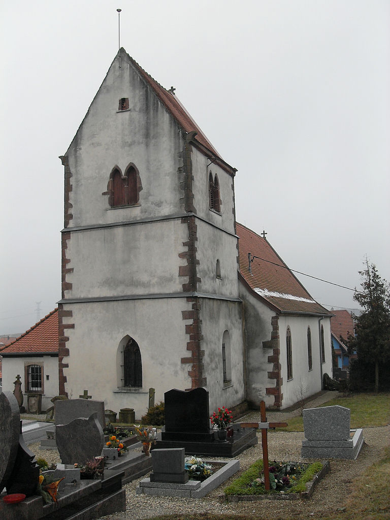
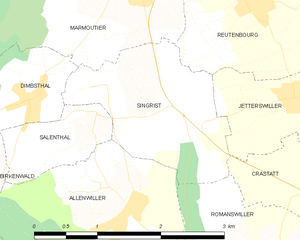
Singrist
- former commune in Bas-Rhin, France
- Country:
- Postal Code: 67440
- Coordinates: 48° 40' 13" N, 7° 23' 14" E
- GPS tracks (wikiloc): [Link]
- Area: 3.54 sq km
- Population: 430


Salenthal
- former commune in Bas-Rhin, France
- Country:
- Postal Code: 67440
- Coordinates: 48° 40' 1" N, 7° 22' 13" E
- GPS tracks (wikiloc): [Link]
- Area: 1.34 sq km
- Population: 257


Hengwiller
- commune in Bas-Rhin, France
- Country:
- Postal Code: 67440
- Coordinates: 48° 40' 2" N, 7° 20' 0" E
- GPS tracks (wikiloc): [Link]
- Area: 2.15 sq km
- Population: 188

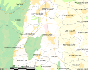
Marmoutier
- commune in Bas-Rhin, France
- Country:
- Postal Code: 67440
- Coordinates: 48° 41' 24" N, 7° 22' 52" E
- GPS tracks (wikiloc): [Link]
- Area: 14.07 sq km
- Population: 2685