Domjean (Domjean)

- commune in Manche, France
- Country:

- Postal Code: 50420
- Coordinates: 48° 59' 13" N, 1° 1' 57" E


- GPS tracks (wikiloc): [Link]
- Area: 16.57 sq km
- Population: 1087
- Wikipedia en: wiki(en)
- Wikipedia: wiki(fr)
- Wikidata storage: Wikidata: Q1003510
- Wikipedia Commons Category: [Link]
- Freebase ID: [/m/03w9kfp]
- Freebase ID: [/m/03w9kfp]
- GeoNames ID: Alt: [6612579]
- GeoNames ID: Alt: [6612579]
- SIREN number: [215001645]
- SIREN number: [215001645]
- BnF ID: [15262141s]
- BnF ID: [15262141s]
- INSEE municipality code: 50164
- INSEE municipality code: 50164
Shares border with regions:
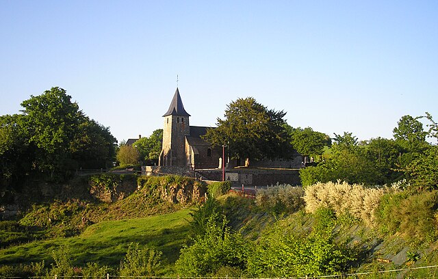
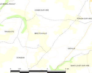
Brectouville
- former commune in Manche, France
- Country:
- Postal Code: 50160
- Coordinates: 49° 1' 19" N, 1° 1' 21" E
- GPS tracks (wikiloc): [Link]
- Area: 3.74 sq km
- Population: 166


Giéville
- former commune in Manche, France
- Country:
- Postal Code: 50160
- Coordinates: 49° 0' 52" N, 0° 58' 46" E
- GPS tracks (wikiloc): [Link]
- Area: 10.33 sq km
- Population: 670


Beuvrigny
- commune in Manche, France
- Country:
- Postal Code: 50420
- Coordinates: 48° 58' 5" N, 1° 0' 16" E
- GPS tracks (wikiloc): [Link]
- Area: 6.77 sq km
- Population: 134


Fourneaux
- commune in Manche, France
- Country:
- Postal Code: 50420
- Coordinates: 48° 57' 52" N, 1° 2' 10" E
- GPS tracks (wikiloc): [Link]
- Area: 3.34 sq km
- Population: 150

Troisgots
- former commune in Manche, France
- Country:
- Postal Code: 50420
- Coordinates: 49° 0' 41" N, 1° 4' 24" E
- GPS tracks (wikiloc): [Link]
- Area: 7.53 sq km
- Population: 325


Fervaches
- former commune in Manche, France
- Country:
- Postal Code: 50420
- Coordinates: 48° 59' 42" N, 1° 5' 8" E
- GPS tracks (wikiloc): [Link]
- Area: 4.89 sq km
- Population: 393


Saint-Louet-sur-Vire
- commune in Manche, France
- Country:
- Postal Code: 50420
- Coordinates: 48° 59' 29" N, 0° 59' 32" E
- GPS tracks (wikiloc): [Link]
- Area: 7.33 sq km
- Population: 206