
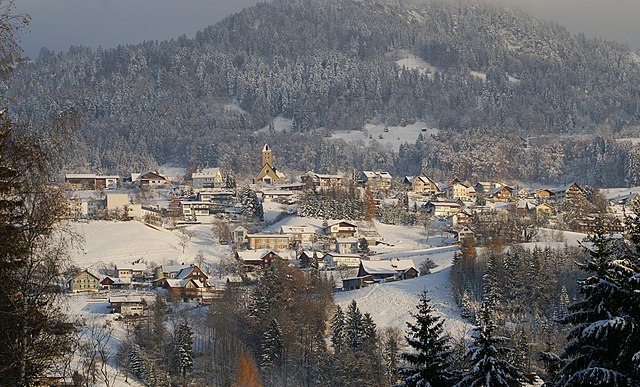
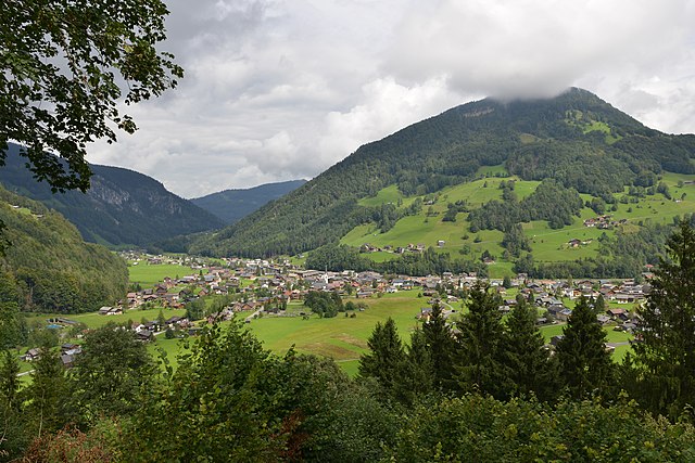
Dornbirn (Dornbirn)

- city in Vorarlberg, Austria
 Hiking in Dornbirn
Dornbirn, located in the Vorarlberg region of Austria, is a fantastic destination for hiking enthusiasts due to its stunning landscapes and proximity to the Alps. Here are some key highlights about hiking in and around Dornbirn:
Trails and Routes
-
Karren Mountain: A prominent peak near Dornbirn, Karren offers various hiking trails. The Karrenbahn cable car takes you to the summit, where you can find well-marked trails with breathtaking views of the surrounding region. The panorama from the peak, including Lake Constance and the Alps, is spectacular.
-
Rappenloch Gorge: This is a popular hiking area featuring impressive geological formations and the roaring waters of the gorge. Trails here can be found that accommodate different skill levels, making it great for families as well.
-
Dornbirn to the Bödele: This route provides a scenic hike through forests and fields, leading to the Bödele. Along the way, there are opportunities to enjoy local flora and fauna and perhaps spot wildlife like deer or various bird species.
-
Metzlersee: A lovely lake just a short hike outside Dornbirn, perfect for a relaxing day. The area around the lake has walking trails suitable for various fitness levels.
Hiking Access and Season
-
Best Time to Hike: Late spring to early autumn is ideal for hiking in Dornbirn. The weather is generally mild, and trails are more accessible. However, you can enjoy winter hiking and snowshoeing in the surrounding areas when snow is present.
-
Trail Access: Most trails are well-marked and accessible to hikers of all levels, from easy walks to more challenging mountain ascents.
Preparation and Tips
-
Gear: It's essential to wear appropriate footwear, especially if you plan to tackle steeper trails. A good pair of hiking boots, moisture-wicking clothing, and weather-appropriate gear will enhance your experience.
-
Safety: Always let someone know your planned route and expected return time. Carry a map, and, if possible, a walking stick for uneven terrain.
-
Local Guidelines: Respect local wildlife and follow the Leave No Trace principles to help preserve the beauty of the area.
Additional Attractions
When you’re done hiking, Dornbirn offers charming local cafes, restaurants, and cultural attractions. The city’s markets and historic sites are worth a visit to get a taste of local culture.
In summary, hiking in Dornbirn provides a mix of natural beauty, accessible trails, and opportunities to explore the rich landscape of Vorarlberg. Whether you're an experienced hiker or just looking for a leisurely nature walk, Dornbirn is a wonderful choice. Happy hiking!
- Country:

- Postal Code: 6850
- Local Dialing Code: 05572
- Licence Plate Code: DO
- Coordinates: 47° 25' 0" N, 9° 45' 0" E


- GPS tracks (wikiloc): [Link]
- AboveSeaLevel: 437 м m
- Area: 120.97 sq km
- Population: 48067
- Web site: http://www.dornbirn.at
- Wikipedia en: wiki(en)
- Wikipedia: wiki(de)
- Wikidata storage: Wikidata: Q171219
- Wikipedia Commons Gallery: [Link]
- Wikipedia Commons Category: [Link]
- Wikipedia Commons Maps Category: [Link]
- Freebase ID: [/m/016d33]
- GeoNames ID: Alt: [2780741]
- BnF ID: [12412382t]
- VIAF ID: Alt: [159530754]
- OSM relation ID: [75110]
- GND ID: Alt: [4012792-8]
- archINFORM location ID: [1382]
- Library of Congress authority ID: Alt: [n86097336]
- MusicBrainz area ID: [b4e850b7-9f68-4784-837d-8a0b13450c1f]
- Quora topic ID: [Dornbirn]
- Encyclopædia Britannica Online ID: [place/Dornbirn]
- Facebook Places ID: [103991356302784]
- Great Russian Encyclopedia Online ID: [1966218]
- Austrian municipality key: [80301]
Includes regions:
Schoren
Hiking in Schoren
Schoren, located in Dornbirn, Austria, is a beautiful area for hiking, offering some fantastic trails that cater to various skill levels. The region is characterized by its lush greenery, hilly terrain, and stunning views of the surrounding Alps and Lake Constance....
- Country:
- Coordinates: 47° 24' 36" N, 9° 43' 38" E
- GPS tracks (wikiloc): [Link]

Hatlerdorf
- human settlement in Austria
Hiking in Hatlerdorf
Hatlerdorf is a picturesque district located in the city of Dornbirn, Austria, at the edge of the beautiful Vorarlberg region. Surrounded by stunning alpine scenery, Hatlerdorf offers a range of hiking opportunities that cater to various skill levels....
- Country:
- Coordinates: 47° 24' 7" N, 9° 44' 18" E
- GPS tracks (wikiloc): [Link]
- Population: 11161

Rohrbach
Hiking in Rohrbach
Hiking in Rohrbach, located in the Dornbirn area of Austria, offers a picturesque experience that combines stunning natural landscapes with well-marked trails suitable for various skill levels. Here are some details to consider for your hiking adventure in this region:...
- Country:
- Coordinates: 47° 25' 20" N, 9° 43' 58" E
- GPS tracks (wikiloc): [Link]
Markt (Dornbirn)
- human settlement in Austria
Hiking in Markt (Dornbirn)
Markt in Dornbirn, Austria, is a great starting point for various hiking adventures given its location near the foothills of the Alps. The natural landscapes around Dornbirn offer a range of trails suited for different skill levels, from leisurely walks to challenging hikes....
- Country:
- Coordinates: 47° 24' 49" N, 9° 44' 32" E
- GPS tracks (wikiloc): [Link]
Oberdorf (Dornbirn)
Hiking in Oberdorf (Dornbirn)
Oberdorf in Dornbirn, Austria, is a fantastic location for hiking, offering picturesque views of the Alpine scenery and a variety of trails suitable for different skill levels. Here are some highlights about hiking in this area:...
- Country:
- Coordinates: 47° 24' 33" N, 9° 45' 4" E
- GPS tracks (wikiloc): [Link]

Haselstauden
- human settlement
Hiking in Haselstauden
Haselstauden is a beautiful district located in the city of Dornbirn, Austria. It offers some scenic hiking opportunities with a blend of natural beauty and picturesque landscapes. Here are some highlights and tips for hiking in this area:...
- Country:
- Coordinates: 47° 25' 48" N, 9° 45' 22" E
- GPS tracks (wikiloc): [Link]
- Population: 5409
Shares border with regions:
Zwischenwasser
- municipality in Austria
Hiking in Zwischenwasser
Zwischenwasser is a small municipality in Austria, located in the Vorarlberg region. The area is known for its picturesque landscapes, rolling hills, and proximity to the Alps, making it a great destination for hiking enthusiasts....
- Country:
- Postal Code: 6835
- Local Dialing Code: 05522
- Licence Plate Code: FK
- Coordinates: 47° 16' 45" N, 9° 39' 56" E
- GPS tracks (wikiloc): [Link]
- AboveSeaLevel: 525 м m
- Area: 22.63 sq km
- Population: 3203
- Web site: [Link]


Lustenau
- town in the Austrian state of Vorarlberg
Hiking in Lustenau
Lustenau, located in Austria near the border with Switzerland and Germany, offers a variety of beautiful hiking opportunities. The region is characterized by its stunning landscapes, including rolling hills, lush forests, and proximity to Lake Constance. Here are some highlights and tips for hiking in the Lustenau area:...
- Country:
- Postal Code: 6893; 6890
- Local Dialing Code: 05577
- Licence Plate Code: DO
- Coordinates: 47° 25' 38" N, 9° 40' 16" E
- GPS tracks (wikiloc): [Link]
- AboveSeaLevel: 404 м m
- Area: 22.55 sq km
- Population: 22821
- Web site: [Link]


Alberschwende
- municipality in Austria
Hiking in Alberschwende
Alberschwende is a picturesque village located in the Vorarlberg region of Austria, known for its beautiful landscapes and outdoor activities, particularly hiking. The area offers a variety of hiking trails that cater to different skill levels, from beginners to experienced hikers....
- Country:
- Postal Code: 6861
- Local Dialing Code: 05579
- Licence Plate Code: B
- Coordinates: 47° 27' 2" N, 9° 49' 53" E
- GPS tracks (wikiloc): [Link]
- AboveSeaLevel: 721 м m
- Area: 21.15 sq km
- Population: 3247
- Web site: [Link]


Laterns
- municipality in Austria
Hiking in Laterns
Laterns is a beautiful area located in the Vorarlberg region of Austria, well-known for its stunning landscapes, lush greenery, and picturesque hiking trails. Here are some key points to consider if you're planning a hiking trip to Laterns:...
- Country:
- Postal Code: 6830
- Local Dialing Code: 05526
- Licence Plate Code: FK
- Coordinates: 47° 16' 0" N, 9° 42' 0" E
- GPS tracks (wikiloc): [Link]
- AboveSeaLevel: 921 м m
- Area: 43.79 sq km
- Population: 662
- Web site: [Link]

Viktorsberg
- municipality in Austria
Hiking in Viktorsberg
Viktorsberg is a beautiful village located in Austria, specifically in the Vorarlberg region, nestled in the foothills of the Alps. It's an excellent destination for hiking, offering a variety of trails that cater to different skill levels and preferences....
- Country:
- Postal Code: 6836
- Local Dialing Code: 05523
- Licence Plate Code: FK
- Coordinates: 47° 18' 7" N, 9° 40' 30" E
- GPS tracks (wikiloc): [Link]
- AboveSeaLevel: 879 м m
- Area: 12.51 sq km
- Population: 411
- Web site: [Link]

Bildstein
- municipality in Austria
Hiking in Bildstein
Bildstein, located in Austria, is a beautiful area known for its serene landscapes and stunning hiking trails. The region offers a variety of trails suitable for different skill levels, from leisurely walks to more challenging hikes....
- Country:
- Postal Code: 6858
- Local Dialing Code: 05572
- Licence Plate Code: B
- Coordinates: 47° 27' 29" N, 9° 46' 20" E
- GPS tracks (wikiloc): [Link]
- AboveSeaLevel: 659 м m
- Area: 9.14 sq km
- Population: 766
- Web site: [Link]

Mellau
- town in Vorarlberg, Austria
Hiking in Mellau
Mellau is a beautiful village located in the Bregenzerwald region of Austria, surrounded by stunning mountain scenery that offers a variety of hiking opportunities. Here are some details about hiking in Mellau:...
- Country:
- Postal Code: 6881
- Local Dialing Code: 05518
- Licence Plate Code: B
- Coordinates: 47° 21' 4" N, 9° 52' 55" E
- GPS tracks (wikiloc): [Link]
- AboveSeaLevel: 688 м m
- Area: 40.55 sq km
- Population: 1301
- Web site: [Link]


Schwarzenberg
- municipality in Vorarlberg, Austria
Hiking in Schwarzenberg
Schwarzenberg, located in the Austrian state of Vorarlberg, is a picturesque town nestled in the Bregenz Forest region, known for its stunning landscapes and excellent hiking opportunities. Here are some highlights and tips for hiking in Schwarzenberg:...
- Country:
- Postal Code: 6867
- Local Dialing Code: 05512
- Licence Plate Code: B
- Coordinates: 47° 24' 48" N, 9° 51' 11" E
- GPS tracks (wikiloc): [Link]
- AboveSeaLevel: 696 м m
- Area: 25.76 sq km
- Population: 1850
- Web site: [Link]


Wolfurt
- municipality in Austria
Hiking in Wolfurt
Wolfurt, located in the Vorarlberg region of Austria, offers some lovely hiking opportunities, particularly due to its proximity to beautiful landscapes and the foothills of the Alps. Here are some highlights for hiking in and around Wolfurt:...
- Country:
- Local Dialing Code: 05574
- Licence Plate Code: B
- Coordinates: 47° 28' 23" N, 9° 45' 14" E
- GPS tracks (wikiloc): [Link]
- AboveSeaLevel: 434 м m
- Area: 10 sq km
- Population: 8429
- Web site: [Link]


Fraxern
- municipality in Austria
Hiking in Fraxern
Fraxern is a small community located in Austria, known for its picturesque landscapes and outdoor activities, including hiking. The region offers a variety of trails suitable for all levels, from easy walks to more challenging hikes. Here are some key points about hiking in Fraxern:...
- Country:
- Postal Code: 6833
- Local Dialing Code: 05523
- Licence Plate Code: FK
- Coordinates: 47° 19' 0" N, 9° 40' 30" E
- GPS tracks (wikiloc): [Link]
- AboveSeaLevel: 817 м m
- Area: 8.87 sq km
- Population: 701
- Web site: [Link]

Hohenems
- municipality in Austria
Hiking in Hohenems
Hohenems is a charming town located in the Vorarlberg region of Austria, surrounded by the beautiful landscapes of the Alps. Hiking in and around Hohenems offers a variety of trails suitable for all skill levels, from easy walks to challenging mountain hikes. Here are some aspects to consider when hiking in this area:...
- Country:
- Postal Code: 6845
- Local Dialing Code: 05576
- Licence Plate Code: DO
- Coordinates: 47° 22' 0" N, 9° 40' 0" E
- GPS tracks (wikiloc): [Link]
- AboveSeaLevel: 432 м m
- Area: 29.18 sq km
- Population: 16317
- Web site: [Link]


Lauterach
- municipality in Vorarlberg, Austria
Hiking in Lauterach
Lauterach is a charming village located in the Vorarlberg region of Austria, close to the town of Bregenz and the shores of Lake Constance. While it's relatively small, it serves as a great base for exploring the surrounding landscape, which offers numerous hiking opportunities....
- Country:
- Postal Code: 6923
- Local Dialing Code: 05574
- Licence Plate Code: B
- Coordinates: 47° 28' 38" N, 9° 43' 53" E
- GPS tracks (wikiloc): [Link]
- AboveSeaLevel: 412 м m
- Area: 11.92 sq km
- Population: 10028
- Web site: [Link]


Reuthe
- municipality in Austria
Hiking in Reuthe
Reuthe is a charming village located in the Bregenz Forest region of Austria, known for its beautiful landscapes and outdoor activities, particularly hiking. The surroundings offer a diverse range of trails suitable for all levels, from easy walks to more challenging hikes....
- Country:
- Postal Code: 6870
- Local Dialing Code: 05514
- Licence Plate Code: B
- Coordinates: 47° 22' 12" N, 9° 53' 36" E
- GPS tracks (wikiloc): [Link]
- AboveSeaLevel: 650 м m
- Area: 10.24 sq km
- Population: 658
- Web site: [Link]

Damüls
- municipality in Austria
Hiking in Damüls
Damüls, located in the Vorarlberg region of Austria, is a stunning destination for hiking enthusiasts. Nestled in the Bregenz Forest, it offers a wide variety of trails that accommodate different skill levels, from easy walks suitable for families to challenging hikes for experienced trekkers....
- Country:
- Postal Code: 6884
- Local Dialing Code: 05510
- Licence Plate Code: B
- Coordinates: 47° 16' 59" N, 9° 52' 59" E
- GPS tracks (wikiloc): [Link]
- AboveSeaLevel: 1432 м m
- Area: 20.92 sq km
- Population: 313
- Web site: [Link]


Schwarzach
- municipality in Austria
Hiking in Schwarzach
Schwarzach in Vorarlberg, Austria, is a beautiful region that offers various hiking opportunities suitable for different skill levels. Nestled in the picturesque Bregenz Forest, this area provides breathtaking alpine landscapes, lush forests, and scenic views of the surrounding mountains....
- Country:
- Postal Code: 6858
- Local Dialing Code: 05572
- Licence Plate Code: B
- Coordinates: 47° 26' 41" N, 9° 45' 47" E
- GPS tracks (wikiloc): [Link]
- AboveSeaLevel: 433 м m
- Area: 4.91 sq km
- Population: 3949
- Web site: [Link]