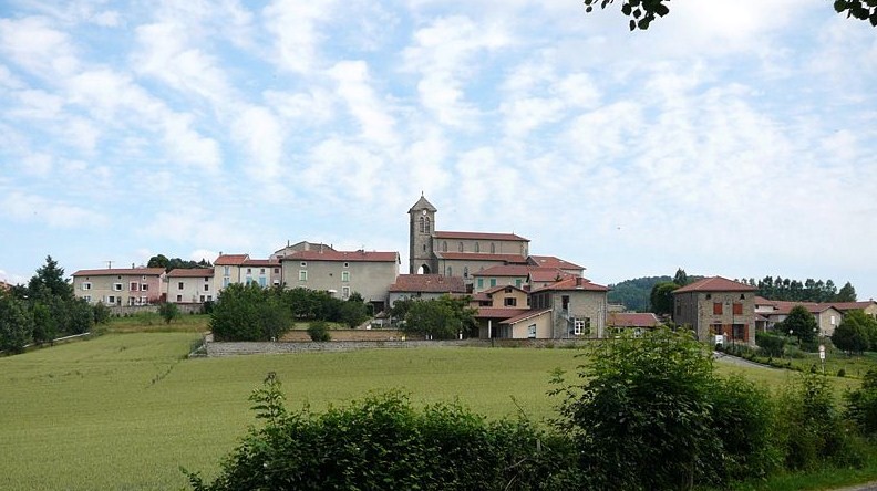
Duerne (Duerne)

- commune in Rhône, France
- Country:

- Postal Code: 69850
- Coordinates: 45° 41' 4" N, 4° 31' 39" E


- GPS tracks (wikiloc): [Link]
- Area: 11.41 sq km
- Population: 811
- Wikipedia en: wiki(en)
- Wikipedia: wiki(fr)
- Wikidata storage: Wikidata: Q1469399
- Wikipedia Commons Category: [Link]
- Freebase ID: [/m/03qgf_l]
- GeoNames ID: Alt: [6450756]
- SIREN number: [216900787]
- BnF ID: [15272166b]
- INSEE municipality code: 69078
Shares border with regions:

La Chapelle-sur-Coise
- commune in Rhône, France
- Country:
- Postal Code: 69590
- Coordinates: 45° 39' 17" N, 4° 29' 59" E
- GPS tracks (wikiloc): [Link]
- Area: 6.58 sq km
- Population: 583
- Web site: [Link]

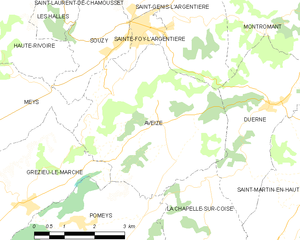
Aveize
- commune in Rhône, France
- Country:
- Postal Code: 69610
- Coordinates: 45° 40' 57" N, 4° 28' 40" E
- GPS tracks (wikiloc): [Link]
- Area: 16.64 sq km
- Population: 1129


Montromant
- commune in Rhône, France
- Country:
- Postal Code: 69610
- Coordinates: 45° 42' 29" N, 4° 31' 32" E
- GPS tracks (wikiloc): [Link]
- Area: 10.99 sq km
- Population: 451
- Web site: [Link]

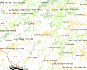
Saint-Martin-en-Haut
- commune in Rhône, France
- Country:
- Postal Code: 69850
- Coordinates: 45° 39' 35" N, 4° 33' 42" E
- GPS tracks (wikiloc): [Link]
- Area: 38.64 sq km
- Population: 3907
- Web site: [Link]

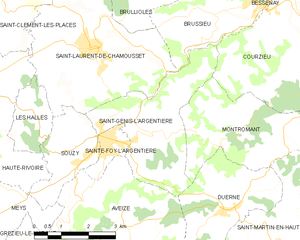
Saint-Genis-l'Argentière
- commune in Rhône, France
- Country:
- Postal Code: 69610
- Coordinates: 45° 42' 36" N, 4° 29' 31" E
- GPS tracks (wikiloc): [Link]
- Area: 10.65 sq km
- Population: 1063
- Web site: [Link]