
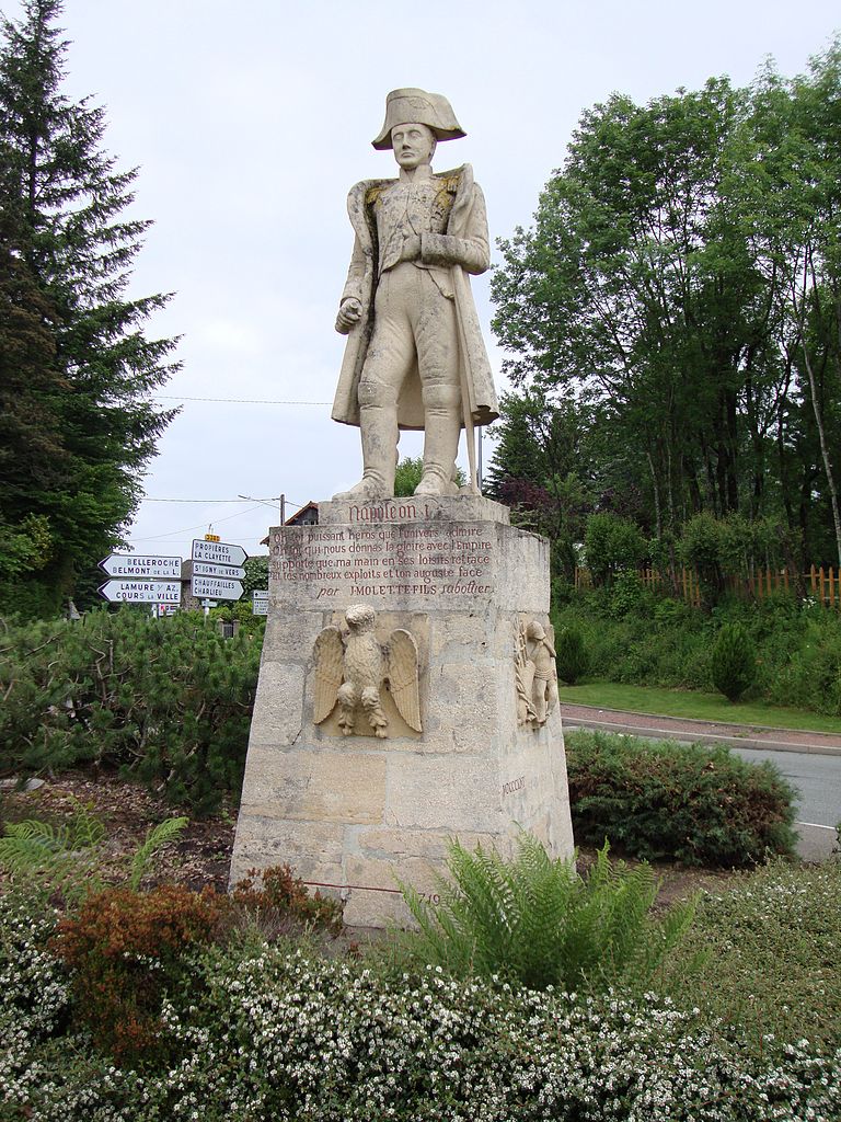
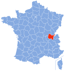
Rhône (Rhône)

- French department
 Hiking in Rhône
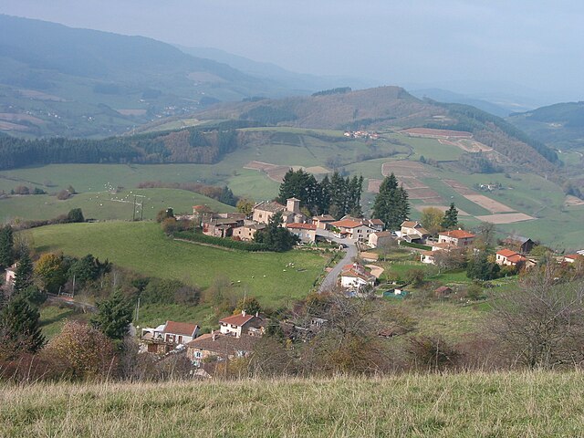
Hiking in the Rhône department, located in the Auvergne-Rhône-Alpes region of France, offers a diverse range of landscapes and trails that cater to various skill levels. Here's a breakdown of what you can expect:
Terrain and Scenery
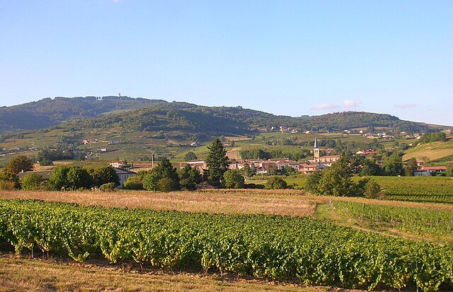
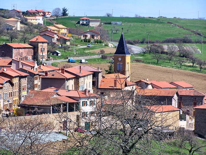
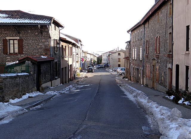
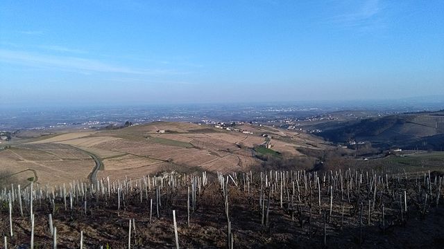
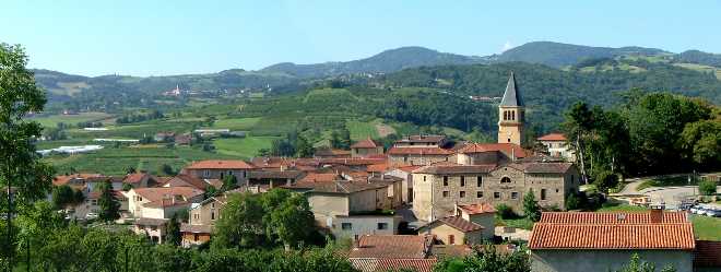
- Hilly Landscapes: The Rhône region features a mix of rolling hills, vineyards, and mountainous areas, particularly in the northern sections where the Beaujolais mountains are found.
- Vineyards: The famous wine regions, especially Beaujolais, provide picturesque trails that often meander through vineyards, allowing hikers to enjoy stunning views and potentially stop at local wineries.
- Rivers and Lakes: The Rhône River and various lakes add to the region's natural beauty, providing opportunities for scenic hikes along the water's edge.
Popular Hiking Areas
-
Beaujolais Regional Natural Park: This area is known for its scenic vineyards, gentle hills, and charming villages. There are numerous trails ranging from easy to moderate difficulty.
-
Monts du Lyonnais: Located southwest of Lyon, this mountain range features trails that take you through forests and offer beautiful panoramic views from higher elevations.
-
The Pilat Regional Natural Park: Slightly south of the Rhône department, this park has rugged terrain and varied landscapes, providing a more mountainous hiking experience with trails suitable for experienced hikers.
Trail Information
- Many trails are well-marked and maintained, with maps and guides available through local tourist offices or hiking clubs.
- The GR (Grande Randonnée) trails also pass through Rhône, including sections of GR7 and GR65, which are great for longer multi-day hikes.
Tips for Hikers
- Weather Considerations: The weather can change rapidly, especially in mountainous areas. Be sure to check forecasts and prepare accordingly.
- Equipment: Depending on the trail difficulty, sturdy hiking boots, and proper clothing are essential. If you plan to hike in colder months, make sure to bring additional layers.
- Local Customs: When hiking through vineyards or private lands, be mindful of local etiquette, such as staying on marked paths and respecting private property.
Accessibility
- The area is relatively accessible from Lyon, making it an ideal spot for day hikes or weekend trips. Public transportation options are available for reaching trailheads.
In summary, hiking in the Rhône department provides a wonderful mix of natural beauty, cultural experiences, and diverse terrain. Whether you're a casual walker or an experienced hiker, there’s something to enjoy on the trails of this scenic region.
- Country:

- Capital: Villefranche-sur-Saône
- Coordinates: 45° 59' 44" N, 4° 43' 10" E


- GPS tracks (wikiloc): [Link]
- Area: 3249 sq km
- Population: 1821995
- Web site: https://www.rhone.fr/
- Wikipedia en: wiki(en)
- Wikipedia: wiki(fr)
- Wikidata storage: Wikidata: Q46130
- Wikipedia Commons Gallery: [Link]
- Wikipedia Commons Category: [Link]
- Wikipedia Commons Maps Category: [Link]
- Freebase ID: [/m/0kwkn]
- GeoNames ID: Alt: [2987410]
- SIREN number: [226900017]
- BnF ID: [15242596r]
- VIAF ID: Alt: [23144814298750924399]
- OSM relation ID: [4850451]
- GND ID: Alt: [4103775-3]
- archINFORM location ID: [2762]
- PACTOLS thesaurus ID: [pcrtdGSf7FYRvz]
- MusicBrainz area ID: [78cae463-5e8b-4a76-b074-c742c016b885]
- TGN ID: [7002985]
- Encyclopædia Britannica Online ID: [place/Rhone]
- NUTS code: [FR716]
- INSEE department code: [69D]
- BHL creator ID: [211130]
- ISO 3166-2 code: FR-69
Includes regions:

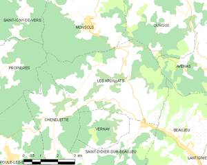
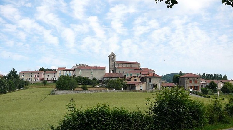
Les Ardillats
- commune in Rhône, France
- Country:
- Postal Code: 69430
- Coordinates: 46° 10' 46" N, 4° 32' 26" E
- GPS tracks (wikiloc): [Link]
- Area: 23.1 sq km
- Population: 633
- Web site: [Link]

Chaponost
- commune in Rhône, France
- Country:
- Postal Code: 69630
- Coordinates: 45° 42' 37" N, 4° 44' 32" E
- GPS tracks (wikiloc): [Link]
- Area: 16.32 sq km
- Population: 8436


Avenas
- commune in Rhône, France
- Country:
- Postal Code: 69430
- Coordinates: 46° 11' 41" N, 4° 36' 18" E
- GPS tracks (wikiloc): [Link]
- Area: 9.49 sq km
- Population: 123


Quincié-en-Beaujolais
- commune in Rhône, France
- Country:
- Postal Code: 69430
- Coordinates: 46° 7' 8" N, 4° 36' 59" E
- GPS tracks (wikiloc): [Link]
- Area: 22.05 sq km
- Population: 1318


Claveisolles
- commune in Rhône, France
- Country:
- Postal Code: 69870
- Coordinates: 46° 6' 0" N, 4° 29' 38" E
- GPS tracks (wikiloc): [Link]
- Area: 28.33 sq km
- Population: 662


Azolette
- commune in Rhône, France
- Country:
- Postal Code: 69790
- Coordinates: 46° 11' 35" N, 4° 25' 7" E
- GPS tracks (wikiloc): [Link]
- Area: 4.18 sq km
- Population: 123


Aigueperse
- commune in Rhône, France
- Country:
- Postal Code: 69790
- Coordinates: 46° 16' 37" N, 4° 26' 3" E
- GPS tracks (wikiloc): [Link]
- Area: 12.95 sq km
- Population: 253

La Chapelle-sur-Coise
- commune in Rhône, France
- Country:
- Postal Code: 69590
- Coordinates: 45° 39' 17" N, 4° 29' 59" E
- GPS tracks (wikiloc): [Link]
- Area: 6.58 sq km
- Population: 583
- Web site: [Link]

Les Chères
- commune in Rhône, France
- Country:
- Postal Code: 69380
- Coordinates: 45° 53' 23" N, 4° 44' 33" E
- GPS tracks (wikiloc): [Link]
- Area: 5.46 sq km
- Population: 1449


Les Haies
- commune in Rhône, France
- Country:
- Postal Code: 69420
- Coordinates: 45° 30' 15" N, 4° 44' 51" E
- GPS tracks (wikiloc): [Link]
- Area: 15.97 sq km
- Population: 797


Les Halles
- commune in Rhône, France
- Country:
- Postal Code: 69610
- Coordinates: 45° 43' 8" N, 4° 25' 56" E
- GPS tracks (wikiloc): [Link]
- Area: 3.09 sq km
- Population: 486


Chevinay
- commune in Rhône, France
- Country:
- Postal Code: 69210
- Coordinates: 45° 46' 13" N, 4° 36' 28" E
- GPS tracks (wikiloc): [Link]
- Area: 8.82 sq km
- Population: 543
- Web site: [Link]

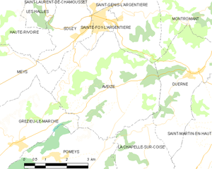
Aveize
- commune in Rhône, France
- Country:
- Postal Code: 69610
- Coordinates: 45° 40' 57" N, 4° 28' 40" E
- GPS tracks (wikiloc): [Link]
- Area: 16.64 sq km
- Population: 1129


Bessenay
- commune in Rhône, France
- Country:
- Postal Code: 69690
- Coordinates: 45° 46' 36" N, 4° 33' 16" E
- GPS tracks (wikiloc): [Link]
- Area: 14.01 sq km
- Population: 2256


Chaussan
- commune in Rhône, France
- Country:
- Postal Code: 69440
- Coordinates: 45° 38' 1" N, 4° 38' 22" E
- GPS tracks (wikiloc): [Link]
- Area: 7.89 sq km
- Population: 1115
- Web site: [Link]


Coise
- commune in Rhône, France
- Country:
- Postal Code: 69590
- Coordinates: 45° 36' 49" N, 4° 28' 24" E
- GPS tracks (wikiloc): [Link]
- Area: 9.03 sq km
- Population: 763

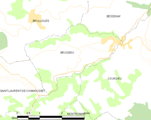
Brussieu
- commune in Rhône, France
- Country:
- Postal Code: 69690
- Coordinates: 45° 44' 53" N, 4° 31' 28" E
- GPS tracks (wikiloc): [Link]
- Area: 6.74 sq km
- Population: 1334


Villié-Morgon
- commune in Rhône, France
- Country:
- Postal Code: 69910
- Coordinates: 46° 9' 44" N, 4° 40' 50" E
- GPS tracks (wikiloc): [Link]
- Area: 18.74 sq km
- Population: 2108
- Web site: [Link]


Régnié-Durette
- commune in Rhône, France
- Country:
- Postal Code: 69430
- Coordinates: 46° 8' 16" N, 4° 38' 29" E
- GPS tracks (wikiloc): [Link]
- AboveSeaLevel: 316 м m
- Area: 11.72 sq km
- Population: 1107
- Web site: [Link]

Fleurie
- commune in Rhône, France
- Country:
- Postal Code: 69820
- Coordinates: 46° 11' 32" N, 4° 41' 51" E
- GPS tracks (wikiloc): [Link]
- Area: 13.94 sq km
- Population: 1248
- Web site: [Link]


Vernay
- commune in Rhône, France
- Country:
- Postal Code: 69430
- Coordinates: 46° 9' 26" N, 4° 31' 45" E
- GPS tracks (wikiloc): [Link]
- Area: 5.59 sq km
- Population: 108


Pont-Trambouze
- former commune in Rhône, France
- Country:
- Postal Code: 69240
- Coordinates: 46° 4' 22" N, 4° 18' 53" E
- GPS tracks (wikiloc): [Link]
- Area: 4.06 sq km
- Population: 447


Civrieux-d'Azergues
- commune in Rhône, France
- Country:
- Postal Code: 69380
- Coordinates: 45° 51' 29" N, 4° 42' 47" E
- GPS tracks (wikiloc): [Link]
- Area: 5.02 sq km
- Population: 1524
- Web site: [Link]


Bibost
- commune in Rhône, France
- Country:
- Postal Code: 69690
- Coordinates: 45° 47' 51" N, 4° 32' 46" E
- GPS tracks (wikiloc): [Link]
- Area: 5.23 sq km
- Population: 571
Bourg-de-Thizy
- former commune in Rhône, France
- Country:
- Postal Code: 69240
- Coordinates: 46° 2' 6" N, 4° 17' 59" E
- GPS tracks (wikiloc): [Link]
- Population: 2518


Chassagny
- former commune in Rhône, France
- Country:
- Postal Code: 69700
- Coordinates: 45° 36' 23" N, 4° 43' 56" E
- GPS tracks (wikiloc): [Link]
- Area: 9.33 sq km
- Population: 1314


Haute-Rivoire
- commune in Rhône, France
- Country:
- Postal Code: 69610
- Coordinates: 45° 42' 56" N, 4° 23' 47" E
- GPS tracks (wikiloc): [Link]
- Area: 20.29 sq km
- Population: 1433
- Web site: [Link]

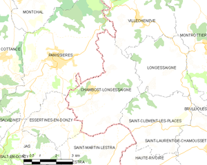
Chambost-Longessaigne
- commune in Rhône, France
- Country:
- Postal Code: 69770
- Coordinates: 45° 46' 22" N, 4° 22' 9" E
- GPS tracks (wikiloc): [Link]
- Area: 15.44 sq km
- Population: 935
- Web site: [Link]


Dommartin
- commune in Rhône, France
- Country:
- Postal Code: 69380
- Coordinates: 45° 50' 6" N, 4° 42' 41" E
- GPS tracks (wikiloc): [Link]
- Area: 7.22 sq km
- Population: 2584
- Web site: [Link]

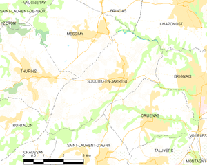
Soucieu-en-Jarrest
- commune in Rhône, France
- Country:
- Postal Code: 69510
- Coordinates: 45° 40' 40" N, 4° 42' 14" E
- GPS tracks (wikiloc): [Link]
- Area: 14.2 sq km
- Population: 4431
- Web site: [Link]


Sainte-Foy-l'Argentière
- commune in Rhône, France
- Country:
- Postal Code: 69610
- Coordinates: 45° 42' 30" N, 4° 28' 13" E
- GPS tracks (wikiloc): [Link]
- Area: 1.54 sq km
- Population: 1289

Sourcieux-les-Mines
- commune in Rhône, France
- Country:
- Postal Code: 69210
- Coordinates: 45° 48' 22" N, 4° 37' 21" E
- GPS tracks (wikiloc): [Link]
- Area: 9.96 sq km
- Population: 1999


Sarcey
- commune in Rhône, France
- Country:
- Postal Code: 69490
- Coordinates: 45° 52' 50" N, 4° 33' 8" E
- GPS tracks (wikiloc): [Link]
- Area: 9.99 sq km
- Population: 990
- Web site: [Link]


Saint-Symphorien-sur-Coise
- commune in Rhône, France
- Country:
- Postal Code: 69590
- Coordinates: 45° 37' 56" N, 4° 27' 26" E
- GPS tracks (wikiloc): [Link]
- Area: 4.07 sq km
- Population: 3627
- Web site: [Link]

Saint-Vincent-de-Reins
- commune in Rhône, France
- Country:
- Postal Code: 69240
- Coordinates: 46° 4' 28" N, 4° 23' 15" E
- GPS tracks (wikiloc): [Link]
- Area: 13.87 sq km
- Population: 657

Thizy
- former commune in Rhône, France
- Country:
- Postal Code: 69240
- Coordinates: 46° 2' 0" N, 4° 18' 44" E
- GPS tracks (wikiloc): [Link]
- Population: 2289
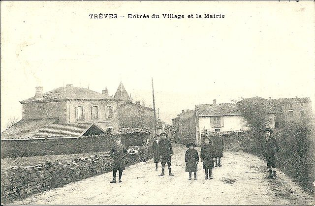

Trèves
- commune in Rhône, France
- Country:
- Postal Code: 69420
- Coordinates: 45° 32' 22" N, 4° 40' 34" E
- GPS tracks (wikiloc): [Link]
- Area: 7.56 sq km
- Population: 725


Villechenève
- commune in Rhône, France
- Country:
- Postal Code: 69770
- Coordinates: 45° 48' 46" N, 4° 24' 22" E
- GPS tracks (wikiloc): [Link]
- Area: 14.15 sq km
- Population: 894
- Web site: [Link]


Saint-Romain-en-Gier
- commune in Rhône, France
- Country:
- Postal Code: 69700
- Coordinates: 45° 33' 55" N, 4° 42' 25" E
- GPS tracks (wikiloc): [Link]
- Area: 4.05 sq km
- Population: 573

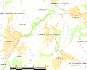
Fleurieux-sur-l'Arbresle
- commune in Rhône, France
- Country:
- Postal Code: 69210
- Coordinates: 45° 50' 11" N, 4° 39' 9" E
- GPS tracks (wikiloc): [Link]
- Area: 9.51 sq km
- Population: 2334
- Web site: [Link]

Tupin-et-Semons
- commune in Rhône, France
- Country:
- Postal Code: 69420
- Coordinates: 45° 28' 42" N, 4° 46' 34" E
- GPS tracks (wikiloc): [Link]
- Area: 8.26 sq km
- Population: 617


Saint-Jean-de-Touslas
- former commune in Rhône, France
- Country:
- Postal Code: 69700
- Coordinates: 45° 34' 38" N, 4° 39' 42" E
- GPS tracks (wikiloc): [Link]
- Area: 5.57 sq km
- Population: 846

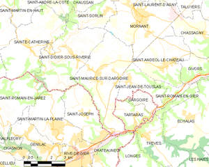
Saint-Maurice-sur-Dargoire
- former commune in Rhône, France
- Country:
- Postal Code: 42800
- Coordinates: 45° 34' 56" N, 4° 37' 52" E
- GPS tracks (wikiloc): [Link]
- Area: 16.27 sq km
- Population: 2319
- Web site: [Link]


Saint-Pierre-la-Palud
- commune in Rhône, France
- Country:
- Postal Code: 69210
- Coordinates: 45° 47' 27" N, 4° 36' 42" E
- GPS tracks (wikiloc): [Link]
- Area: 7.53 sq km
- Population: 2629
- Web site: [Link]
Nuelles
- former commune in Rhône, France
- Country:
- Postal Code: 69210
- Coordinates: 45° 50' 55" N, 4° 37' 34" E
- GPS tracks (wikiloc): [Link]


Montromant
- commune in Rhône, France
- Country:
- Postal Code: 69610
- Coordinates: 45° 42' 29" N, 4° 31' 32" E
- GPS tracks (wikiloc): [Link]
- Area: 10.99 sq km
- Population: 451
- Web site: [Link]

Lantignié
- commune in Rhône, France
- Country:
- Postal Code: 69430
- Coordinates: 46° 8' 50" N, 4° 37' 24" E
- GPS tracks (wikiloc): [Link]
- Area: 7.4 sq km
- Population: 886

Saint-Julien-sur-Bibost
- commune in Rhône, France
- Country:
- Postal Code: 69690
- Coordinates: 45° 48' 15" N, 4° 31' 9" E
- GPS tracks (wikiloc): [Link]
- Area: 13.28 sq km
- Population: 562
- Web site: [Link]

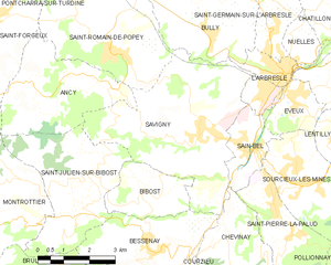
Sain-Bel
- commune in Rhône, France
- Country:
- Postal Code: 69210
- Coordinates: 45° 48' 37" N, 4° 35' 53" E
- GPS tracks (wikiloc): [Link]
- Area: 3.68 sq km
- Population: 2309
- Web site: [Link]
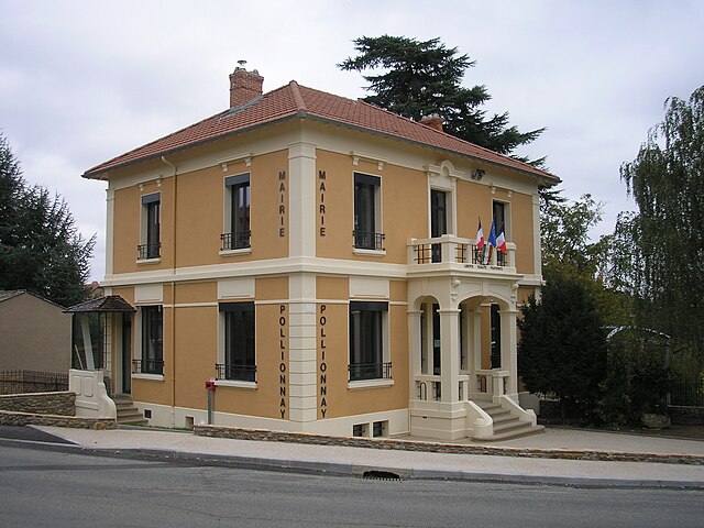

Pollionnay
- commune in Rhône, France
- Country:
- Postal Code: 69290
- Coordinates: 45° 45' 53" N, 4° 39' 40" E
- GPS tracks (wikiloc): [Link]
- Area: 15.8 sq km
- Population: 2388
- Web site: [Link]

Marnand
- former commune in Rhône, France
- Country:
- Postal Code: 69240
- Coordinates: 46° 2' 10" N, 4° 19' 47" E
- GPS tracks (wikiloc): [Link]
- Area: 8.75 sq km
- Population: 609

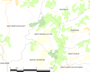
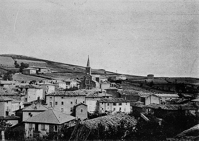
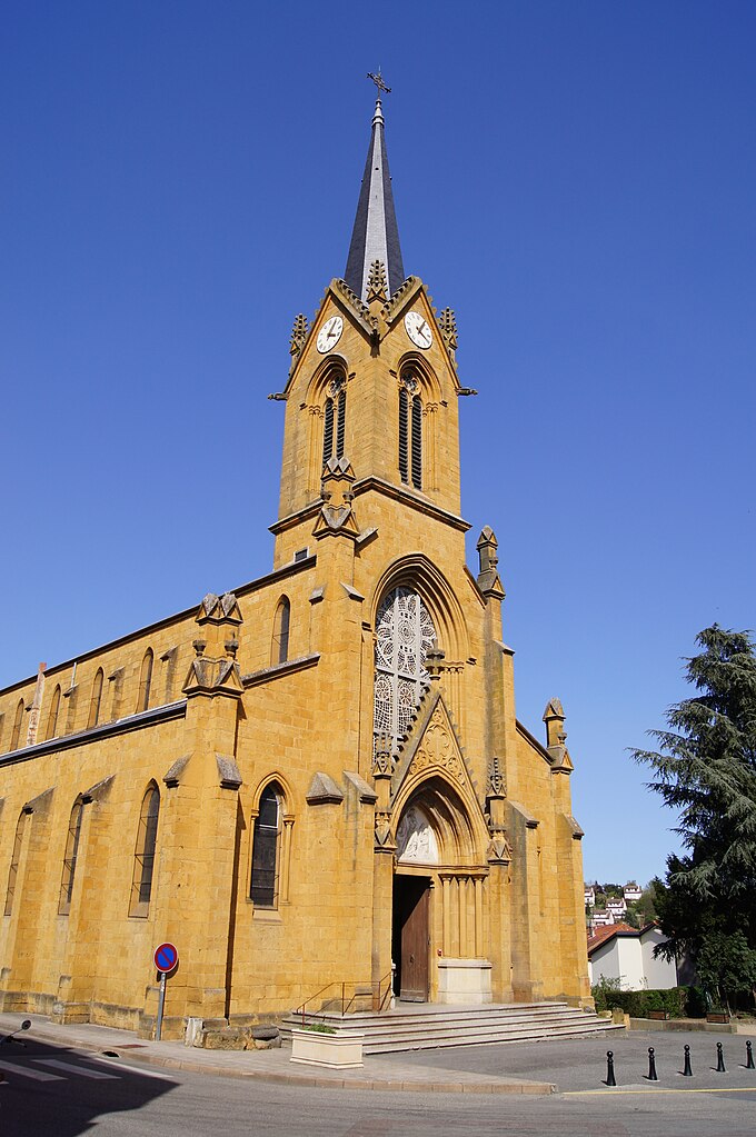
Saint-André-la-Côte
- commune in Rhône, France
- Country:
- Postal Code: 69440
- Coordinates: 45° 37' 49" N, 4° 36' 3" E
- GPS tracks (wikiloc): [Link]
- Area: 4.77 sq km
- Population: 284


Saint-Nizier-d'Azergues
- commune in Rhône, France
- Country:
- Postal Code: 69870
- Coordinates: 46° 5' 15" N, 4° 27' 57" E
- GPS tracks (wikiloc): [Link]
- Area: 24.23 sq km
- Population: 773
- Web site: [Link]

Jullié
- commune in Rhône, France
- Country:
- Postal Code: 69840
- Coordinates: 46° 14' 32" N, 4° 40' 41" E
- GPS tracks (wikiloc): [Link]
- Area: 9.88 sq km
- Population: 435


Saint-Mamert
- commune in Rhône, France
- Country:
- Postal Code: 69860
- Coordinates: 46° 15' 2" N, 4° 34' 57" E
- GPS tracks (wikiloc): [Link]
- Area: 3.21 sq km
- Population: 67


Marcilly-d'Azergues
- commune in Rhône, France
- Country:
- Postal Code: 69380
- Coordinates: 45° 52' 18" N, 4° 43' 46" E
- GPS tracks (wikiloc): [Link]
- Area: 4.18 sq km
- Population: 864
Savigny
- commune in Rhône, France
- Country:
- Postal Code: 69210
- Coordinates: 45° 48' 57" N, 4° 34' 27" E
- GPS tracks (wikiloc): [Link]
- Area: 21.42 sq km
- Population: 2010

Poule-les-Écharmeaux
- commune in Rhône, France
- Country:
- Postal Code: 69870
- Coordinates: 46° 8' 56" N, 4° 27' 26" E
- GPS tracks (wikiloc): [Link]
- Area: 31.23 sq km
- Population: 1095
- Web site: [Link]


Longessaigne
- commune in Rhône, France
- Country:
- Postal Code: 69770
- Coordinates: 45° 47' 30" N, 4° 25' 26" E
- GPS tracks (wikiloc): [Link]
- Area: 11.92 sq km
- Population: 598


Meaux-la-Montagne
- commune in Rhône, France
- Country:
- Postal Code: 69550
- Coordinates: 46° 2' 42" N, 4° 25' 7" E
- GPS tracks (wikiloc): [Link]
- Area: 9.19 sq km
- Population: 243
- Web site: [Link]

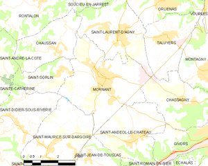
Mornant
- commune in Rhône, France
- Country:
- Postal Code: 69440
- Coordinates: 45° 37' 8" N, 4° 40' 20" E
- GPS tracks (wikiloc): [Link]
- Area: 15.76 sq km
- Population: 5582

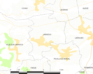
Jarnioux
- commune in Rhône, France
- Country:
- Postal Code: 69640
- Coordinates: 45° 57' 53" N, 4° 37' 38" E
- GPS tracks (wikiloc): [Link]
- Area: 4.2 sq km
- Population: 661

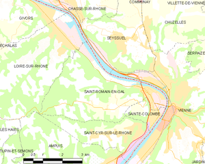
Saint-Romain-en-Gal
- commune in Rhône, France
- Country:
- Postal Code: 69560
- Coordinates: 45° 31' 57" N, 4° 51' 43" E
- GPS tracks (wikiloc): [Link]
- Area: 13.39 sq km
- Population: 1800


Saint-Christophe
- commune in Rhône, France
- Country:
- Postal Code: 69860
- Coordinates: 46° 15' 43" N, 4° 32' 31" E
- GPS tracks (wikiloc): [Link]
- AboveSeaLevel: 512 м m
- Area: 14.62 sq km
- Population: 240
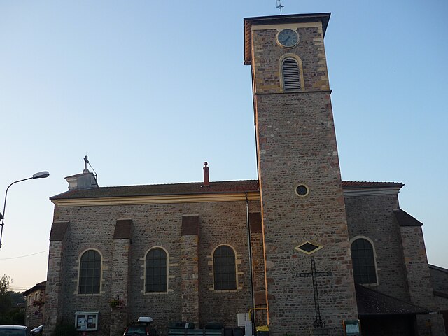
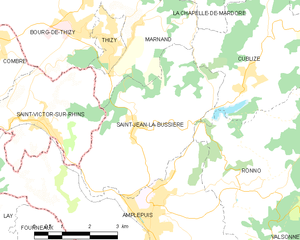
Saint-Jean-la-Bussière
- commune in Rhône, France
- Country:
- Postal Code: 69550
- Coordinates: 46° 0' 2" N, 4° 19' 25" E
- GPS tracks (wikiloc): [Link]
- Area: 15.48 sq km
- Population: 1212

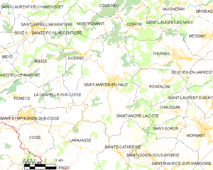
Saint-Martin-en-Haut
- commune in Rhône, France
- Country:
- Postal Code: 69850
- Coordinates: 45° 39' 35" N, 4° 33' 42" E
- GPS tracks (wikiloc): [Link]
- Area: 38.64 sq km
- Population: 3907
- Web site: [Link]


Saint-Jacques-des-Arrêts
- commune in Rhône, France
- Country:
- Postal Code: 69860
- Coordinates: 46° 15' 21" N, 4° 35' 51" E
- GPS tracks (wikiloc): [Link]
- Area: 7.47 sq km
- Population: 101


Sainte-Catherine
- commune in Rhône, France
- Country:
- Postal Code: 69440
- Coordinates: 45° 35' 57" N, 4° 34' 11" E
- GPS tracks (wikiloc): [Link]
- AboveSeaLevel: 700 м m
- Area: 13.76 sq km
- Population: 996
- Web site: [Link]


Saint-Laurent-d'Agny
- commune in Rhône, France
- Country:
- Postal Code: 69440
- Coordinates: 45° 38' 29" N, 4° 41' 8" E
- GPS tracks (wikiloc): [Link]
- Area: 10.55 sq km
- Population: 2099


Communay
- commune in Rhône, France
- Country:
- Postal Code: 69360
- Coordinates: 45° 36' 16" N, 4° 50' 6" E
- GPS tracks (wikiloc): [Link]
- Area: 10.54 sq km
- Population: 4153
- Web site: [Link]

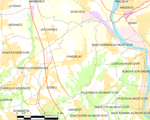
Chasselay
- commune in Rhône, France
- Country:
- Postal Code: 69380
- Coordinates: 45° 52' 28" N, 4° 46' 21" E
- GPS tracks (wikiloc): [Link]
- Area: 12.78 sq km
- Population: 2766
- Web site: [Link]


Échalas
- commune in Rhône, France
- Country:
- Postal Code: 69700
- Coordinates: 45° 33' 7" N, 4° 42' 56" E
- GPS tracks (wikiloc): [Link]
- Area: 20.95 sq km
- Population: 1737


Lamure-sur-Azergues
- commune in Rhône, France
- Country:
- Postal Code: 69870
- Coordinates: 46° 3' 45" N, 4° 29' 31" E
- GPS tracks (wikiloc): [Link]
- Area: 15.61 sq km
- Population: 1048
- Web site: [Link]


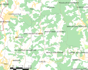
Saint-Bonnet-le-Troncy
- commune in Rhône, France
- Country:
- Postal Code: 69870
- Coordinates: 46° 5' 6" N, 4° 25' 38" E
- GPS tracks (wikiloc): [Link]
- Area: 15.65 sq km
- Population: 306

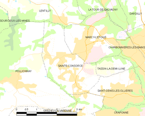
Sainte-Consorce
- commune in Rhône, France
- Country:
- Postal Code: 69280
- Coordinates: 45° 46' 33" N, 4° 41' 25" E
- GPS tracks (wikiloc): [Link]
- Area: 5.81 sq km
- Population: 1909
- Web site: [Link]

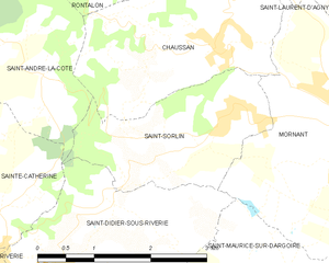
Saint-Sorlin
- former commune in Rhône, France
- Country:
- Postal Code: 69440
- Coordinates: 45° 37' 16" N, 4° 38' 23" E
- GPS tracks (wikiloc): [Link]
- Area: 4.7 sq km
- Population: 577


Rontalon
- commune in Rhône, France
- Country:
- Postal Code: 69510
- Coordinates: 45° 39' 37" N, 4° 37' 55" E
- GPS tracks (wikiloc): [Link]
- Area: 12.67 sq km
- Population: 1190
- Web site: [Link]

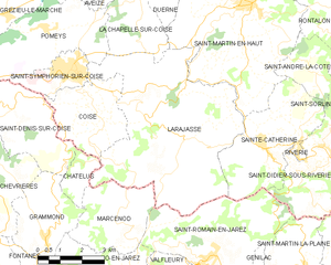
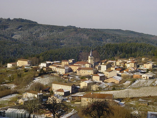
Larajasse
- commune in Rhône, France
- Country:
- Postal Code: 69590
- Coordinates: 45° 36' 50" N, 4° 30' 4" E
- GPS tracks (wikiloc): [Link]
- Area: 33.61 sq km
- Population: 1856

Saint-Laurent-de-Vaux
- former commune in Rhône, France
- Country:
- Postal Code: 69670
- Coordinates: 45° 42' 56" N, 4° 37' 57" E
- GPS tracks (wikiloc): [Link]
- Area: 2.64 sq km
- Population: 288

Ranchal
- commune in Rhône, France
- Country:
- Postal Code: 69470
- Coordinates: 46° 7' 48" N, 4° 23' 56" E
- GPS tracks (wikiloc): [Link]
- Area: 15.14 sq km
- Population: 314
- Web site: [Link]


Meys
- commune in Rhône, France
- Country:
- Postal Code: 69610
- Coordinates: 45° 40' 44" N, 4° 23' 12" E
- GPS tracks (wikiloc): [Link]
- Area: 14.65 sq km
- Population: 853


Saint-Didier-sur-Beaujeu
- commune in Rhône, France
- Country:
- Postal Code: 69430
- Coordinates: 46° 9' 25" N, 4° 32' 47" E
- GPS tracks (wikiloc): [Link]
- Area: 14.62 sq km
- Population: 620

Duerne
- commune in Rhône, France
- Country:
- Postal Code: 69850
- Coordinates: 45° 41' 4" N, 4° 31' 39" E
- GPS tracks (wikiloc): [Link]
- Area: 11.41 sq km
- Population: 811

Montagny
- commune in Rhône, France
- Country:
- Postal Code: 69700
- Coordinates: 45° 37' 41" N, 4° 44' 52" E
- GPS tracks (wikiloc): [Link]
- Area: 8.3 sq km
- Population: 2841
- Web site: [Link]

L'Arbresle
- commune in Rhône, France
- Country:
- Postal Code: 69210
- Coordinates: 45° 50' 8" N, 4° 37' 1" E
- GPS tracks (wikiloc): [Link]
- Area: 3.36 sq km
- Population: 6360
- Web site: [Link]
Orliénas
- commune in Rhône, France
- Country:
- Postal Code: 69530
- Coordinates: 45° 39' 32" N, 4° 43' 6" E
- GPS tracks (wikiloc): [Link]
- Area: 10.42 sq km
- Population: 2373


Bully
- commune in Rhône, France
- Country:
- Postal Code: 69210
- Coordinates: 45° 51' 4" N, 4° 35' 0" E
- GPS tracks (wikiloc): [Link]
- Area: 12.59 sq km
- Population: 2060
- Web site: [Link]


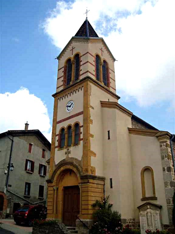
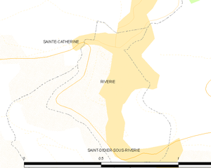
Saint-Didier-sous-Riverie
- former commune in Rhône, France
- Country:
- Postal Code: 69440
- Coordinates: 45° 35' 48" N, 4° 36' 30" E
- GPS tracks (wikiloc): [Link]
- Area: 13.9 sq km
- Population: 1232

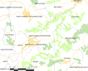
Saint-Genis-l'Argentière
- commune in Rhône, France
- Country:
- Postal Code: 69610
- Coordinates: 45° 42' 36" N, 4° 29' 31" E
- GPS tracks (wikiloc): [Link]
- Area: 10.65 sq km
- Population: 1063
- Web site: [Link]


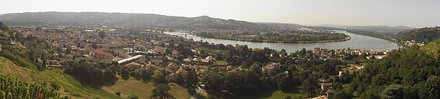
Loire-sur-Rhône
- commune in Rhône, France
- Country:
- Postal Code: 69700
- Coordinates: 45° 33' 38" N, 4° 48' 22" E
- GPS tracks (wikiloc): [Link]
- AboveSeaLevel: 157 м m
- Area: 16.6 sq km
- Population: 2549

Mardore
- former commune in Rhône, France
- Country:
- Postal Code: 69240
- Coordinates: 46° 4' 12" N, 4° 20' 17" E
- GPS tracks (wikiloc): [Link]
- Population: 506


Moiré
- commune in Rhône, France
- Country:
- Postal Code: 69620
- Coordinates: 45° 55' 39" N, 4° 36' 13" E
- GPS tracks (wikiloc): [Link]
- Area: 2.03 sq km
- Population: 200
- Web site: [Link]


Saint-Bonnet-des-Bruyères
- commune in Rhône, France
- Country:
- Postal Code: 69790
- Coordinates: 46° 16' 15" N, 4° 28' 12" E
- GPS tracks (wikiloc): [Link]
- Area: 21.2 sq km
- Population: 366


Pomeys
- commune in Rhône, France
- Country:
- Postal Code: 69590
- Coordinates: 45° 38' 59" N, 4° 26' 38" E
- GPS tracks (wikiloc): [Link]
- Area: 13.1 sq km
- Population: 1136
Saint-Germain-sur-l'Arbresle
- former commune in Rhône, France
- Country:
- Postal Code: 69210
- Coordinates: 45° 51' 11" N, 4° 36' 43" E
- GPS tracks (wikiloc): [Link]
- Population: 1471


Cublize
- commune in Rhône, France
- Country:
- Postal Code: 69550
- Coordinates: 46° 1' 5" N, 4° 22' 39" E
- GPS tracks (wikiloc): [Link]
- Area: 15.56 sq km
- Population: 1257
- Web site: [Link]


Saint-Just-d'Avray
- commune in Rhône, France
- Country:
- Postal Code: 69870
- Coordinates: 46° 0' 7" N, 4° 26' 46" E
- GPS tracks (wikiloc): [Link]
- Area: 17.5 sq km
- Population: 754
- Web site: [Link]


Ronno
- commune in Rhône, France
- Country:
- Postal Code: 69550
- Coordinates: 45° 59' 5" N, 4° 22' 57" E
- GPS tracks (wikiloc): [Link]
- Area: 22.92 sq km
- Population: 626


Valsonne
- commune in Rhône, France
- Country:
- Postal Code: 69170
- Coordinates: 45° 56' 47" N, 4° 25' 47" E
- GPS tracks (wikiloc): [Link]
- Area: 18.25 sq km
- Population: 912


Amplepuis
- commune in Rhône, France
- Country:
- Postal Code: 69550
- Coordinates: 45° 58' 21" N, 4° 19' 49" E
- GPS tracks (wikiloc): [Link]
- Area: 38.44 sq km
- Population: 5072
- Web site: [Link]


Saint-Cyr-sur-le-Rhône
- commune in Rhône, France
- Country:
- Postal Code: 69560
- Coordinates: 45° 30' 57" N, 4° 51' 9" E
- GPS tracks (wikiloc): [Link]
- Area: 6.02 sq km
- Population: 1311
- Web site: [Link]

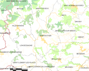
Montrottier
- commune in Rhône, France
- Country:
- Postal Code: 69770
- Coordinates: 45° 47' 24" N, 4° 28' 0" E
- GPS tracks (wikiloc): [Link]
- Area: 23.1 sq km
- Population: 1370


Saint-Symphorien-d'Ozon
- commune in Rhône, France
- Country:
- Postal Code: 69360
- Coordinates: 45° 37' 58" N, 4° 51' 23" E
- GPS tracks (wikiloc): [Link]
- Area: 13.37 sq km
- Population: 5678
- Web site: [Link]

Cenves
- commune in Rhône, France
- Country:
- Postal Code: 69840
- Coordinates: 46° 16' 5" N, 4° 38' 59" E
- GPS tracks (wikiloc): [Link]
- Area: 26.48 sq km
- Population: 407
- Web site: [Link]


Saint-Laurent-de-Mure
- commune in Rhône, France
Hiking in Saint-Laurent-de-Mure
Saint-Laurent-de-Mure is a charming commune located in the Auvergne-Rhône-Alpes region of France, near Lyon. While it may not be as famous as some of the larger national parks, it offers some scenic opportunities for hiking and enjoying the natural landscape....
- Country:
- Postal Code: 69720
- Coordinates: 45° 41' 8" N, 5° 2' 41" E
- GPS tracks (wikiloc): [Link]
- Area: 18.63 sq km
- Population: 5391
- Web site: [Link]


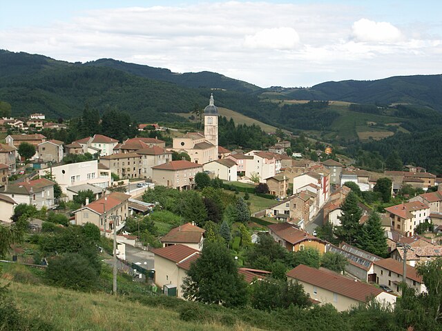
Cours-la-Ville
- former commune in Rhône, France
- Country:
- Postal Code: 69470
- Coordinates: 46° 5' 58" N, 4° 19' 14" E
- GPS tracks (wikiloc): [Link]
- Area: 19.48 sq km
- Population: 3803

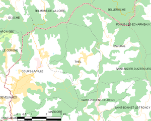
Thel
- former commune in Rhône, France
- Country:
- Postal Code: 69470
- Coordinates: 46° 6' 56" N, 4° 22' 37" E
- GPS tracks (wikiloc): [Link]
- Area: 10.27 sq km
- Population: 339


Vourles
- commune in Rhône, France
- Country:
- Postal Code: 69390
- Coordinates: 45° 39' 32" N, 4° 46' 24" E
- GPS tracks (wikiloc): [Link]
- Area: 5.6 sq km
- Population: 3338


Toussieu
- commune in Rhône, France
Hiking in Toussieu
Toussieu is a charming commune located in the Auvergne-Rhône-Alpes region of France, not far from Lyon. While it may not be as globally recognized for hiking as some other regions, it does boast beautiful landscapes and natural settings that make for enjoyable hiking experiences....
- Country:
- Postal Code: 69780
- Coordinates: 45° 39' 16" N, 4° 59' 6" E
- GPS tracks (wikiloc): [Link]
- Area: 5.02 sq km
- Population: 2837


Sérézin-du-Rhône
- commune in Rhône, France
- Country:
- Postal Code: 69360
- Coordinates: 45° 37' 43" N, 4° 49' 26" E
- GPS tracks (wikiloc): [Link]
- Area: 3.97 sq km
- Population: 2588


Longes
- commune in Rhône, France
- Country:
- Postal Code: 69420
- Coordinates: 45° 30' 17" N, 4° 41' 19" E
- GPS tracks (wikiloc): [Link]
- Area: 24.06 sq km
- Population: 944


Saint-Clément-de-Vers
- commune in Rhône, France
- Country:
- Postal Code: 69790
- Coordinates: 46° 13' 36" N, 4° 24' 12" E
- GPS tracks (wikiloc): [Link]
- Area: 8.96 sq km
- Population: 227


Propières
- commune in Rhône, France
- Country:
- Postal Code: 69790
- Coordinates: 46° 11' 30" N, 4° 26' 14" E
- GPS tracks (wikiloc): [Link]
- Area: 16 sq km
- Population: 454


Ouroux
- commune in Rhône, France
- Country:
- Postal Code: 69860
- Coordinates: 46° 13' 51" N, 4° 35' 40" E
- GPS tracks (wikiloc): [Link]
- Area: 21.06 sq km
- Population: 337
- Web site: [Link]


Pusignan
- commune in Rhône, France
- Country:
- Postal Code: 69330
- Coordinates: 45° 45' 20" N, 5° 4' 2" E
- GPS tracks (wikiloc): [Link]
- Area: 13.04 sq km
- Population: 4011

Saint-Bonnet-de-Mure
- commune in Rhône, France
Hiking in Saint-Bonnet-de-Mure
Saint-Bonnet-de-Mure is a charming commune located near Lyon, in the Auvergne-Rhône-Alpes region of France. While it may not be as famous as some larger hiking destinations, it offers some pleasant trails and outdoor opportunities for hikers. Here are a few points of interest regarding hiking in and around Saint-Bonnet-de-Mure:...
- Country:
- Postal Code: 69720
- Coordinates: 45° 41' 26" N, 5° 1' 45" E
- GPS tracks (wikiloc): [Link]
- Area: 16.34 sq km
- Population: 6851
- Web site: [Link]


Lozanne
- commune in Rhône, France
- Country:
- Postal Code: 69380
- Coordinates: 45° 51' 26" N, 4° 40' 51" E
- GPS tracks (wikiloc): [Link]
- Area: 5.5 sq km
- Population: 2630
- Web site: [Link]


Monsols
- commune in Rhône, France
- Country:
- Postal Code: 69860
- Coordinates: 46° 13' 10" N, 4° 31' 12" E
- GPS tracks (wikiloc): [Link]
- Area: 19.82 sq km
- Population: 914

Grandris
- commune in Rhône, France
- Country:
- Postal Code: 69870
- Coordinates: 46° 2' 16" N, 4° 28' 31" E
- GPS tracks (wikiloc): [Link]
- Area: 15.22 sq km
- Population: 1145
- Web site: [Link]

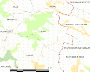
Chénas
- commune in Rhône, France
- Country:
- Postal Code: 69840
- Coordinates: 46° 12' 44" N, 4° 43' 10" E
- GPS tracks (wikiloc): [Link]
- Area: 8.18 sq km
- Population: 549

Chambost-Allières
- commune in Rhône, France
- Country:
- Postal Code: 69870
- Coordinates: 46° 1' 6" N, 4° 29' 55" E
- GPS tracks (wikiloc): [Link]
- Area: 14.14 sq km
- Population: 820

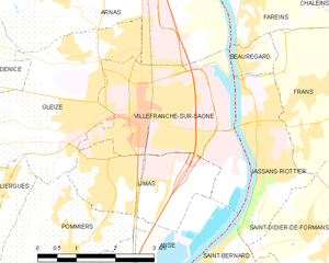
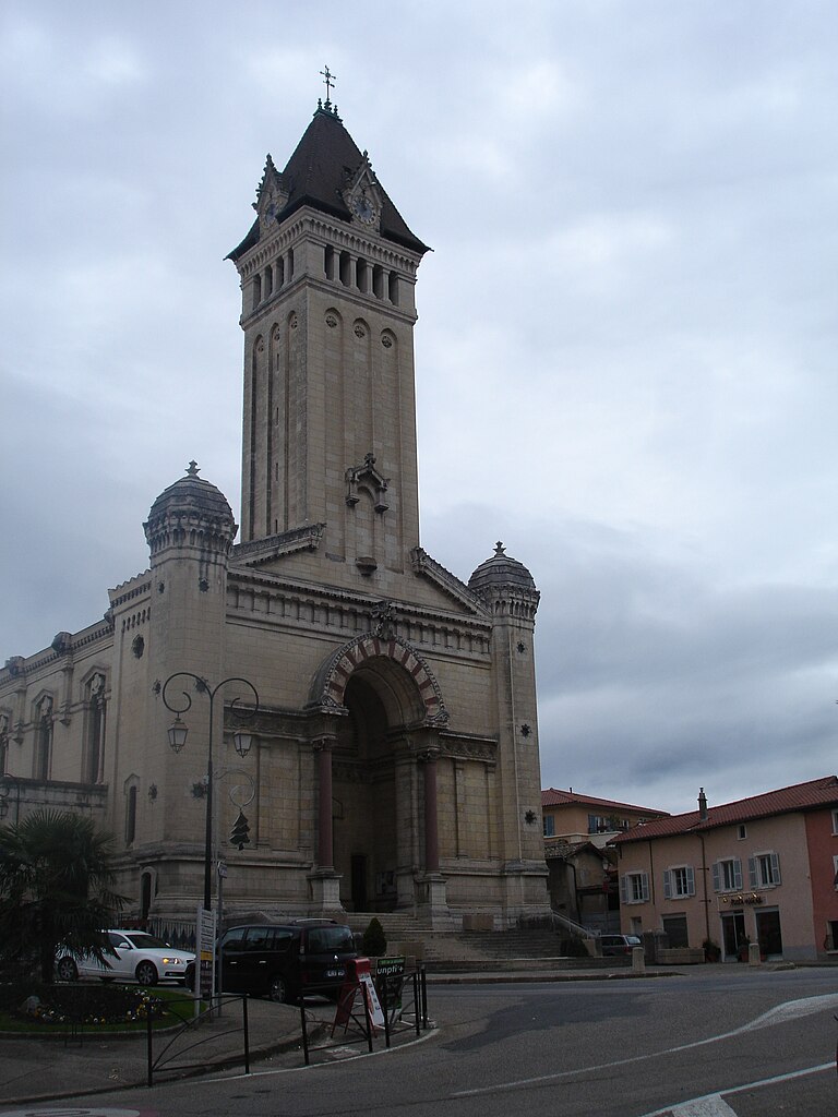
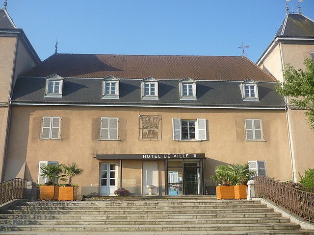
Villefranche-sur-Saône
- commune in Rhône, France
- Country:
- Postal Code: 69400
- Coordinates: 45° 59' 22" N, 4° 43' 11" E
- GPS tracks (wikiloc): [Link]
- AboveSeaLevel: 191 м m
- Area: 9.48 sq km
- Population: 36671
- Web site: [Link]

Crépieux-la-Pape
- former commune in Rhône, France
- Country:
- Coordinates: 45° 48' 21" N, 4° 53' 6" E
- GPS tracks (wikiloc): [Link]
La Guillotière
- former commune in Rhône, France
- Country:
- Coordinates: 45° 45' 19" N, 4° 50' 35" E
- GPS tracks (wikiloc): [Link]

Rillieux
- former commune in Rhône, France
- Country:
- Coordinates: 45° 49' 17" N, 4° 53' 54" E
- GPS tracks (wikiloc): [Link]


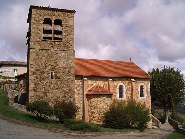
Marennes, Rhône
- commune in Rhône, France
Hiking in Marennes, Rhône
Marennes, located in the Rhône department of France, is not as widely recognized for hiking as some other regions, but it offers picturesque landscapes and trails that can be appealing to nature lovers and outdoor enthusiasts....
- Country:
- Postal Code: 69970
- Coordinates: 45° 37' 15" N, 4° 54' 45" E
- GPS tracks (wikiloc): [Link]
- Area: 12.44 sq km
- Population: 1617

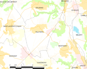
Taluyers
- commune in Rhône, France
- Country:
- Postal Code: 69440
- Coordinates: 45° 38' 23" N, 4° 43' 19" E
- GPS tracks (wikiloc): [Link]
- Area: 8.09 sq km
- Population: 2521


Ampuis
- commune in Rhône, France
- Country:
- Postal Code: 69420
- Coordinates: 45° 29' 21" N, 4° 48' 36" E
- GPS tracks (wikiloc): [Link]
- Area: 15.57 sq km
- Population: 2711
- Web site: [Link]

Marchampt
- commune in Rhône, France
- Country:
- Postal Code: 69430
- Coordinates: 46° 6' 45" N, 4° 34' 17" E
- GPS tracks (wikiloc): [Link]
- Area: 17.74 sq km
- Population: 448


Vauxrenard
- commune in Rhône, France
- Country:
- Postal Code: 69820
- Coordinates: 46° 12' 34" N, 4° 38' 39" E
- GPS tracks (wikiloc): [Link]
- Area: 19.19 sq km
- Population: 320
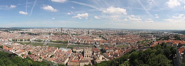

arrondissement of Lyon
- arrondissement of France
Hiking in arrondissement of Lyon
The Arrondissement of Lyon, located in the Auvergne-Rhône-Alpes region of France, is not only famous for its rich culture and gastronomy but also offers a variety of hiking opportunities both within the city and in the nearby natural surroundings....
- Country:
- Capital: Lyon
- Coordinates: 45° 45' 0" N, 4° 35' 0" E
- GPS tracks (wikiloc): [Link]
- Area: 1746 sq km
- Population: 1370678


Grézieu-la-Varenne
- commune in Rhône, France
- Country:
- Postal Code: 69290
- Coordinates: 45° 44' 50" N, 4° 41' 25" E
- GPS tracks (wikiloc): [Link]
- Area: 7.45 sq km
- Population: 5525
- Web site: [Link]


Brignais
- commune in Rhône, France
- Country:
- Postal Code: 69530
- Coordinates: 45° 40' 26" N, 4° 45' 15" E
- GPS tracks (wikiloc): [Link]
- AboveSeaLevel: 300 м m
- Area: 10.36 sq km
- Population: 11327
- Web site: [Link]


Saint-Igny-de-Vers
- commune in Rhône, France
- Country:
- Postal Code: 69790
- Coordinates: 46° 14' 26" N, 4° 26' 10" E
- GPS tracks (wikiloc): [Link]
- Area: 27.35 sq km
- Population: 594

Yzeron
- commune in Rhône, France
- Country:
- Postal Code: 69510
- Coordinates: 45° 42' 29" N, 4° 35' 28" E
- GPS tracks (wikiloc): [Link]
- Area: 10.75 sq km
- Population: 1055
- Web site: [Link]


Éveux
- commune in Rhône, France
- Country:
- Postal Code: 69210
- Coordinates: 45° 49' 35" N, 4° 37' 23" E
- GPS tracks (wikiloc): [Link]
- Area: 3.32 sq km
- Population: 1197
- Web site: [Link]


Saint-Andéol-le-Château
- former commune in Rhône, France
- Country:
- Postal Code: 69700
- Coordinates: 45° 35' 9" N, 4° 41' 42" E
- GPS tracks (wikiloc): [Link]
- Area: 9.95 sq km
- Population: 1734

Brindas
- commune in Rhône, France
- Country:
- Postal Code: 69126
- Coordinates: 45° 43' 16" N, 4° 41' 37" E
- GPS tracks (wikiloc): [Link]
- Area: 11.27 sq km
- Population: 5960
- Web site: [Link]


Simandres
- commune in Rhône, France
- Country:
- Postal Code: 69360
- Coordinates: 45° 37' 10" N, 4° 52' 23" E
- GPS tracks (wikiloc): [Link]
- Area: 10.45 sq km
- Population: 1726


Trades
- commune in Rhône, France
- Country:
- Postal Code: 69860
- Coordinates: 46° 16' 41" N, 4° 33' 42" E
- GPS tracks (wikiloc): [Link]
- Area: 7.93 sq km
- Population: 115

Souzy
- commune in Rhône, France
- Country:
- Postal Code: 69610
- Coordinates: 45° 42' 20" N, 4° 26' 55" E
- GPS tracks (wikiloc): [Link]
- Area: 5.09 sq km
- Population: 796


Lentilly
- commune in Rhône, France
- Country:
- Postal Code: 69210
- Coordinates: 45° 49' 7" N, 4° 39' 47" E
- GPS tracks (wikiloc): [Link]
- Area: 18.39 sq km
- Population: 5390


Brullioles
- commune in Rhône, France
- Country:
- Postal Code: 69690
- Coordinates: 45° 45' 40" N, 4° 29' 57" E
- GPS tracks (wikiloc): [Link]
- Area: 12.25 sq km
- Population: 821

Riverie
- commune in Rhône, France
- Country:
- Postal Code: 69440
- Coordinates: 45° 35' 59" N, 4° 35' 19" E
- GPS tracks (wikiloc): [Link]
- Area: 0.42 sq km
- Population: 309

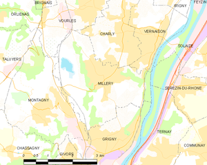
Millery
- commune in Rhône, France
- Country:
- Postal Code: 69390
- Coordinates: 45° 37' 56" N, 4° 46' 55" E
- GPS tracks (wikiloc): [Link]
- Area: 9.22 sq km
- Population: 4341

arrondissement of Villefranche-sur-Saône
- arrondissement of France
- Country:
- Capital: Villefranche-sur-Saône
- Coordinates: 46° 0' 0" N, 4° 30' 0" E
- GPS tracks (wikiloc): [Link]
- Area: 1503 sq km
- Population: 451317


Courzieu
- commune in Rhône, France
- Country:
- Postal Code: 69690
- Coordinates: 45° 44' 34" N, 4° 34' 15" E
- GPS tracks (wikiloc): [Link]
- Area: 27.04 sq km
- Population: 1071


Beaujeu
- commune in Rhône, France
- Country:
- Postal Code: 69430
- Coordinates: 46° 9' 15" N, 4° 35' 18" E
- GPS tracks (wikiloc): [Link]
- Area: 17.85 sq km
- Population: 2087


Chénelette
- commune in Rhône, France
- Country:
- Postal Code: 69430
- Coordinates: 46° 10' 7" N, 4° 29' 28" E
- GPS tracks (wikiloc): [Link]
- Area: 11.02 sq km
- Population: 331


Colombier-Saugnieu
- commune in Rhône, France
Hiking in Colombier-Saugnieu
Colombier-Saugnieu, located in the Auvergne-Rhône-Alps region of France, offers a variety of hiking opportunities that showcase the natural beauty of the surrounding landscape. Here are some key points about hiking in this area:...
- Country:
- Postal Code: 69124
- Coordinates: 45° 42' 41" N, 5° 6' 44" E
- GPS tracks (wikiloc): [Link]
- Area: 27.62 sq km
- Population: 2554


Juliénas
- commune in Rhône, France
- Country:
- Postal Code: 69840
- Coordinates: 46° 14' 6" N, 4° 42' 41" E
- GPS tracks (wikiloc): [Link]
- Area: 7.56 sq km
- Population: 895
- Web site: [Link]

Genas
- commune in Rhône, France
- Country:
- Postal Code: 69740
- Coordinates: 45° 43' 53" N, 5° 0' 8" E
- GPS tracks (wikiloc): [Link]
- Area: 23.84 sq km
- Population: 12741
- Web site: [Link]


Sainte-Colombe
- commune in Rhône, France
- Country:
- Postal Code: 69560
- Coordinates: 45° 31' 31" N, 4° 52' 0" E
- GPS tracks (wikiloc): [Link]
- Area: 1.6 sq km
- Population: 1962

Chiroubles
- commune in Rhône, France
- Country:
- Postal Code: 69115
- Coordinates: 46° 10' 50" N, 4° 39' 56" E
- GPS tracks (wikiloc): [Link]
- Area: 7.32 sq km
- Population: 410

Condrieu
- commune in Rhône, France
- Country:
- Postal Code: 69420
- Coordinates: 45° 27' 47" N, 4° 46' 4" E
- GPS tracks (wikiloc): [Link]
- Area: 9.21 sq km
- Population: 3883
- Web site: [Link]


Vaugneray
- former commune in Rhône, France
- Country:
- Postal Code: 69670
- Coordinates: 45° 44' 16" N, 4° 39' 23" E
- GPS tracks (wikiloc): [Link]
- Area: 22.38 sq km
- Population: 5130
- Web site: [Link]


Chaponnay
- commune in Rhône, France
Hiking in Chaponnay
Chaponnay is a charming commune located in the Rhône department in the Auvergne-Rhône-Alpes region of France. While it may not be as widely known for hiking as some of the nearby national parks or mountain regions, there are still opportunities for outdoor enthusiasts to enjoy nature and explore the beautiful landscapes in and around Chaponnay....
- Country:
- Postal Code: 69970
- Coordinates: 45° 37' 39" N, 4° 56' 10" E
- GPS tracks (wikiloc): [Link]
- Area: 18.89 sq km
- Population: 4098
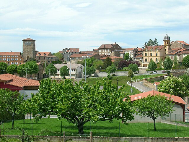
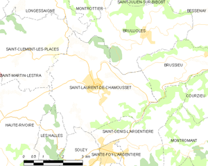
Saint-Laurent-de-Chamousset
- commune in Rhône, France
- Country:
- Postal Code: 69930
- Coordinates: 45° 44' 18" N, 4° 27' 51" E
- GPS tracks (wikiloc): [Link]
- Area: 17.25 sq km
- Population: 1887
- Web site: [Link]


Ternay
- commune in Rhône, France
- Country:
- Postal Code: 69360
- Coordinates: 45° 36' 8" N, 4° 48' 38" E
- GPS tracks (wikiloc): [Link]
- Area: 8.06 sq km
- Population: 5430

Jons
- commune in Rhône, France
- Country:
- Postal Code: 69330
- Coordinates: 45° 48' 4" N, 5° 5' 0" E
- GPS tracks (wikiloc): [Link]
- Area: 7.41 sq km
- Population: 1456
- Web site: [Link]


Saint-Pierre-de-Chandieu
- commune in Rhône, France
Hiking in Saint-Pierre-de-Chandieu
Saint-Pierre-de-Chandieu is a small commune located in the Rhône department of the Auvergne-Rhône-Alpes region in France, not far from the city of Lyon. While it may not be as widely recognized as a hiking destination compared to larger national parks or mountainous areas, it offers some charming trails and outdoor activities....
- Country:
- Postal Code: 69780
- Coordinates: 45° 38' 47" N, 5° 0' 53" E
- GPS tracks (wikiloc): [Link]
- Area: 29.28 sq km
- Population: 4546
- Web site: [Link]

Thurins
- commune in Rhône, France
- Country:
- Postal Code: 69510
- Coordinates: 45° 40' 54" N, 4° 38' 27" E
- GPS tracks (wikiloc): [Link]
- Area: 19.36 sq km
- Population: 3015
- Web site: [Link]

Émeringes
- commune in Rhône, France
- Country:
- Postal Code: 69840
- Coordinates: 46° 13' 23" N, 4° 40' 25" E
- GPS tracks (wikiloc): [Link]
- Area: 3.01 sq km
- Population: 242

La Chapelle-de-Mardore
- former commune in Rhône, France
- Country:
- Postal Code: 69240
- Coordinates: 46° 3' 10" N, 4° 21' 21" E
- GPS tracks (wikiloc): [Link]
- Population: 228
- Web site: [Link]


Saint-Clément-les-Places
- commune in Rhône, France
- Country:
- Postal Code: 69930
- Coordinates: 45° 45' 10" N, 4° 25' 24" E
- GPS tracks (wikiloc): [Link]
- Area: 12.42 sq km
- Population: 635


Messimy
- commune in Rhône, France
- Country:
- Postal Code: 69510
- Coordinates: 45° 41' 53" N, 4° 40' 27" E
- GPS tracks (wikiloc): [Link]
- AboveSeaLevel: 350 м m
- Area: 11.1 sq km
- Population: 3387
- Web site: [Link]


Grézieu-le-Marché
- commune in Rhône, France
- Country:
- Postal Code: 69610
- Coordinates: 45° 39' 23" N, 4° 25' 16" E
- GPS tracks (wikiloc): [Link]
- AboveSeaLevel: 650 м m
- Area: 11.49 sq km
- Population: 803
- Web site: [Link]
Shares border with regions:


Isère
- French department
Hiking in Isère
Isère, located in the Auvergne-Rhône-Alpes region of France, offers some of the most beautiful and diverse hiking opportunities in the French Alps. Known for its stunning mountain scenery, charming villages, and rich cultural heritage, Isère is a fantastic destination for hikers of all levels. Here are some highlights of hiking in Isère:...
- Country:
- Capital: Grenoble
- Coordinates: 45° 20' 0" N, 5° 30' 0" E
- GPS tracks (wikiloc): [Link]
- AboveSeaLevel: 846 м m
- Area: 7431 sq km
- Population: 1251060
- Web site: [Link]


Loire
- French department
- Country:
- Capital: Saint-Étienne
- Coordinates: 45° 45' 14" N, 4° 13' 29" E
- GPS tracks (wikiloc): [Link]
- Area: 4781 sq km
- Population: 759411
- Web site: [Link]


Saône-et-Loire
- French department
Hiking in Saône-et-Loire
Saône-et-Loire is a beautiful department in the Bourgogne-Franche-Comté region of France, known for its rich history, stunning landscapes, and diverse trails suitable for all levels of hikers. Here’s what you can expect when hiking in this picturesque region:...
- Country:
- Capital: Mâcon
- Coordinates: 46° 40' 0" N, 4° 42' 0" E
- GPS tracks (wikiloc): [Link]
- Area: 8575 sq km
- Population: 555408
- Web site: [Link]

Ain
- French département
Hiking in Ain
Certainly! Ain, a department located in the Auvergne-Rhône-Alpes region of France, offers a diverse range of hiking opportunities, from gentle trails suited for families to more challenging hikes for experienced trekkers. Here are some highlights about hiking in Ain:...
- Country:
- Capital: Bourg-en-Bresse
- Coordinates: 46° 5' 0" N, 5° 20' 0" E
- GPS tracks (wikiloc): [Link]
- Area: 5762 sq km
- Population: 631877
- Web site: [Link]