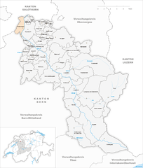
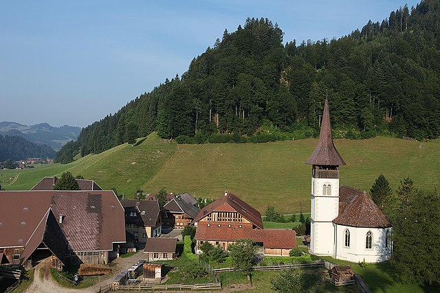
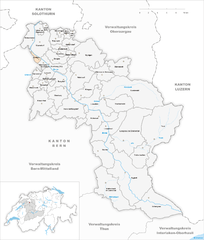
Emmental administrative district (Verwaltungskreis Emmental)

- administrative district of the canton of Bern, Switzerland (Verwaltungskreis)
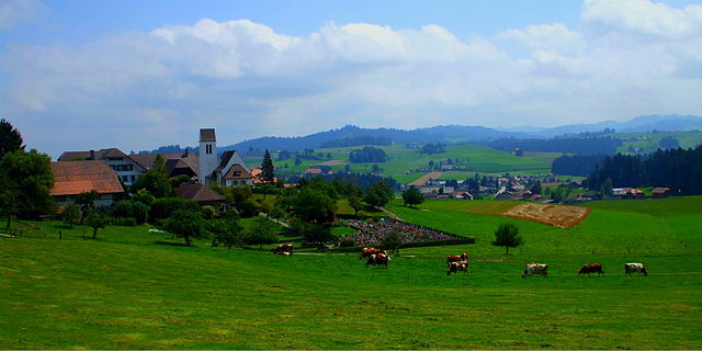
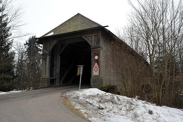
 Hiking in Emmental administrative district
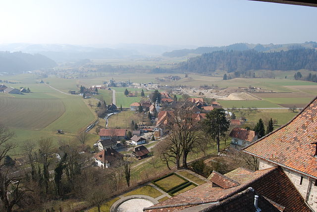
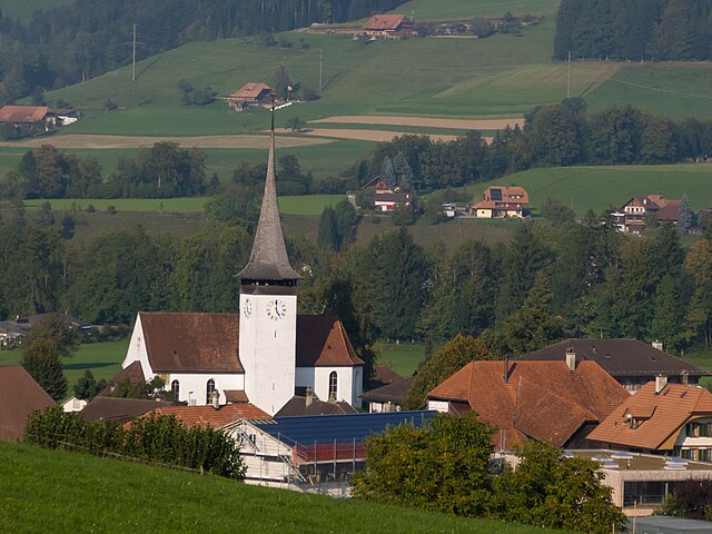
Emmental, located in the canton of Bern, Switzerland, is a picturesque region renowned for its rolling hills, lush meadows, and stunning landscapes, making it an excellent destination for hiking enthusiasts. Here’s an overview of what you can expect when hiking in Emmental:
Scenic Trails
Emmental offers a variety of hiking trails suitable for all experience levels. From gentle walks through idyllic pastures to more challenging hikes that lead to panoramic viewpoints, there's something for everyone. Some popular trails include:
- Küngoldinger Rundweg - A circular route that showcases the beauty of Emmental's countryside, featuring charming villages and farms.
- Hike to the Emmental viewpoint - A trail that leads to breathtaking overlooks such as the "Emmental viewpoint," where you can enjoy sweeping views of the valley and surrounding areas.
- The Simmental trail - While not directly in Emmental, it's a nearby option worth exploring, leading through a picturesque landscape with plenty of photo opportunities.
Natural Beauty
The region is characterized by its unique topography, with typical Swiss chalet architecture, verdant valleys, and the meandering Emme River. In spring and summer, wildflowers bloom vividly, and in autumn, the foliage offers a stunning display of colors.
Flora and Fauna
Hikers may encounter diverse wildlife, including deer, foxes, and a variety of bird species. The region is also home to diverse vegetation, from lush grasslands to tranquil forests.
Cultural Heritage
As you hike, you may come across traditional Swiss farmhouses and experience local culture. Emmental is famous for its cheese, and you could take a detour to visit local cheese dairies to learn about the cheese-making process.
Accessibility and Signage
The hiking trails in Emmental are well-marked and maintained, making it easy for hikers to navigate. Public transportation options are also available, linking various points of interest and trailheads, which is ideal for those who prefer not to drive.
Safety Tips
- Weather: Always check the weather forecast before heading out, as conditions can change rapidly in the mountains.
- Footwear: Wear sturdy hiking boots for comfort and safety.
- Hydration: Carry enough water and snacks, especially on longer hikes.
- Navigation: Although trails are well-marked, having a map or GPS can be helpful.
Overall, hiking in Emmental offers an enriching experience of nature and culture, with splendid views and a peaceful atmosphere. Whether you're a seasoned hiker or a beginner, you'll find plenty to explore in this beautiful region of Switzerland.
- Country:

- Capital: Langnau im Emmental
- Licence Plate Code: BE
- Coordinates: 47° 2' 39" N, 7° 39' 42" E


- GPS tracks (wikiloc): [Link]
- AboveSeaLevel: 775 м m
- Area: 691 sq km
- Wikipedia en: wiki(en)
- Wikipedia: wiki(de)
- Wikidata storage: Wikidata: Q666253
- Wikipedia Commons Category: [Link]
- Freebase ID: [/m/0bh78w2]
- GeoNames ID: Alt: [8260133]
- BnF ID: [12243142j]
- archINFORM location ID: [42768]
Includes regions:

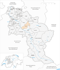
Affoltern im Emmental
- municipality in Switzerland
Hiking in Affoltern im Emmental
Affoltern im Emmental, located in the Bernese Oberland region of Switzerland, is a beautiful area ideal for hiking enthusiasts. The picturesque rolling hills, lush green meadows, and stunning views of the Swiss Alps offer a perfect backdrop for a variety of hiking trails suitable for all skill levels....
- Country:
- Postal Code: 3416
- Local Dialing Code: 034
- Licence Plate Code: BE
- Coordinates: 47° 2' 59" N, 7° 43' 0" E
- GPS tracks (wikiloc): [Link]
- AboveSeaLevel: 801 м m
- Area: 11.5 sq km
- Population: 1133
- Web site: [Link]


Röthenbach im Emmental
- municipality in Switzerland
Hiking in Röthenbach im Emmental
Röthenbach im Emmental, located in the picturesque Emmental region of Switzerland, offers a range of beautiful hiking opportunities for all levels of experience. The area is known for its rolling hills, lush green meadows, and stunning views of the Alps, making it a wonderful destination for nature lovers and outdoor enthusiasts....
- Country:
- Postal Code: 3538
- Local Dialing Code: 034
- Licence Plate Code: BE
- Coordinates: 46° 50' 59" N, 7° 43' 59" E
- GPS tracks (wikiloc): [Link]
- AboveSeaLevel: 833 м m
- Area: 36.8 sq km
- Population: 1184
- Web site: [Link]


Krauchthal
- municipality in Switzerland
Hiking in Krauchthal
Krauchthal is a picturesque area located in the canton of Aargau, Switzerland, and offers attractive hiking opportunities for outdoor enthusiasts. The region is characterized by beautiful landscapes, scenic views, and charming rural areas, making it perfect for hiking and nature walks....
- Country:
- Postal Code: 3325, 3326, 3411
- Local Dialing Code: 034
- Licence Plate Code: BE
- Coordinates: 47° 0' 35" N, 7° 33' 44" E
- GPS tracks (wikiloc): [Link]
- AboveSeaLevel: 596 м m
- Area: 19.4 sq km
- Population: 2333
- Web site: [Link]
Zielebach
- municipality in Switzerland
Hiking in Zielebach
Zielebach is a lesser-known spot for hiking, but it offers some beautiful trails that are perfect for nature enthusiasts. Located in Germany, particularly in the region of Saxony, it's surrounded by picturesque landscapes and lush forests....
- Country:
- Postal Code: 4564
- Local Dialing Code: 032
- Licence Plate Code: BE
- Coordinates: 47° 9' 31" N, 7° 34' 35" E
- GPS tracks (wikiloc): [Link]
- AboveSeaLevel: 460 м m
- Area: 1.9 sq km
- Population: 323
- Web site: [Link]


Langnau im Emmental
- municipality in Switzerland
Hiking in Langnau im Emmental
Langnau im Emmental, located in the picturesque Emmental region of Switzerland, offers a wealth of hiking opportunities. The area is known for its rolling hills, lush green landscapes, and stunning views of the Bernese Alps, making it a great destination for nature enthusiasts and hikers of all levels....
- Country:
- Postal Code: 3550
- Local Dialing Code: 034
- Licence Plate Code: BE
- Coordinates: 46° 56' 36" N, 7° 47' 7" E
- GPS tracks (wikiloc): [Link]
- AboveSeaLevel: 736 м m
- Area: 48.5 sq km
- Population: 9419
- Web site: [Link]


Kirchberg
- municipality in the canton of Bern, Switzerland
Hiking in Kirchberg
Kirchberg is a charming municipality located in the Bern district of Switzerland, surrounded by beautiful landscapes that make it an excellent destination for hiking enthusiasts. Here are some highlights and tips for hiking in this area:...
- Country:
- Postal Code: 3422
- Local Dialing Code: 034
- Licence Plate Code: BE
- Coordinates: 47° 4' 58" N, 7° 36' 18" E
- GPS tracks (wikiloc): [Link]
- AboveSeaLevel: 566 м m
- Area: 9.0 sq km
- Population: 5940
- Web site: [Link]

Koppigen
- municipality in Switzerland
Hiking in Koppigen
Koppigen is a charming municipality in the canton of Bern, Switzerland, known for its beautiful landscapes and outdoor activities, making it a great destination for hiking enthusiasts....
- Country:
- Postal Code: 3425
- Local Dialing Code: 034
- Licence Plate Code: BE
- Coordinates: 47° 8' 9" N, 7° 36' 10" E
- GPS tracks (wikiloc): [Link]
- AboveSeaLevel: 471 м m
- Area: 6.98 sq km
- Population: 2092
- Web site: [Link]


Schangnau
- municipality in Switzerland
Hiking in Schangnau
Schangnau, located in the beautiful Emmental region of Switzerland, offers a range of hiking opportunities that showcase stunning landscapes and the charm of the Swiss countryside. Here are some highlights about hiking in Schangnau:...
- Country:
- Postal Code: 6197
- Local Dialing Code: 034
- Licence Plate Code: BE
- Coordinates: 46° 48' 40" N, 7° 53' 0" E
- GPS tracks (wikiloc): [Link]
- AboveSeaLevel: 963 м m
- Area: 36.5 sq km
- Population: 897
- Web site: [Link]


Alchenstorf
- municipality in Switzerland
Hiking in Alchenstorf
Alchenstorf, located in the Canton of Bern in Switzerland, is a picturesque area that offers scenic landscapes and opportunities for hiking enthusiasts. The region is characterized by its rolling hills, lush forests, and charming rural scenery. Here are some things you might consider when hiking in and around Alchenstorf:...
- Country:
- Postal Code: 3473
- Local Dialing Code: 034
- Licence Plate Code: BE
- Coordinates: 47° 7' 28" N, 7° 38' 37" E
- GPS tracks (wikiloc): [Link]
- AboveSeaLevel: 507 м m
- Area: 6.57 sq km
- Population: 579
- Web site: [Link]


Hasle bei Burgdorf
- municipality in Switzerland
Hiking in Hasle bei Burgdorf
Hasle bei Burgdorf, located in the Canton of Bern in Switzerland, offers a variety of hiking opportunities that showcase the scenic beauty and diverse landscapes of the region. Here are some highlights for hiking in and around Hasle bei Burgdorf:...
- Country:
- Postal Code: 3415
- Local Dialing Code: 034
- Licence Plate Code: BE
- Coordinates: 47° 3' 13" N, 7° 37' 9" E
- GPS tracks (wikiloc): [Link]
- AboveSeaLevel: 549 м m
- Area: 21.89 sq km
- Population: 3268
- Web site: [Link]

Trachselwald
- municipality in Switzerland
Hiking in Trachselwald
Trachselwald, located in the canton of Bern, Switzerland, offers beautiful hiking opportunities amidst the scenic landscapes of the Emmental region. Here are some highlights and tips for hiking in this lovely area:...
- Country:
- Postal Code: 3456
- Local Dialing Code: 034
- Licence Plate Code: BE
- Coordinates: 47° 1' 1" N, 7° 44' 16" E
- GPS tracks (wikiloc): [Link]
- AboveSeaLevel: 685 м m
- Area: 15.98 sq km
- Population: 961
- Web site: [Link]

Lauperswil
- municipality in Switzerland
Hiking in Lauperswil
Lauperswil is a picturesque municipality located in the canton of Bern, Switzerland. The area is known for its stunning natural landscapes, making it a great destination for hiking enthusiasts. Here are some key points about hiking in Lauperswil:...
- Country:
- Postal Code: 3438
- Local Dialing Code: 034
- Licence Plate Code: BE
- Coordinates: 46° 57' 39" N, 7° 44' 53" E
- GPS tracks (wikiloc): [Link]
- AboveSeaLevel: 635 м m
- Area: 21.9 sq km
- Population: 2629
- Web site: [Link]


Signau
- municipality in Switzerland
Hiking in Signau
Signau is a charming municipality located in the canton of Bern, Switzerland, known for its picturesque landscapes and outdoor activities. Hiking in Signau offers a variety of trails suited for different skill levels, all set against a backdrop of rolling hills, lush forests, and stunning alpine views. Here are some highlights and tips for hiking in the area:...
- Country:
- Postal Code: 3534
- Local Dialing Code: 034
- Licence Plate Code: BE
- Coordinates: 46° 55' 18" N, 7° 43' 36" E
- GPS tracks (wikiloc): [Link]
- AboveSeaLevel: 683 м m
- Area: 22.1 sq km
- Population: 2694
- Web site: [Link]


Eggiwil
- municipality in Switzerland
Hiking in Eggiwil
Eggiwil is a charming municipality in the Emmental region of Switzerland, known for its beautiful landscapes and outdoor opportunities, making it an excellent destination for hiking enthusiasts. Here are some key highlights of hiking in Eggiwil:...
- Country:
- Postal Code: 3537
- Local Dialing Code: 034
- Licence Plate Code: BE
- Coordinates: 46° 51' 55" N, 7° 48' 33" E
- GPS tracks (wikiloc): [Link]
- AboveSeaLevel: 765 м m
- Area: 60.3 sq km
- Population: 2455
- Web site: [Link]


Wiler bei Utzenstorf
- municipality in Switzerland
Hiking in Wiler bei Utzenstorf
Wiler bei Utzenstorf is a charming village located in the Canton of Bern, Switzerland. The surrounding area offers beautiful landscapes, making it an appealing destination for hiking enthusiasts. Here are some highlights and tips for hiking in and around Wiler bei Utzenstorf:...
- Country:
- Postal Code: 3428
- Local Dialing Code: 032
- Licence Plate Code: BE
- Coordinates: 47° 9' 5" N, 7° 33' 30" E
- GPS tracks (wikiloc): [Link]
- AboveSeaLevel: 462 м m
- Area: 3.82 sq km
- Population: 910
- Web site: [Link]


Willadingen
- municipality in Switzerland
Hiking in Willadingen
Willadingen is a charming village nestled in the scenic landscapes of the Black Forest region in Germany. Though it may not be as widely known as some other hiking destinations, it offers beautiful trails that showcase nature’s beauty....
- Country:
- Postal Code: 3425
- Local Dialing Code: 034
- Licence Plate Code: BE
- Coordinates: 47° 8' 42" N, 7° 36' 53" E
- GPS tracks (wikiloc): [Link]
- AboveSeaLevel: 465 м m
- Area: 2.2 sq km
- Population: 207
- Web site: [Link]


Wynigen
- municipality in Switzerland
Hiking in Wynigen
Wynigen, located in the Aargau canton of Switzerland, is a charming village that offers various opportunities for hiking enthusiasts. The region is characterized by its picturesque landscapes, rolling hills, and serene countryside, making it an excellent destination for outdoor activities....
- Country:
- Postal Code: 3472
- Local Dialing Code: 034
- Licence Plate Code: BE
- Coordinates: 47° 6' 14" N, 7° 41' 31" E
- GPS tracks (wikiloc): [Link]
- AboveSeaLevel: 576 м m
- Area: 28.0 sq km
- Population: 2043
- Web site: [Link]


Rüdtligen-Alchenflüh
- municipality in Switzerland
Hiking in Rüdtligen-Alchenflüh
Rüdtligen-Alchenflüh is a picturesque municipality in the Canton of Bern, Switzerland, surrounded by beautiful landscapes that are perfect for hiking enthusiasts. The region is characterized by its rolling hills, lush forests, and stunning views of the surrounding countryside, including the nearby Bernese Alps....
- Country:
- Postal Code: 3422
- Local Dialing Code: 034
- Licence Plate Code: BE
- Coordinates: 47° 5' 4" N, 7° 34' 55" E
- GPS tracks (wikiloc): [Link]
- AboveSeaLevel: 505 м m
- Area: 2.72 sq km
- Population: 2396
- Web site: [Link]


Hindelbank
- municipality in Switzerland
Hiking in Hindelbank
Hindelbank is a picturesque village located in the canton of Bern, Switzerland. It's surrounded by lush landscapes, rolling hills, and scenic views, making it a wonderful destination for hiking enthusiasts. Here are some key points to consider for hiking in and around Hindelbank:...
- Country:
- Postal Code: 3324
- Local Dialing Code: 034
- Licence Plate Code: BE
- Coordinates: 47° 2' 30" N, 7° 32' 36" E
- GPS tracks (wikiloc): [Link]
- AboveSeaLevel: 527 м m
- Area: 6.7 sq km
- Population: 2495
- Web site: [Link]


Lyssach
- municipality in Switzerland
Hiking in Lyssach
Lyssach is a charming municipality located in the Canton of Bern, Switzerland, known for its picturesque landscapes and accessibility to nature. While it's a smaller area, it offers some lovely opportunities for hiking enthusiasts....
- Country:
- Postal Code: 3421
- Local Dialing Code: 034
- Licence Plate Code: BE
- Coordinates: 47° 3' 52" N, 7° 34' 46" E
- GPS tracks (wikiloc): [Link]
- AboveSeaLevel: 516 м m
- Area: 6.1 sq km
- Population: 1424
- Web site: [Link]

Bätterkinden
- municipality in Switzerland
Hiking in Bätterkinden
Bätterkinden, located in Switzerland, is a charming spot for hiking enthusiasts. Nestled in the Emmental region, it offers a variety of scenic trails that allow hikers to explore picturesque landscapes, rolling hills, and lush agricultural fields....
- Country:
- Postal Code: 3315
- Local Dialing Code: 032
- Licence Plate Code: BE
- Coordinates: 47° 8' 13" N, 7° 31' 48" E
- GPS tracks (wikiloc): [Link]
- AboveSeaLevel: 467 м m
- Area: 10.19 sq km
- Population: 3246
- Web site: [Link]


Kernenried
- municipality in Switzerland
Hiking in Kernenried
Kernenried is a small municipality in the canton of Bern, Switzerland, surrounded by beautiful landscapes and nature ideal for hiking enthusiasts. Hiking in this area offers a variety of trails that cater to different skill levels, making it a great destination for both beginners and experienced hikers....
- Country:
- Postal Code: 3309
- Local Dialing Code: 031
- Licence Plate Code: BE
- Coordinates: 47° 3' 58" N, 7° 32' 59" E
- GPS tracks (wikiloc): [Link]
- AboveSeaLevel: 515 м m
- Area: 3.3 sq km
- Population: 531
- Web site: [Link]


Heimiswil
- municipality in Switzerland
Hiking in Heimiswil
Heimiswil is a charming village located in the region of Bern, Switzerland, surrounded by beautiful landscapes ideal for hiking enthusiasts. The area is characterized by rolling hills, lush greenery, and stunning views of the Swiss Alps, making it a great destination for nature lovers....
- Country:
- Postal Code: 3412
- Local Dialing Code: 034
- Licence Plate Code: BE
- Coordinates: 47° 3' 47" N, 7° 40' 15" E
- GPS tracks (wikiloc): [Link]
- AboveSeaLevel: 665 м m
- Area: 23.4 sq km
- Population: 1621
- Web site: [Link]


Ersigen
- municipality in Switzerland
Hiking in Ersigen
Ersigen, located in the canton of Bern, Switzerland, is a charming village that offers a variety of hiking opportunities set against the backdrop of the beautiful Swiss landscape. Here are some highlights and tips for hiking in and around Ersigen:...
- Country:
- Postal Code: 3423, 3424
- Local Dialing Code: 034
- Licence Plate Code: BE
- Coordinates: 47° 5' 51" N, 7° 36' 15" E
- GPS tracks (wikiloc): [Link]
- AboveSeaLevel: 544 м m
- Area: 8.72 sq km
- Population: 2068
- Web site: [Link]

Oberösch
- former municipality of Switzerland in Bern
Hiking in Oberösch
Oberösch is a picturesque area that offers a variety of hiking opportunities, particularly in regions like Switzerland or parts of southern Germany where the name may apply. When planning a hike in this area, consider the following tips:...
- Country:
- Postal Code: 3424
- Local Dialing Code: 034
- Licence Plate Code: BE
- Coordinates: 47° 6' 29" N, 7° 36' 36" E
- GPS tracks (wikiloc): [Link]
- AboveSeaLevel: 494 м m
- Area: 2.15 sq km


Rüderswil
- municipality in Switzerland
Hiking in Rüderswil
Rüderswil is a charming village located in the Swiss canton of Bern, nestled at the foot of the beautiful Emmental region. It offers a variety of hiking opportunities that showcase the stunning Swiss landscape, including rolling hills, lush forests, and picturesque farms....
- Country:
- Postal Code: 3437
- Local Dialing Code: 034
- Licence Plate Code: BE
- Coordinates: 46° 59' 4" N, 7° 43' 26" E
- GPS tracks (wikiloc): [Link]
- AboveSeaLevel: 727 м m
- Area: 2.9 sq km
- Population: 2363
- Web site: [Link]


Niederösch
- former municipality of Switzerland
Hiking in Niederösch
Niederösch, located in Austria, offers a variety of hiking opportunities for outdoor enthusiasts. While it's a more off-the-beaten-path location compared to some of the more popular hiking destinations in Austria, it boasts beautiful landscapes, lush forests, and scenic trails that make it worthwhile for those seeking tranquility in nature....
- Country:
- Postal Code: 3424
- Local Dialing Code: 034
- Licence Plate Code: BE
- Coordinates: 47° 7' 4" N, 7° 36' 36" E
- GPS tracks (wikiloc): [Link]
- AboveSeaLevel: 485 м m
- Area: 4.63 sq km


Utzenstorf
- municipality in Switzerland
Hiking in Utzenstorf
Utzenstorf is a charming village located in the canton of Bern, Switzerland, surrounded by picturesque landscapes and scenic hiking trails. Here are some key points about hiking in and around Utzenstorf:...
- Country:
- Postal Code: 3427
- Local Dialing Code: 032
- Licence Plate Code: BE
- Coordinates: 47° 7' 26" N, 7° 33' 49" E
- GPS tracks (wikiloc): [Link]
- AboveSeaLevel: 476 м m
- Area: 16.94 sq km
- Population: 4295
- Web site: [Link]


Höchstetten
- municipality in the canton of Bern, Switzerland
Hiking in Höchstetten
Höchstetten is a small municipality located in the Canton of Bern, Switzerland. While it may not be as famous as some larger Swiss hiking destinations, it offers opportunities for hiking enthusiasts who appreciate serene landscapes and local charm. Here are some aspects of hiking in and around Höchstetten:...
- Country:
- Postal Code: 3429
- Local Dialing Code: 034
- Licence Plate Code: BE
- Coordinates: 47° 8' 38" N, 7° 37' 54" E
- GPS tracks (wikiloc): [Link]
- AboveSeaLevel: 467 м m
- Area: 2.6 sq km
- Population: 278
- Web site: [Link]


Rumendingen
- municipality in Switzerland
Hiking in Rumendingen
Rumendingen, located in the scenic region of Switzerland, offers beautiful hiking opportunities amidst its stunning natural landscapes. Here’s what you need to know about hiking in Rumendingen:...
- Country:
- Postal Code: 3472
- Local Dialing Code: 034
- Licence Plate Code: BE
- Coordinates: 47° 6' 19" N, 7° 38' 39" E
- GPS tracks (wikiloc): [Link]
- AboveSeaLevel: 526 м m
- Area: 2.43 sq km
- Population: 77
Rüti bei Lyssach
- municipality in Switzerland
Hiking in Rüti bei Lyssach
Rüti bei Lyssach is a picturesque area in the canton of Bern, Switzerland, known for its beautiful natural landscapes and charming village atmosphere. Hiking in this region offers a wonderful opportunity to explore the scenic surroundings, including rolling hills, lush forests, and stunning views of the Alps....
- Country:
- Postal Code: 3421
- Local Dialing Code: 034
- Licence Plate Code: BE
- Coordinates: 47° 3' 23" N, 7° 34' 37" E
- GPS tracks (wikiloc): [Link]
- AboveSeaLevel: 523 м m
- Area: 1.3 sq km
- Population: 166


Lützelflüh
- municipality in Switzerland
Hiking in Lützelflüh
Lützelflüh, located in the scenic canton of Bern in Switzerland, offers beautiful hiking opportunities characterized by picturesque landscapes, charming villages, and lush greenery. The region is less crowded than some of the more famous hiking destinations in Switzerland, making it a great place for those looking to enjoy nature in a more tranquil setting....
- Country:
- Postal Code: 3432
- Local Dialing Code: 034
- Licence Plate Code: BE
- Coordinates: 47° 0' 33" N, 7° 41' 21" E
- GPS tracks (wikiloc): [Link]
- AboveSeaLevel: 614 м m
- Area: 26.9 sq km
- Population: 4165
- Web site: [Link]
Mötschwil
- municipality in Switzerland
Hiking in Mötschwil
Mötschwil, located in Switzerland, offers a variety of scenic hiking opportunities that cater to different skill levels. This area is characterized by picturesque landscapes, rolling hills, forested paths, and stunning views of the surrounding region. Here are some key points to consider:...
- Country:
- Postal Code: 3324
- Local Dialing Code: 034
- Licence Plate Code: BE
- Coordinates: 47° 2' 58" N, 7° 34' 7" E
- GPS tracks (wikiloc): [Link]
- AboveSeaLevel: 530 м m
- Area: 2.9 sq km
- Population: 127
Rüegsau
- municipality in Switzerland
Hiking in Rüegsau
Rüegsau is a picturesque village located in the Canton of Bern in Switzerland, surrounded by beautiful landscapes that offer a range of hiking opportunities for outdoor enthusiasts. The region features an array of trails suitable for different skill levels, making it accessible for both beginners and experienced hikers....
- Country:
- Postal Code: 3417
- Local Dialing Code: 034
- Licence Plate Code: BE
- Coordinates: 47° 0' 59" N, 7° 40' 59" E
- GPS tracks (wikiloc): [Link]
- AboveSeaLevel: 589 м m
- Area: 15.1 sq km
- Population: 3256
- Web site: [Link]

Trub
- municipality in Switzerland
Hiking in Trub
Trub is a small municipality located in the Canton of Bern, Switzerland. The surrounding area features beautiful landscapes, including rolling hills, forests, and views of the Alps, making it a great destination for hiking enthusiasts....
- Country:
- Postal Code: 3556
- Local Dialing Code: 034
- Licence Plate Code: BE
- Coordinates: 46° 57' 46" N, 7° 53' 29" E
- GPS tracks (wikiloc): [Link]
- AboveSeaLevel: 933 м m
- Area: 62.0 sq km
- Population: 1350
- Web site: [Link]

Oberburg
- municipality in the canton of Bern, Switzerland
Hiking in Oberburg
Oberburg is a charming municipality located in the canton of Bern, Switzerland, and it offers several opportunities for hiking enthusiasts. Here are some details and tips for hiking in and around Oberburg:...
- Country:
- Postal Code: 3414
- Local Dialing Code: 034
- Licence Plate Code: BE
- Coordinates: 47° 1' 23" N, 7° 36' 24" E
- GPS tracks (wikiloc): [Link]
- AboveSeaLevel: 635 м m
- Area: 14.1 sq km
- Population: 2917
- Web site: [Link]


Sumiswald
- municipality in Switzerland
Hiking in Sumiswald
Sumiswald is a charming village located in the Canton of Bern, Switzerland, known for its picturesque landscapes and access to stunning hiking trails. Here are some highlights about hiking in this region:...
- Country:
- Postal Code: 3454
- Local Dialing Code: 034
- Licence Plate Code: BE
- Coordinates: 47° 1' 39" N, 7° 44' 43" E
- GPS tracks (wikiloc): [Link]
- AboveSeaLevel: 948 м m
- Area: 59.4 sq km
- Population: 5044
- Web site: [Link]


Burgdorf
- municipality in the canton of Bern, Switzerland
Hiking in Burgdorf
Burgdorf, located in the Emmental region of Switzerland, is a charming town surrounded by beautiful landscapes that offer numerous hiking opportunities. Here are some highlights for hiking in and around Burgdorf:...
- Country:
- Postal Code: 3400
- Local Dialing Code: 034
- Licence Plate Code: BE
- Coordinates: 47° 3' 24" N, 7° 37' 35" E
- GPS tracks (wikiloc): [Link]
- AboveSeaLevel: 533 м m
- Area: 15.6 sq km
- Population: 16280
- Web site: [Link]
Aefligen
- municipality in Switzerland
Hiking in Aefligen
Aefligen, located in Switzerland, offers a variety of hiking opportunities that cater to all levels of experience. The picturesque landscapes, featuring rolling hills, lush forests, and stunning mountain views, make it a fantastic destination for nature lovers....
- Country:
- Postal Code: 3426
- Local Dialing Code: 034
- Licence Plate Code: BE
- Coordinates: 47° 5' 44" N, 7° 33' 25" E
- GPS tracks (wikiloc): [Link]
- AboveSeaLevel: 497 м m
- Area: 2.04 sq km
- Population: 1091
- Web site: [Link]


Hellsau
- municipality in Switzerland
Hiking in Hellsau
Hellsau is a picturesque area, often associated with beautiful landscapes and a variety of hiking trails suitable for different skill levels. While specific trails may vary based on local conditions, here are some general features about hiking in areas that might be similar to Hellsau:...
- Country:
- Postal Code: 3429
- Local Dialing Code: 062
- Licence Plate Code: BE
- Coordinates: 47° 8' 37" N, 7° 38' 54" E
- GPS tracks (wikiloc): [Link]
- AboveSeaLevel: 521 м m
- Area: 1.5 sq km
- Population: 209
- Web site: [Link]


Trubschachen
- municipality in Switzerland
Hiking in Trubschachen
Trubschachen is a picturesque village located in the Canton of Bern, Switzerland, known for its stunning natural landscapes and a variety of hiking opportunities. The region is rich in scenic views, ranging from rolling hills to majestic mountains....
- Country:
- Postal Code: 3555
- Local Dialing Code: 034
- Licence Plate Code: BE
- Coordinates: 46° 54' 30" N, 7° 50' 13" E
- GPS tracks (wikiloc): [Link]
- AboveSeaLevel: 806 м m
- Area: 15.6 sq km
- Population: 1444
- Web site: [Link]
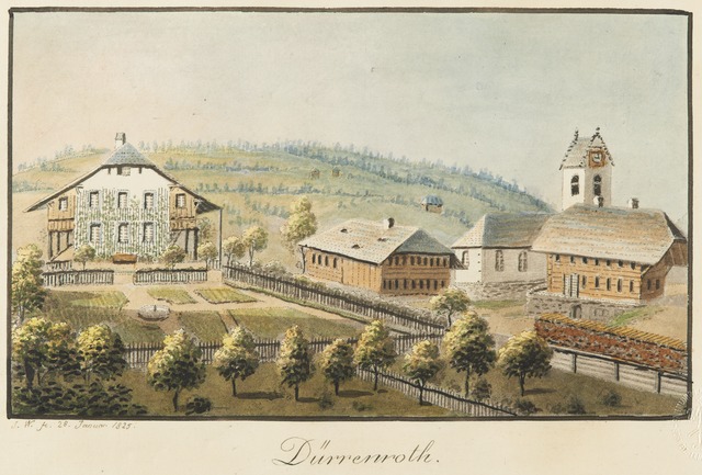

Dürrenroth
- municipality in Switzerland
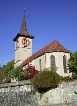
Hiking in Dürrenroth
Dürrenroth is a small municipality in the Emmental region of Switzerland, known for its picturesque landscapes, rolling hills, and beautiful countryside. Hiking in this area can be a delightful experience, offering a mix of scenic views, tranquility, and the chance to explore charming Swiss villages....
- Country:
- Postal Code: 3465
- Local Dialing Code: 062
- Licence Plate Code: BE
- Coordinates: 47° 5' 21" N, 7° 47' 28" E
- GPS tracks (wikiloc): [Link]
- AboveSeaLevel: 726 м m
- Area: 14.1 sq km
- Population: 1062
- Web site: [Link]