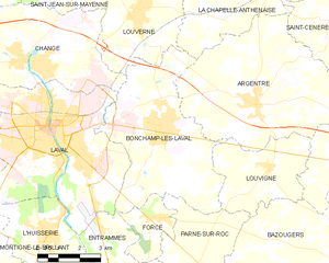
Entrammes (Entrammes)
- commune in Mayenne, France
- Country:

- Postal Code: 53260
- Licence Plate Code: 53
- Coordinates: 47° 59' 45" N, 0° 42' 50" E


- GPS tracks (wikiloc): [Link]
- Area: 26.16 sq km
- Population: 2242
- Web site: http://www.entrammes.mairie53.fr
- Wikipedia en: wiki(en)
- Wikipedia: wiki(fr)
- Wikidata storage: Wikidata: Q1003637
- Wikipedia Commons Category: [Link]
- Freebase ID: [/m/03qdd9g]
- GeoNames ID: Alt: [6449677]
- SIREN number: [215300948]
- BnF ID: [152638878]
- VIAF ID: Alt: [235576798]
- Digital Atlas of the Roman Empire ID: [15683]
- INSEE municipality code: 53094
Shares border with regions:


Nuillé-sur-Vicoin
- commune in Mayenne, France
- Country:

- Postal Code: 53970
- Coordinates: 47° 59' 6" N, 0° 47' 1" E


- GPS tracks (wikiloc): [Link]
- Area: 23.59 sq km
- Population: 1231
- Web site: [Link]


Villiers-Charlemagne
- commune in Mayenne, France
- Country:

- Postal Code: 53170
- Coordinates: 47° 55' 20" N, 0° 40' 35" E


- GPS tracks (wikiloc): [Link]
- Area: 27.57 sq km
- Population: 1114
- Web site: [Link]

Parné-sur-Roc
- commune in Mayenne, France
- Country:

- Postal Code: 53260
- Coordinates: 48° 0' 21" N, 0° 40' 6" E


- GPS tracks (wikiloc): [Link]
- Area: 23.74 sq km
- Population: 1332
- Web site: [Link]


Origné
- commune in Mayenne, France
- Country:

- Postal Code: 53360
- Coordinates: 47° 57' 10" N, 0° 43' 48" E


- GPS tracks (wikiloc): [Link]
- Area: 10.05 sq km
- Population: 424
- Web site: [Link]


L'Huisserie
- commune in Mayenne, France
- Country:

- Postal Code: 53970
- Coordinates: 48° 1' 26" N, 0° 46' 8" E


- GPS tracks (wikiloc): [Link]
- Area: 14.72 sq km
- Population: 4182
- Web site: [Link]


Bonchamp-lès-Laval
- commune in Mayenne, France
- Country:

- Postal Code: 53960
- Coordinates: 48° 4' 27" N, 0° 42' 5" E


- GPS tracks (wikiloc): [Link]
- Area: 27.51 sq km
- Population: 5900
- Web site: [Link]


Laval
- commune in Mayenne, France
- Country:

- Postal Code: 53000
- Licence Plate Code: 53
- Coordinates: 48° 4' 22" N, 0° 46' 12" E


- GPS tracks (wikiloc): [Link]
- AboveSeaLevel: 70 м m
- Area: 34.22 sq km
- Population: 49848
- Web site: [Link]


Forcé
- commune in Mayenne, France
- Country:

- Postal Code: 53260
- Coordinates: 48° 2' 0" N, 0° 41' 59" E


- GPS tracks (wikiloc): [Link]
- Area: 4.94 sq km
- Population: 1035
- Web site: [Link]


Maisoncelles-du-Maine
- commune in Mayenne, France
- Country:

- Postal Code: 53170
- Coordinates: 47° 57' 54" N, 0° 39' 5" E


- GPS tracks (wikiloc): [Link]
- Area: 15.83 sq km
- Population: 528
- Web site: [Link]
