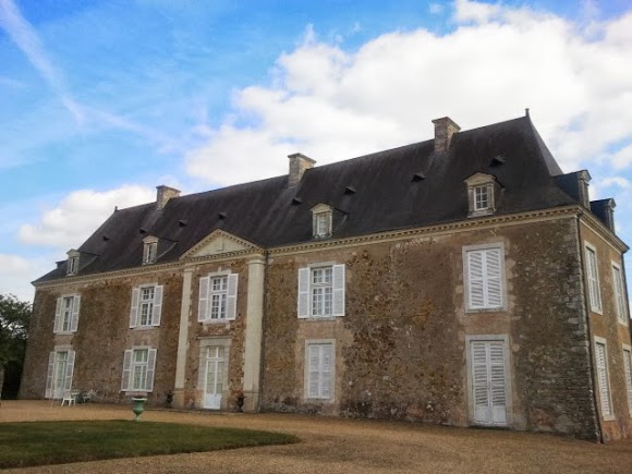
Villiers-Charlemagne (Villiers-Charlemagne)

- commune in Mayenne, France
- Country:

- Postal Code: 53170
- Coordinates: 47° 55' 20" N, 0° 40' 35" E


- GPS tracks (wikiloc): [Link]
- Area: 27.57 sq km
- Population: 1114
- Web site: http://www.villiers-charlemagne.com
- Wikipedia en: wiki(en)
- Wikipedia: wiki(fr)
- Wikidata storage: Wikidata: Q1100112
- Wikipedia Commons Category: [Link]
- Freebase ID: [/m/03nq0qd]
- Freebase ID: [/m/03nq0qd]
- GeoNames ID: Alt: [6436518]
- GeoNames ID: Alt: [6436518]
- SIREN number: [215302738]
- SIREN number: [215302738]
- BnF ID: [15264066b]
- BnF ID: [15264066b]
- PACTOLS thesaurus ID: [pcrtfpgXvGEyBg]
- PACTOLS thesaurus ID: [pcrtfpgXvGEyBg]
- INSEE municipality code: 53273
- INSEE municipality code: 53273
Shares border with regions:


Entrammes
- commune in Mayenne, France
- Country:
- Postal Code: 53260
- Licence Plate Code: 53
- Coordinates: 47° 59' 45" N, 0° 42' 50" E
- GPS tracks (wikiloc): [Link]
- Area: 26.16 sq km
- Population: 2242
- Web site: [Link]


Le Bignon-du-Maine
- commune in Mayenne, France
- Country:
- Postal Code: 53170
- Coordinates: 47° 57' 2" N, 0° 36' 36" E
- GPS tracks (wikiloc): [Link]
- Area: 14.29 sq km
- Population: 339

Ruillé-Froid-Fonds
- commune in Mayenne, France
- Country:
- Postal Code: 53170
- Coordinates: 47° 54' 2" N, 0° 38' 32" E
- GPS tracks (wikiloc): [Link]
- Area: 23.56 sq km
- Population: 555


Origné
- commune in Mayenne, France
- Country:
- Postal Code: 53360
- Coordinates: 47° 57' 10" N, 0° 43' 48" E
- GPS tracks (wikiloc): [Link]
- Area: 10.05 sq km
- Population: 424
- Web site: [Link]


Fromentières
- commune in Mayenne, France
- Country:
- Postal Code: 53200
- Coordinates: 47° 51' 52" N, 0° 39' 55" E
- GPS tracks (wikiloc): [Link]
- Area: 22.06 sq km
- Population: 831


Houssay
- commune in Mayenne, France
- Country:
- Postal Code: 53360
- Coordinates: 47° 54' 51" N, 0° 44' 9" E
- GPS tracks (wikiloc): [Link]
- Area: 14.26 sq km
- Population: 481


Saint-Sulpice
- commune in Mayenne, France
- Country:
- Postal Code: 53360
- Coordinates: 47° 54' 3" N, 0° 42' 55" E
- GPS tracks (wikiloc): [Link]
- Area: 8.17 sq km
- Population: 244


Maisoncelles-du-Maine
- commune in Mayenne, France
- Country:
- Postal Code: 53170
- Coordinates: 47° 57' 54" N, 0° 39' 5" E
- GPS tracks (wikiloc): [Link]
- Area: 15.83 sq km
- Population: 528
- Web site: [Link]