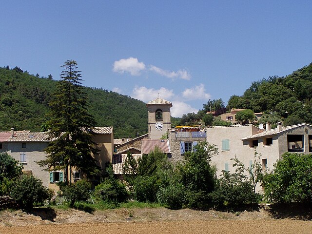
Entrevennes (Entrevennes)
- commune in Alpes-de-Haute-Provence, France
 Hiking in Entrevennes
Entrevennes is a charming village located in the Alpes-de-Haute-Provence department in southeastern France. It's surrounded by beautiful natural landscapes, making it an excellent destination for hiking enthusiasts. Here are some key points to consider if you're planning to hike in and around Entrevennes:
Scenic Trails
-
Diverse Terrain: The region offers a variety of landscapes, from rolling hills and valleys to rocky outcrops and forested areas. You'll find trails that cater to different skill levels, whether you’re a casual walker or a more experienced hiker.
-
Stunning Views: Many hiking routes provide spectacular views of the surrounding mountains, valleys, and even the nearby Verdon Gorge. The area is known for its picturesque scenery, especially in Spring and Fall when the flora is particularly vibrant.
-
Route Options: There are several well-marked hiking trails in the vicinity. You may consider:
- Local Paths: Shorter nature walks around the village.
- Longer Treks: More extensive hiking routes leading to nearby scenic spots.
Best Times to Hike
- Spring (April to June): Flowers are in bloom, the weather is generally mild, and it's a great time to experience the natural beauty of the region.
- Fall (September to October): The temperatures are comfortable, and the autumn colors can be breathtaking.
Safety and Preparation
- Weather: Always check the weather forecast before setting out, as conditions can change rapidly in mountainous areas.
- Gear: Wear sturdy hiking boots and carry sufficient water, snacks, a map, a compass or GPS, and a first aid kit.
Local Tips
- Guided Tours: If you’re unfamiliar with the region, consider joining a guided hike or tour. Local guides can provide insights into the flora, fauna, and history of the area.
- Respect Nature: Follow Leave No Trace principles to protect the environment and maintain the beauty of the area.
Nearby Attractions
- After hiking, you may want to explore local cultural sites or enjoy the cuisine in Entrevennes or nearby towns to make the most of your visit.
Overall, Entrevennes offers a peaceful and captivating hiking experience, making it a great choice for nature lovers and outdoor adventurers alike. Enjoy your hike!
- Country:

- Postal Code: 04700
- Coordinates: 43° 56' 16" N, 6° 1' 24" E


- GPS tracks (wikiloc): [Link]
- Area: 29.81 sq km
- Population: 163
- Web site: http://www.cc-ilo.com/entrevennes.html
- Wikipedia en: wiki(en)
- Wikipedia: wiki(fr)
- Wikidata storage: Wikidata: Q745197
- Wikipedia Commons Category: [Link]
- Freebase ID: [/m/03m7wkb]
- Freebase ID: [/m/03m7wkb]
- GeoNames ID: Alt: [3020118]
- GeoNames ID: Alt: [3020118]
- SIREN number: [210400776]
- SIREN number: [210400776]
- INSEE municipality code: 04077
- INSEE municipality code: 04077
Shares border with regions:

Saint-Julien-d'Asse
- commune in Alpes-de-Haute-Provence, France
Hiking in Saint-Julien-d'Asse
Saint-Julien-d'Asse is a charming commune in the Alpes-de-Haute-Provence region of southeastern France. It's surrounded by picturesque landscapes, offering a variety of hiking opportunities for outdoor enthusiasts. Here are some key points to consider if you're planning to hike in this area:...
- Country:
- Postal Code: 04270
- Coordinates: 43° 55' 2" N, 6° 5' 39" E
- GPS tracks (wikiloc): [Link]
- Area: 25.6 sq km
- Population: 196


Saint-Jeannet
- commune in Alpes-de-Haute-Provence, France
Hiking in Saint-Jeannet
Saint-Jeannet is a charming village located in the Alpes-de-Haute-Provence region of southeastern France. This area is known for its stunning natural landscapes, making it an excellent destination for hiking enthusiasts. Here’s what you can expect when hiking around Saint-Jeannet:...
- Country:
- Postal Code: 04270
- Coordinates: 43° 57' 46" N, 6° 7' 37" E
- GPS tracks (wikiloc): [Link]
- Area: 21.14 sq km
- Population: 63

Puimichel
- commune in Alpes-de-Haute-Provence, France
Hiking in Puimichel
Puimichel is a picturesque village located in the Provence-Alpes-Côte d'Azur region of southeastern France. It is known for its natural beauty, charming landscapes, and opportunities for outdoor activities such as hiking. Here’s what you can expect when hiking in and around Puimichel:...
- Country:
- Postal Code: 04700
- Coordinates: 43° 58' 26" N, 6° 1' 14" E
- GPS tracks (wikiloc): [Link]
- Area: 36.81 sq km
- Population: 218
- Web site: [Link]
Le Castellet
- commune in Alpes-de-Haute-Provence, France
Hiking in Le Castellet
Le Castellet, located in the Alpes-de-Haute-Provence region of France, offers a variety of beautiful hiking opportunities amidst stunning landscapes and rich natural beauty. Here are some key points to consider when hiking in this area:...
- Country:
- Postal Code: 04700
- Coordinates: 43° 56' 19" N, 5° 58' 48" E
- GPS tracks (wikiloc): [Link]
- Area: 18.87 sq km
- Population: 292
- Web site: [Link]

Brunet
- commune in Alpes-de-Haute-Provence, France
Hiking in Brunet
Brunet, located in the Alpes-de-Haute-Provence region of France, offers a unique hiking experience with its stunning landscapes and diverse natural features. Here are some highlights and tips for hiking in this beautiful area:...
- Country:
- Postal Code: 04210
- Coordinates: 43° 53' 29" N, 6° 1' 49" E
- GPS tracks (wikiloc): [Link]
- Area: 28.47 sq km
- Population: 255