Ernée (Ernée)

- commune in Mayenne, France
- Country:

- Postal Code: 53500
- Coordinates: 48° 17' 52" N, 0° 55' 53" E


- GPS tracks (wikiloc): [Link]
- Area: 36.53 sq km
- Population: 5757
- Web site: http://www.ville-ernee.fr/
- Wikipedia en: wiki(en)
- Wikipedia: wiki(fr)
- Wikidata storage: Wikidata: Q838741
- Wikipedia Commons Category: [Link]
- Freebase ID: [/m/02pv4c3]
- GeoNames ID: Alt: [3019895]
- SIREN number: [215300963]
- BnF ID: [15263889z]
- VIAF ID: Alt: [728144783208136971330]
- GND ID: Alt: [1054341648]
- PACTOLS thesaurus ID: [pcrt1Av4WweTHv]
- MusicBrainz area ID: [849f0d16-a577-4c77-b978-3f1a3b01e0eb]
- WOEID: [589900]
- INSEE municipality code: 53096
Shares border with regions:


Saint-Denis-de-Gastines
- commune in Mayenne, France
- Country:
- Postal Code: 53500
- Coordinates: 48° 20' 31" N, 0° 51' 27" E
- GPS tracks (wikiloc): [Link]
- Area: 48.01 sq km
- Population: 1591
- Web site: [Link]


Larchamp
- commune in Mayenne, France
- Country:
- Postal Code: 53220
- Coordinates: 48° 21' 43" N, 0° 59' 55" E
- GPS tracks (wikiloc): [Link]
- Area: 40.17 sq km
- Population: 1091
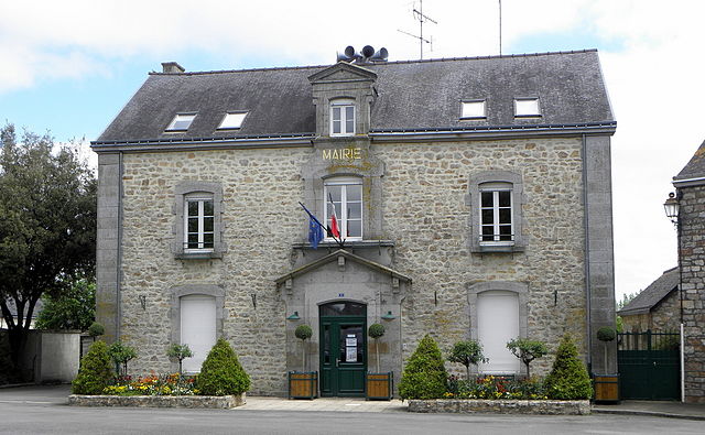
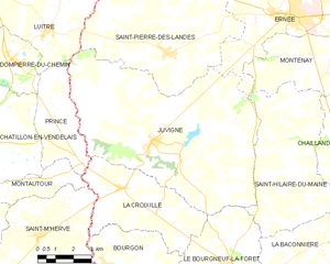
Juvigné
- commune in Mayenne, France
- Country:
- Postal Code: 53380
- Coordinates: 48° 13' 47" N, 1° 2' 3" E
- GPS tracks (wikiloc): [Link]
- Area: 62.16 sq km
- Population: 1466
- Web site: [Link]


Montenay
- commune in Mayenne, France
- Country:
- Postal Code: 53500
- Coordinates: 48° 17' 19" N, 0° 53' 34" E
- GPS tracks (wikiloc): [Link]
- Area: 37.2 sq km
- Population: 1362
- Web site: [Link]


Saint-Pierre-des-Landes
- commune in Mayenne, France
- Country:
- Postal Code: 53500
- Coordinates: 48° 16' 27" N, 1° 1' 41" E
- GPS tracks (wikiloc): [Link]
- Area: 40.9 sq km
- Population: 955
- Web site: [Link]