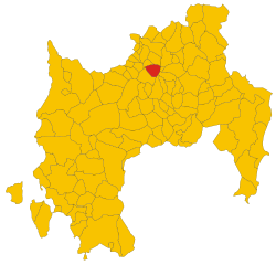
Escolca (Escolca)
%20-%202016.svg)
- Italian comune
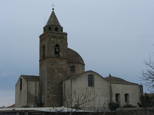
 Hiking in Escolca
Escolca is a small village in Sardinia, Italy, nestled in a picturesque landscape that offers a variety of hiking opportunities. The region is characterized by its beautiful natural scenery, including rugged hills, lush forests, and stunning views of the surrounding countryside. Here are some highlights and tips about hiking in Escolca:
Hiking Trails
-
Local Trails: Escolca has several local trails that vary in difficulty. You can find easier paths suitable for beginners as well as more challenging routes for experienced hikers.
-
Scenic Views: Many trails lead to panoramic viewpoints where you can enjoy breathtaking views of the Sarcidano region and the distant mountains. The landscape is dotted with natural features, traditional Sardinian farms, and ancient trees.
-
Historical Routes: Some trails may also pass by archaeological sites, old churches, or historical landmarks, providing a glimpse into the region's rich history.
Flora and Fauna
- The area around Escolca is home to diverse plant and animal life. Keep your eyes open for native flora and various bird species, making it a great spot for nature lovers and photographers.
Best Time to Hike
- The best time for hiking in Escolca is usually during the spring (March to June) and fall (September to October) when the weather is mild, and the natural beauty is vibrant. Summers can be quite hot, while winters may bring rain and colder temperatures.
Preparation
- Footwear: Wear sturdy hiking shoes as some trails can be rocky and uneven.
- Supplies: Carry plenty of water, snacks, a map or GPS device, and sun protection. Depending on the length of your hike, you might also want to pack a small first aid kit.
Local Culture
- After your hike, consider exploring the village of Escolca to enjoy local cuisine, visit artisan shops, and experience the Sardinian culture.
Safety Tips
- Always inform someone about your hiking plans, particularly if you’re going solo.
- Stay on marked trails to protect the environment and avoid getting lost.
- Check local weather conditions before heading out, as they can change quickly.
In summary, hiking in Escolca offers a delightful experience filled with natural beauty, cultural richness, and a chance to connect with the outdoors. Enjoy your adventure!
- Country:

- Postal Code: 08030
- Local Dialing Code: 0782
- Licence Plate Code: SU
- Coordinates: 39° 41' 56" N, 9° 7' 20" E


- GPS tracks (wikiloc): [Link]
- AboveSeaLevel: 416 м m
- Area: 14.76 sq km
- Population: 582
- Web site: http://www.comune.escolca.ca.it/
- Wikipedia en: wiki(en)
- Wikipedia: wiki(it)
- Wikidata storage: Wikidata: Q283927
- Wikipedia Commons Category: [Link]
- Freebase ID: [/m/0gqvbs]
- Freebase ID: [/m/0gqvbs]
- GeoNames ID: Alt: [6537853]
- GeoNames ID: Alt: [6537853]
- OSM relation ID: [40013]
- OSM relation ID: [40013]
- ISTAT ID: 111019
- ISTAT ID: 111019
- Italian cadastre code: D431
- Italian cadastre code: D431
Shares border with regions:
Gergei
- Italian comune
Hiking in Gergei
Gergei is a small village in the Sulcis region of Sardinia, Italy, known for its beautiful landscapes and rich natural environment. Hiking in Gergei and the surrounding areas can be a delightful experience, offering a chance to explore the unique flora and fauna of this region, as well as historical and cultural sites....
- Country:
- Postal Code: 08030
- Local Dialing Code: 0782
- Licence Plate Code: SU
- Coordinates: 39° 41' 58" N, 9° 6' 3" E
- GPS tracks (wikiloc): [Link]
- AboveSeaLevel: 374 м m
- Area: 36.18 sq km
- Population: 1218
- Web site: [Link]
Gesico
- Italian comune
Hiking in Gesico
Gesico is a small town in the region of Sardinia, Italy, known for its beautiful landscapes and rich cultural heritage. While it may not be as widely recognized as some of the larger tourist destinations, it offers opportunities for hiking enthusiasts looking for a peaceful experience in nature....
- Country:
- Postal Code: 09040
- Local Dialing Code: 070
- Licence Plate Code: SU
- Coordinates: 39° 36' 56" N, 9° 6' 27" E
- GPS tracks (wikiloc): [Link]
- AboveSeaLevel: 300 м m
- Area: 25.62 sq km
- Population: 845
- Web site: [Link]


Mandas
- Italian comune
Hiking in Mandas
Mandas, a picturesque town in Sardinia, Italy, offers some beautiful hiking experiences for outdoor enthusiasts. The surrounding landscape features a mix of rugged terrain, rolling hills, and lush greenery, making it ideal for various hiking trails suitable for different skill levels....
- Country:
- Postal Code: 09040
- Local Dialing Code: 070
- Licence Plate Code: SU
- Coordinates: 39° 39' 19" N, 9° 7' 47" E
- GPS tracks (wikiloc): [Link]
- AboveSeaLevel: 491 м m
- Area: 45.02 sq km
- Population: 2174
- Web site: [Link]
Serri
- Italian comune
Hiking in Serri
Serri, located in the beautiful landscape of the Sarrabus region in Sardinia, Italy, offers a variety of hiking opportunities for both novice and experienced hikers. The area is known for its rugged terrain, stunning natural scenery, and rich biodiversity, making it an ideal destination for outdoor enthusiasts....
- Country:
- Postal Code: 08030
- Local Dialing Code: 0782
- Licence Plate Code: SU
- Coordinates: 39° 42' 5" N, 9° 8' 41" E
- GPS tracks (wikiloc): [Link]
- AboveSeaLevel: 640 м m
- Area: 19.18 sq km
- Population: 644
- Web site: [Link]


Barumini
- Italian comune
Hiking in Barumini
Barumini, located in the south of Sardinia, Italy, is not only famous for its archaeological site, Su Nuraxi, which is recognized as a UNESCO World Heritage Site, but it also offers some beautiful hiking opportunities in the surrounding area. Here are some aspects to consider if you're looking to hike in and around Barumini:...
- Country:
- Postal Code: 09021
- Local Dialing Code: 070
- Licence Plate Code: SU
- Coordinates: 39° 42' 14" N, 9° 0' 13" E
- GPS tracks (wikiloc): [Link]
- AboveSeaLevel: 202 м m
- Area: 26.4 sq km
- Population: 1273
- Web site: [Link]
Villanovafranca
- Italian comune
Hiking in Villanovafranca
Villanovafranca is a charming town located in the province of South Sardinia, Italy. Nestled on the outskirts of the Marmilla region, it offers a beautiful landscape for hiking enthusiasts. The area is characterized by rolling hills, lush vegetation, and panoramic views, making it an ideal setting for outdoor adventures....
- Country:
- Postal Code: 09020
- Local Dialing Code: 070
- Licence Plate Code: SU
- Coordinates: 39° 38' 38" N, 9° 0' 12" E
- GPS tracks (wikiloc): [Link]
- AboveSeaLevel: 292 м m
- Area: 27.59 sq km
- Population: 1315
- Web site: [Link]