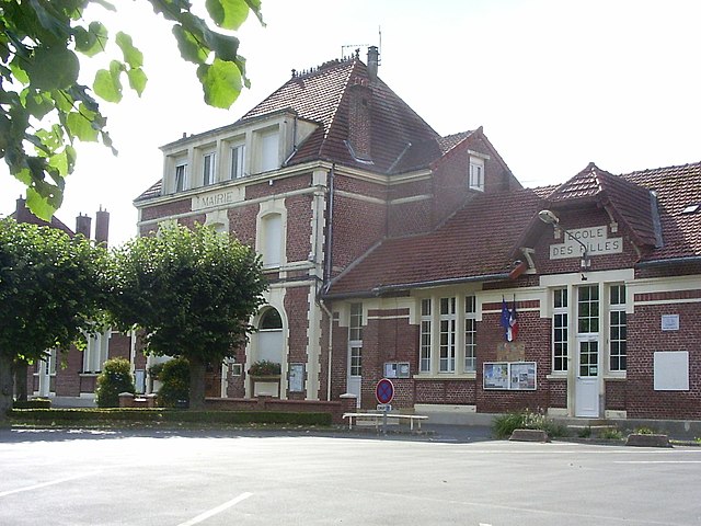
Esmery-Hallon (Esmery-Hallon)

- commune in Somme, France
- Country:

- Postal Code: 80400
- Coordinates: 49° 43' 1" N, 3° 0' 35" E


- GPS tracks (wikiloc): [Link]
- Area: 18.9 sq km
- Population: 774
- Wikipedia en: wiki(en)
- Wikipedia: wiki(fr)
- Wikidata storage: Wikidata: Q82068
- Wikipedia Commons Category: [Link]
- Freebase ID: [/m/03nr2qq]
- GeoNames ID: Alt: [6444417]
- SIREN number: [218002723]
- BnF ID: [15276766z]
- INSEE municipality code: 80284
Shares border with regions:


Golancourt
- commune in Oise, France
- Country:
- Postal Code: 60640
- Coordinates: 49° 42' 21" N, 3° 3' 51" E
- GPS tracks (wikiloc): [Link]
- Area: 4.13 sq km
- Population: 382


Muille-Villette
- commune in Somme, France
- Country:
- Postal Code: 80400
- Coordinates: 49° 43' 39" N, 3° 4' 0" E
- GPS tracks (wikiloc): [Link]
- Area: 6.53 sq km
- Population: 825
- Web site: [Link]
Flavy-le-Meldeux
- commune in Oise, France
- Country:
- Postal Code: 60640
- Coordinates: 49° 41' 7" N, 3° 2' 38" E
- GPS tracks (wikiloc): [Link]
- Area: 3.15 sq km
- Population: 215
Libermont
- commune in Oise, France
- Country:
- Postal Code: 60640
- Coordinates: 49° 41' 38" N, 2° 58' 14" E
- GPS tracks (wikiloc): [Link]
- Area: 11.37 sq km
- Population: 200
Fréniches
- commune in Oise, France
- Country:
- Postal Code: 60640
- Coordinates: 49° 40' 16" N, 3° 0' 14" E
- GPS tracks (wikiloc): [Link]
- Area: 5.96 sq km
- Population: 347


Guiscard
- commune in Oise, France
- Country:
- Postal Code: 60640
- Coordinates: 49° 39' 21" N, 3° 3' 6" E
- GPS tracks (wikiloc): [Link]
- Area: 20.49 sq km
- Population: 1796


Grécourt
- commune in Somme, France
- Country:
- Postal Code: 80400
- Coordinates: 49° 43' 31" N, 2° 59' 11" E
- GPS tracks (wikiloc): [Link]
- Area: 2.34 sq km
- Population: 20


Hombleux
- commune in Somme, France
- Country:
- Postal Code: 80400
- Coordinates: 49° 44' 19" N, 2° 59' 7" E
- GPS tracks (wikiloc): [Link]
- Area: 15.81 sq km
- Population: 1142
- Web site: [Link]
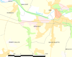
Eppeville
- commune in Somme, France
- Country:
- Postal Code: 80400
- Coordinates: 49° 44' 30" N, 3° 3' 1" E
- GPS tracks (wikiloc): [Link]
- Area: 4.95 sq km
- Population: 1839