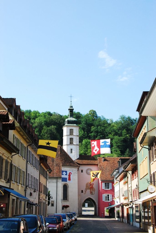
Ettingen (Ettingen)

- municipality in Switzerland
 Hiking in Ettingen
Ettingen, located in the region of Basel-Country in Switzerland, is a charming village surrounded by beautiful natural landscapes, making it a great spot for hiking enthusiasts. The area is characterized by rolling hills, forests, and picturesque views typical of the Swiss countryside.
Hiking Trails:
-
Local Trails: Ettingen has several marked trails that vary in difficulty. Beginners can enjoy leisurely walks through oak and beech forests, while more experienced hikers can tackle steeper routes that lead to elevated viewpoints.
-
Nordic Walking: The region is also popular for Nordic walking, with dedicated tracks that are easy to navigate and perfect for those seeking a low-impact workout.
-
Scenic Routes: Many trails offer scenic vistas of the surrounding landscape, including views of the nearby Jura Mountains and the Rhine River valley.
Recommended Hikes:
- Ettingen to Liestal: A moderately challenging trail that takes you through beautiful nature and provides a glimpse of local wildlife.
- Ettingen to the Blauen Pass: A more strenuous hike that rewards trekkers with stunning panoramic views and an opportunity to enjoy the diverse flora and fauna.
Tips for Hiking in Ettingen:
- Weather Considerations: Always check the weather before heading out, as conditions can change quickly in the mountains.
- Footwear: Wear sturdy hiking boots for better grip and support on uneven terrains.
- Hydration and Snacks: Carry enough water and snacks to keep your energy levels up during your hike.
- Maps and Trails Information: It’s advisable to have a local hiking map or download a hiking app to stay on track.
Best Time to Hike:
The best hiking seasons are typically from late spring to early autumn, when the weather is mild and the trails are clear. However, winter hikes can also be enjoyable if you are equipped for snowy conditions.
Local Attractions:
While in Ettingen, consider exploring other local attractions, such as historic buildings and local cafes that offer regional delicacies.
Whether you're a beginner or an experienced hiker, Ettingen provides a lovely backdrop for a day of adventure and exploration in nature.
- Country:

- Postal Code: 4107
- Local Dialing Code: 061
- Licence Plate Code: BL
- Coordinates: 47° 28' 28" N, 7° 32' 45" E


- GPS tracks (wikiloc): [Link]
- AboveSeaLevel: 443 м m
- Area: 6.35 sq km
- Population: 5156
- Web site: http://www.ettingen.ch
- Wikipedia en: wiki(en)
- Wikipedia: wiki(de)
- Wikidata storage: Wikidata: Q70012
- Wikipedia Commons Category: [Link]
- Freebase ID: [/m/0g77rs]
- GeoNames ID: Alt: [7285780]
- VIAF ID: Alt: [157259763]
- OSM relation ID: [1683646]
- MusicBrainz area ID: [ebbfc817-c52e-4790-8cf0-a87f4e233f00]
- HDS ID: [1196]
- Swiss municipality code: [2768]
Shares border with regions:


Pfeffingen
- municipality in the canton of Basel-Country, Switzerland
Hiking in Pfeffingen
Pfeffingen, located in the Basel-Landschaft region of Switzerland, is a charming area known for its beautiful landscapes and hiking opportunities. Here are some key points about hiking in Pfeffingen:...
- Country:
- Postal Code: 4148
- Local Dialing Code: 061
- Licence Plate Code: BL
- Coordinates: 47° 27' 26" N, 7° 34' 49" E
- GPS tracks (wikiloc): [Link]
- AboveSeaLevel: 489 м m
- Area: 4.89 sq km
- Population: 2358
- Web site: [Link]


Therwil
- municipality in Switzerland
Hiking in Therwil
Therwil is a small municipality located in the canton of Basel-Landschaft in Switzerland, known for its scenic landscapes and proximity to nature. While it may not be a major hiking destination, it offers several opportunities for outdoor enthusiasts to explore the beautiful surroundings....
- Country:
- Postal Code: 4106
- Local Dialing Code: 061
- Licence Plate Code: BL
- Coordinates: 47° 29' 51" N, 7° 33' 33" E
- GPS tracks (wikiloc): [Link]
- AboveSeaLevel: 308 м m
- Area: 7.63 sq km
- Population: 9947
- Web site: [Link]

Aesch BL
- municipality in the canton of Basel-Country, Switzerland
Hiking in Aesch BL
Aesch, located in the Basel-Landschaft region of Switzerland, is a wonderful starting point for hiking enthusiasts. The area offers picturesque landscapes, lush forests, and well-marked trails of varying difficulty levels, catering to hikers of all experience levels....
- Country:
- Postal Code: 4147
- Local Dialing Code: 061
- Licence Plate Code: BL
- Coordinates: 47° 28' 26" N, 7° 35' 7" E
- GPS tracks (wikiloc): [Link]
- AboveSeaLevel: 310 м m
- Area: 7.39 sq km
- Population: 10237
- Web site: [Link]