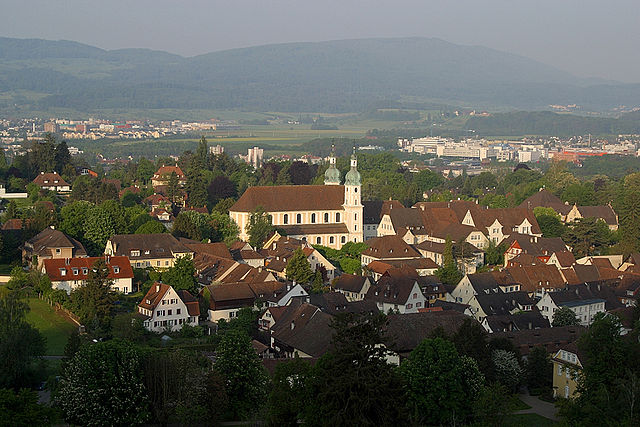
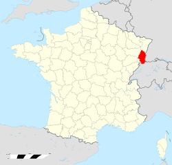
Basel-Landschaft (Kanton Basel-Landschaft)


- canton of Switzerland
 Hiking in Basel-Landschaft
Hiking in the Canton of Basel-Landschaft, located in Switzerland, offers an excellent opportunity to explore the region's beautiful landscapes, charming villages, and diverse ecosystems. Here are some key points to consider when planning your hike in this area:
Scenic Trails:
-
Loreto Trail: This is a picturesque trail that leads through woodlands and along the hills offering stunning views of the region. It is suitable for various skill levels.
-
Sole Valley: The trail through the Sole Valley takes you along the river and offers a mix of natural scenery and cultural landmarks. It's perfect for those interested in both nature and history.
-
Birseck Castle Trail: This trail offers a historical perspective as you hike past the remains of medieval castles and through quaint villages.
Difficulty Levels:
The trails in Basel-Landschaft cater to all skill levels, from easy walks suited for families to more challenging hikes for experienced adventurers. Be sure to check the trail markings and descriptions before heading out.
Natural Beauty:
The canton is characterized by rolling hills, dense forests, and open meadows. It is part of the Jura mountain range, which provides unique flora and fauna. In spring and summer, wildflowers bloom, while autumn offers a spectacular display of fall colors.
Wildlife:
While hiking, you may encounter a variety of wildlife including deer, foxes, and numerous bird species. It’s always advisable to respect the natural habitat, maintain a safe distance from wildlife, and follow local guidelines.
Recommendations:
- Safety First: Always check the weather conditions before heading out, wear appropriate hiking footwear, and carry sufficient water and snacks.
- Navigation: Use local maps or a hiking app to navigate trails. Signage is generally clear, but it’s good practice to have a backup.
- Local Culture: Take time to explore villages along the way. Many small towns offer local cuisine, shops, and cultural sites.
Accessibility:
Public transportation is typically good in Switzerland, making it easy to reach various trailheads. The local transport systems provide access to many wonderful starting points for hikes.
In summary, hiking in the Canton of Basel-Landschaft is a rewarding experience that combines natural beauty, cultural heritage, and a variety of trails suitable for all hikers. Whether you're an experienced hiker or just looking to enjoy a peaceful walk in nature, you'll find plenty to explore in this picturesque region.
- Country:

- Capital: Liestal
- Licence Plate Code: BL
- Coordinates: 47° 27' 47" N, 7° 45' 21" E


- GPS tracks (wikiloc): [Link]
- AboveSeaLevel: 327 м m
- Area: 517.67 sq km
- Web site: https://www.baselland.ch/
- Wikipedia en: wiki(en)
- Wikipedia: wiki(de)
- Wikidata storage: Wikidata: Q12146
- Wikipedia Commons Gallery: [Link]
- Wikipedia Commons Category: [Link]
- Freebase ID: [/m/0d7mt]
- GeoNames ID: Alt: [2661603]
- BnF ID: [12036667f]
- VIAF ID: Alt: [138954768]
- OSM relation ID: [53111]
- GND ID: Alt: [4315877-8]
- archINFORM location ID: [2701]
- Library of Congress authority ID: Alt: [n95112386]
- MusicBrainz area ID: [be24a782-f13d-45a3-b141-87c765b15a3a]
- Quora topic ID: [Canton-of-Basel-Landschaft]
- SUDOC authorities ID: [028554108]
- Encyclopædia Britannica Online ID: [place/Basel-Landschaft]
- Gran Enciclopèdia Catalana ID: [0008116]
- HDS ID: [7477]
- ISNI: Alt: [0000 0001 1172 4109]
- NUTS code: [CH032]
- Ringgold ID: [128894]
- ISO 3166-2 code: CH-BL
- FIPS 10-4 (countries and regions): SZ03
Includes regions:


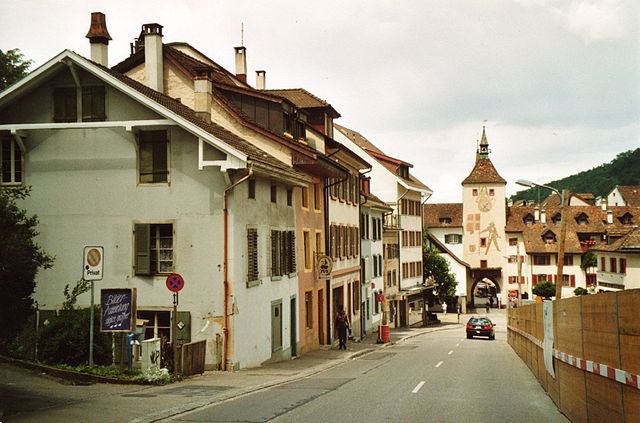
Laufen District
- district in Switzerland
Hiking in Laufen District
Laufen District, located in the northeastern part of Switzerland near the French border, offers a variety of scenic hiking opportunities. The region is characterized by its lush landscapes, rolling hills, and beautiful views of the Jura mountains and the Rhine River....
- Country:
- Capital: Laufen
- Licence Plate Code: BL
- Coordinates: 47° 25' 0" N, 7° 30' 0" E
- GPS tracks (wikiloc): [Link]
- AboveSeaLevel: 419 м m
- Area: 89.55 sq km


Waldenburg District
- district in Switzerland
Hiking in Waldenburg District
Waldenburg District, located in the state of Baden-Württemberg, Germany, offers an array of hiking opportunities that cater to various skill levels. The picturesque landscape of this district is characterized by rolling hills, lush forests, and charming villages, making it a great destination for outdoor enthusiasts....
- Country:
- Capital: Waldenburg
- Licence Plate Code: BL
- Coordinates: 47° 23' 0" N, 7° 45' 0" E
- GPS tracks (wikiloc): [Link]
- AboveSeaLevel: 538 м m
- Area: 104.93 sq km

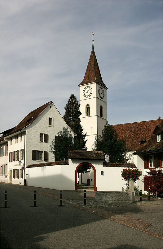
Liestal District
- district in Switzerland
Hiking in Liestal District
Liestal District, located in the canton of Basel-Landschaft in Switzerland, offers beautiful hiking opportunities characterized by picturesque landscapes, rolling hills, and a rich array of flora and fauna. Here are some highlights and tips for hiking in the Liestal District:...
- Country:
- Capital: Liestal
- Licence Plate Code: BL
- Coordinates: 47° 29' 0" N, 7° 44' 0" E
- GPS tracks (wikiloc): [Link]
- AboveSeaLevel: 366 м m
- Area: 85.83 sq km

Sissach District
- district in Switzerland
Hiking in Sissach District
Sissach District, located in the Basel-Landschaft region of Switzerland, offers beautiful hiking opportunities that showcase the region's natural beauty and diverse landscapes. Here are some highlights of hiking in this area:...
- Country:
- Capital: Sissach
- Licence Plate Code: BL
- Coordinates: 46° 4' 0" N, 7° 3' 0" E
- GPS tracks (wikiloc): [Link]
- AboveSeaLevel: 467 м m
- Area: 138.29 sq km

Arlesheim District
- district in Switzerland
Hiking in Arlesheim District
Hiking in the Arlesheim District, located in Switzerland near Basel, offers beautiful natural landscapes, historical sites, and a variety of trails suitable for different skill levels. Here’s a brief overview of what you can expect:...
- Country:
- Capital: Arlesheim
- Licence Plate Code: BL
- Coordinates: 47° 29' 0" N, 7° 37' 0" E
- GPS tracks (wikiloc): [Link]
- AboveSeaLevel: 356 м m
- Area: 96.24 sq km
Shares border with regions:

Canton of Solothurn
- canton of Switzerland
Hiking in Canton of Solothurn
Hiking in the Canton of Solothurn offers a fantastic blend of natural beauty, historical sites, and picturesque villages. Located in Switzerland, Solothurn is known for its picturesque landscapes, ranging from rolling hills to stunning valleys and the scenic banks of the River Aare....
- Country:
- Capital: Solothurn
- Licence Plate Code: SO
- Coordinates: 47° 9' 0" N, 7° 38' 0" E
- GPS tracks (wikiloc): [Link]
- AboveSeaLevel: 432 м m
- Area: 790.45 sq km
- Web site: [Link]


Aargau
- canton of Switzerland
Hiking in Aargau
The Canton of Aargau, located in Switzerland, offers a variety of hiking opportunities that cater to different skill levels and preferences. Here's an overview of what you can expect when hiking in this beautiful region:...
- Country:
- Capital: Aarau
- Licence Plate Code: AG
- Coordinates: 47° 22' 49" N, 8° 0' 51" E
- GPS tracks (wikiloc): [Link]
- AboveSeaLevel: 382 м m
- Area: 1403.77 sq km
- Population: 568671
- Web site: [Link]

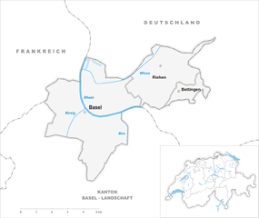
Basel-Stadt
- canton of Switzerland
Hiking in Basel-Stadt
Hiking in the Canton of Basel-Stadt offers a unique blend of urban landscapes and natural surroundings. Though Basel-Stadt is one of the smallest cantons in Switzerland and is largely urban, it provides access to beautiful parks, scenic riversides, and nearby regions that are perfect for hiking....
- Country:
- Capital: Basel
- Licence Plate Code: BS
- Coordinates: 47° 34' 0" N, 7° 36' 0" E
- GPS tracks (wikiloc): [Link]
- AboveSeaLevel: 260 м m
- Area: 36.95 sq km
- Population: 200256
- Web site: [Link]

Haut-Rhin
- French department
Hiking in Haut-Rhin
Haut-Rhin, located in the Alsace region of France, offers some stunning hiking opportunities. The region is characterized by its picturesque landscapes, charming villages, and a rich cultural heritage, making it an excellent destination for hikers of all levels. Here are some highlights and tips for hiking in Haut-Rhin:...
- Country:

- Capital: Colmar
- Coordinates: 47° 57' 51" N, 7° 19' 11" E
- GPS tracks (wikiloc): [Link]
- Area: 3525 sq km
- Population: 762743
- Web site: [Link]


Canton of Jura
- canton of Switzerland
Hiking in Canton of Jura
Hiking in the Canton of Jura, Switzerland, is a fantastic experience for outdoor enthusiasts. This region is known for its stunning landscapes, rolling hills, dense forests, and picturesque Jura mountains. Here are some key points to consider if you're planning to hike in the Canton of Jura:...
- Country:
- Capital: Delémont
- Licence Plate Code: JU
- Coordinates: 47° 22' 0" N, 7° 9' 0" E
- GPS tracks (wikiloc): [Link]
- AboveSeaLevel: 435 м m
- Area: 838.51 sq km
- Population: 69100
- Web site: [Link]


Baden-Württemberg
- federal state in the South-West of Germany
Hiking in Baden-Württemberg
Baden-Württemberg, located in southwestern Germany, is a fantastic region for hiking enthusiasts. With its diverse landscapes, from the Black Forest to the Swabian Jura and picturesque vineyards along the Rhine River, the area offers a variety of trails suitable for all skill levels. Here are some highlights:...
- Country:

- Capital: Stuttgart
- Coordinates: 48° 32' 16" N, 9° 2' 28" E
- GPS tracks (wikiloc): [Link]
- AboveSeaLevel: 327 м m
- Area: 35751.65 sq km
- Population: 10703000
- Web site: [Link]