Exmes (Exmes)

- former commune in Orne, France
- Country:

- Postal Code: 61310
- Coordinates: 48° 45' 38" N, 0° 10' 47" E


- GPS tracks (wikiloc): [Link]
- Area: 10.43 sq km
- Population: 293
- Wikipedia en: wiki(en)
- Wikipedia: wiki(fr)
- Wikidata storage: Wikidata: Q736192
- Wikipedia Commons Category: [Link]
- Freebase ID: [/m/02w7m1z]
- Freebase ID: [/m/02w7m1z]
- GeoNames ID: Alt: [6454466]
- GeoNames ID: Alt: [6454466]
- BnF ID: [15268089z]
- BnF ID: [15268089z]
- VIAF ID: Alt: [241904968]
- VIAF ID: Alt: [241904968]
- PACTOLS thesaurus ID: [pcrtDEoFbk4d2O]
- PACTOLS thesaurus ID: [pcrtDEoFbk4d2O]
- WOEID: [590408]
- WOEID: [590408]
- INSEE municipality code: 61157
- INSEE municipality code: 61157
Shares border with regions:

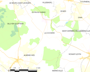
La Cochère
- former commune in Orne, France
- Country:
- Postal Code: 61310
- Coordinates: 48° 43' 25" N, 0° 9' 0" E
- GPS tracks (wikiloc): [Link]
- Area: 12.92 sq km
- Population: 140
Avernes-sous-Exmes
- former commune in Orne, France
- Country:
- Postal Code: 61310
- Coordinates: 48° 47' 20" N, 0° 12' 14" E
- GPS tracks (wikiloc): [Link]
- Area: 7.03 sq km
- Population: 83


Le Pin-au-Haras
- commune in Orne, France
- Country:
- Postal Code: 61310
- Coordinates: 48° 44' 41" N, 0° 8' 31" E
- GPS tracks (wikiloc): [Link]
- Area: 8.66 sq km
- Population: 287


Ginai
- commune in Orne, France
- Country:
- Postal Code: 61310
- Coordinates: 48° 44' 50" N, 0° 13' 2" E
- GPS tracks (wikiloc): [Link]
- AboveSeaLevel: 320 м m
- Area: 9.25 sq km
- Population: 102

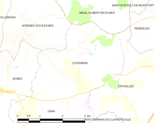
Courménil
- former commune in Orne, France
- Country:
- Postal Code: 61310
- Coordinates: 48° 46' 39" N, 0° 14' 6" E
- GPS tracks (wikiloc): [Link]
- Area: 9.53 sq km
- Population: 123


Villebadin
- former commune in Orne, France
- Country:
- Postal Code: 61310
- Coordinates: 48° 46' 45" N, 0° 9' 16" E
- GPS tracks (wikiloc): [Link]
- Area: 12.93 sq km
- Population: 131