Avernes-sous-Exmes (Avernes-sous-Exmes)

- former commune in Orne, France
- Country:

- Postal Code: 61310
- Coordinates: 48° 47' 20" N, 0° 12' 14" E


- GPS tracks (wikiloc): [Link]
- Area: 7.03 sq km
- Population: 83
- Wikipedia en: wiki(en)
- Wikipedia: wiki(fr)
- Wikidata storage: Wikidata: Q1095210
- Wikipedia Commons Category: [Link]
- Freebase ID: [/m/03qcs9h]
- Freebase ID: [/m/03qcs9h]
- GeoNames ID: Alt: [6450171]
- GeoNames ID: Alt: [6450171]
- BnF ID: [15267954j]
- BnF ID: [15267954j]
- INSEE municipality code: 61019
- INSEE municipality code: 61019
Shares border with regions:

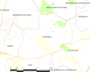
Courménil
- former commune in Orne, France
- Country:
- Postal Code: 61310
- Coordinates: 48° 46' 39" N, 0° 14' 6" E
- GPS tracks (wikiloc): [Link]
- Area: 9.53 sq km
- Population: 123

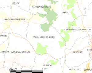
Ménil-Hubert-en-Exmes
- commune in Orne, France
- Country:
- Postal Code: 61230
- Coordinates: 48° 48' 48" N, 0° 13' 31" E
- GPS tracks (wikiloc): [Link]
- Area: 10.34 sq km
- Population: 119


Villebadin
- former commune in Orne, France
- Country:
- Postal Code: 61310
- Coordinates: 48° 46' 45" N, 0° 9' 16" E
- GPS tracks (wikiloc): [Link]
- Area: 12.93 sq km
- Population: 131
Omméel
- former commune in Orne, France
- Country:
- Postal Code: 61160
- Coordinates: 48° 48' 14" N, 0° 8' 44" E
- GPS tracks (wikiloc): [Link]
- Area: 9.34 sq km
- Population: 130
Saint-Pierre-la-Rivière
- former commune in Orne, France
- Country:
- Postal Code: 61310
- Coordinates: 48° 49' 35" N, 0° 11' 24" E
- GPS tracks (wikiloc): [Link]
- Area: 9.37 sq km
- Population: 164


Exmes
- former commune in Orne, France
- Country:
- Postal Code: 61310
- Coordinates: 48° 45' 38" N, 0° 10' 47" E
- GPS tracks (wikiloc): [Link]
- Area: 10.43 sq km
- Population: 293