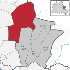
Falkenberg (Falkenberg)

- locality of Berlin, Germany
 Hiking in Falkenberg
Falkenberg is a district located in the eastern part of Berlin, known for its relatively tranquil environment compared to the bustling city center. While it may not be as famous for hiking as some larger nature parks or forested areas, there are still opportunities to explore the natural beauty nearby.
Hiking Opportunities:
-
Surrounding Natural Areas: Falkenberg is close to several natural reserves and parks. The nearby Müritz National Park and Spreewald area provide expansive landscapes with well-marked trails for hiking.
-
Tegeler Forest: A little northwest of Falkenberg, the Tegeler Forest features multiple walking trails amidst lush greenery, offering a serene escape from urban life.
-
Walking and Bike trails: There are various paths for hiking and cycling that weave through the area, including routes along the Spree River. These trails offer scenic views and opportunities to enjoy wildlife.
Tips for Hiking in Falkenberg:
-
Weather Preparation: Always check the weather before you head out. Berlin experiences varying weather conditions, so layering clothing is advisable.
-
Stay Hydrated: Bring enough water, especially on longer hikes, as amenities may be sparse.
-
Trail Maps: Familiarize yourself with trail maps and markers. Local tourist information centers can provide useful maps.
-
Safety Measures: Inform someone about your hiking plans and expected return time, especially if you're going on less traveled paths.
-
Public Transport Access: Falkenberg is accessible via Berlin's public transport system, so it is relatively easy to reach various hiking destinations without needing a car.
Nearby Hiking Locations:
If you're looking to expand your hiking options, consider exploring areas further afield such as:
- Grunewald Forest: Located on the western side of Berlin, it has a plethora of trails and some notable elevation changes.
- Müggelberge: Located southeast of the city, it features some of the highest hills in Berlin and offers gorgeous views of the surrounding landscape.
Falkenberg's surroundings provide a great balance of urban and natural experiences, making it a practical starting point for a variety of hiking adventures in and around Berlin.
- Country:

- Coordinates: 52° 34' 15" N, 13° 32' 45" E


- GPS tracks (wikiloc): [Link]
- AboveSeaLevel: 56 м m
- Area: 3.06 sq km
- Wikipedia en: wiki(en)
- Wikipedia: wiki(de)
- Wikidata storage: Wikidata: Q674988
- Wikipedia Commons Gallery: [Link]
- Wikipedia Commons Category: [Link]
- Freebase ID: [/m/0bwlfj7]
- GeoNames ID: Alt: [2928001]
- VIAF ID: Alt: [244557992]
- GND ID: Alt: [4087309-2]
- archINFORM location ID: [43226]
Shares border with regions:


Wartenberg
- locality of Berlin
Hiking in Wartenberg
Wartenberg is a district located in the northeastern part of Berlin, known for its more residential and green areas compared to the bustling city center. While it may not be a well-known hiking destination like some national parks or renowned trails, there are still several opportunities for outdoor activity and exploration in and around Wartenberg....
- Country:
- Coordinates: 52° 34' 45" N, 13° 31' 15" E
- GPS tracks (wikiloc): [Link]
- AboveSeaLevel: 58 м m
- Area: 6.92 sq km


Neu-Hohenschönhausen
- locality of Berlin
Hiking in Neu-Hohenschönhausen
Neu-Hohenschönhausen is a district located in the northeastern part of Berlin, Germany. While it is primarily an urban area known for its residential neighborhoods, parks, and recreational spaces, there are still opportunities for hiking and enjoying nature nearby, particularly in green spaces and surrounding areas....
- Country:
- Coordinates: 52° 33' 48" N, 13° 30' 18" E
- GPS tracks (wikiloc): [Link]
- AboveSeaLevel: 55 м m
- Area: 5.16 sq km
- Population: 53374

Marzahn
- locality of Berlin
Hiking in Marzahn
Marzahn, a district located in the northeastern part of Berlin, Germany, is not typically known as a hiking destination in the traditional sense, as it is more urbanized compared to other areas. However, there are still opportunities for walking and exploring nature in and around this district....
- Country:
- Postal Code: 12689; 12687; 12685; 12681; 12679
- Coordinates: 52° 32' 45" N, 13° 33' 45" E
- GPS tracks (wikiloc): [Link]
- AboveSeaLevel: 62 м m
- Area: 19.54 sq km
- Population: 106640