
Berlin (Berlin)


- capital and largest city of Germany
 Hiking in Berlin
Hiking in and around Berlin offers a unique blend of urban exploration and access to nature. While Berlin itself is a bustling metropolis, there are various parks, forested areas, and nearby trails that provide excellent opportunities for hiking. Here are some highlights:
Parks and Urban Trails
-
Tiergarten: This central park is a great spot for leisurely hikes, with winding paths, lakes, and a variety of flora and fauna. It's perfect for a short hike to get a breath of fresh air in the city.
-
Tempelhofer Feld: The former airport turned public park offers vast open spaces. While it's not a traditional hiking trail, you can walk along the former runways and enjoy a unique outdoor experience.
-
Grunewald Forest: Located in the southwest of Berlin, Grunewald has several trails. You can hike to the top of the Teufelsberg, a former spy station, for panoramic views of the city. The forest is home to numerous trails of varying difficulties, making it perfect for a day hike.
Nearby Hiking Areas
-
Sachsenhausen Concentration Camp: While this is a more somber destination, it’s an important historical site about 35 kilometers north of Berlin. Hiking in this area allows you to reflect on history while enjoying the surrounding landscape. The journey itself can be a contemplative hike.
-
Müritz National Park: Located about two hours from Berlin, Müritz is the largest national park in Germany and offers extensive hiking trails. You’ll find beautiful lakes, forests, and diverse wildlife.
-
Havelland: This picturesque area just outside of Berlin offers scenic trails that follow rivers and lakes, perfect for more leisurely hikes immersed in nature. You might explore the Havel River paths which wind through charming villages.
Hiking Tips
- Public Transport: Berlin’s public transportation system is efficient. Use it to reach the outskirts where hiking trails are abundant. Many trails are easily accessible via S-Bahn or U-Bahn.
- Staying Hydrated: Always carry enough water and snacks, especially when hiking longer trails.
- Check Weather Conditions: Weather can change quickly, so be prepared with appropriate clothing and gear.
- Trail Maps and Apps: Consider downloading hiking apps like Komoot or using local trail maps to help navigate the paths.
Events and Groups
Look for local hiking clubs or groups that organize regular hikes. They can be a great way to meet fellow hiking enthusiasts and explore trails you might not discover on your own.
Overall, hiking in Berlin can range from easy urban walks to more rigorous trails in nearby forests and parks, making it suitable for all skill levels. Enjoy exploring the blend of nature and history that this vibrant city has to offer!
- Country:

- Postal Code: 10115–14199
- Local Dialing Code: 030
- Licence Plate Code: B; I
- Coordinates: 52° 31' 0" N, 13° 23' 0" E


- GPS tracks (wikiloc): [Link]
- AboveSeaLevel: 34 м m
- Area: 891.12 sq km
- Population: 3611222
- Web site: https://www.berlin.de/
- Wikipedia en: wiki(en)
- Wikipedia: wiki(de)
- Wikidata storage: Wikidata: Q64
- Wikipedia Commons Gallery: [Link]
- Wikipedia Commons Category: [Link]
- Wikipedia Commons Maps Category: [Link]
- Freebase ID: [/m/0156q]
- GeoNames ID: Alt: [6547383]
- BnF ID: [15298132w]
- VIAF ID: Alt: [122530980]
- OSM relation ID: [62422]
- GND ID: Alt: [4005728-8]
- archINFORM location ID: [289]
- Library of Congress authority ID: Alt: [n79034972]
- MusicBrainz area ID: [c9ac1239-e832-41bc-9930-e252a1fd1105]
- Quora topic ID: [Berlin]
- TGN ID: [7003712]
- UN/LOCODE: [DEBER]
- Encyclopædia Britannica Online ID: [place/Berlin]
- Encyclopædia Universalis ID: [berlin-foyer-culturel]
- HDS ID: [6583]
- Historical Gazetteer (GOV) ID: [BERLINJO62PM]
- EMLO location ID: [c224d808-aa0c-410f-8ccd-786b2a4b38f8]
- Facebook Places ID: [111175118906315]
- Great Russian Encyclopedia Online ID: [1860540]
- ISNI: Alt: [0000 0001 2341 9654]
- NKCR AUT ID: [ge128749]
- DMOZ ID: Alt: [World/Japanese/地域/ヨーロッパ/ドイツ/市町村/ベルリン/]
- National Library of Israel ID: [000974947]
- NUTS code: [DE3]
- YSO ID: [105612]
- Nomisma ID: [berlin]
- Klexikon article ID: [Berlin]
- Ringgold ID: [273870]
- BabelNet ID: [00010025n]
- Brockhaus Enzyklopädie online ID: [berlin-20]
- subreddit: [berlin]
- FAST ID: [1204829]
- NDL Auth ID: [00629194]
- UK Parliament thesaurus ID: [8632]
- STW Thesaurus for Economics ID: [16830-0]
- Catholic Encyclopedia ID: [02493b]
- BNE ID: Alt: [XX451163]
- SELIBR ID: [161170]
- Canadiana Authorities ID: [0053C1712]
- Image Archive, Herder Institute: [Q64]
- Encyclopedia of Modern Ukraine ID: [39444]
- MeSH ID: Alt: [D001604]
- Comic Vine ID: [4020-55686]
- Dagens Nyheter topic ID: [berlin]
- German municipality key: 11000000
- US National Archives Identifier: 10044974
- ISO 3166-2 code: DE-BE
- German district key: 11000
- German regional key: 11
- FIPS 10-4 (countries and regions): GM16
- GACS ID: 28603
- LAU: 11000000
- Swedish Anbytarforum: 6077.0
Includes regions:

Marzahn-Hellersdorf
- borough of Berlin, Germany
Hiking in Marzahn-Hellersdorf
Marzahn-Hellersdorf, located in the eastern part of Berlin, is primarily known as a residential district, but it does have some green spaces and parks that can be suitable for short hikes and nature walks. Although it may not offer extensive hiking trails like more rural areas, there are still some places worth exploring:...
- Country:
- Coordinates: 52° 32' 0" N, 13° 35' 0" E
- GPS tracks (wikiloc): [Link]
- Area: 61.74 sq km
- Web site: [Link]

Steglitz-Zehlendorf
- borough of Berlin, Germany
Hiking in Steglitz-Zehlendorf
Steglitz-Zehlendorf, a district in southwest Berlin, offers a lovely blend of urban and natural landscapes, making it a unique hiking destination. Here are some key points to consider when hiking in this area:...
- Country:
- Coordinates: 52° 26' 0" N, 13° 15' 0" E
- GPS tracks (wikiloc): [Link]
- Area: 103 sq km
- Web site: [Link]


Spandau
- borough of Berlin, Germany
Hiking in Spandau
Spandau, located in the western part of Berlin, Germany, is an area rich in history and natural beauty, making it a great spot for hiking enthusiasts. While Spandau is more urbanized than many rural hiking areas, there are several parks and natural reserves that offer opportunities for hiking and enjoying the outdoors....
- Country:
- Postal Code: 14089; 14052; 13629; 13599; 13597; 13595; 13593; 13591; 13589; 13587; 13585; 13583; 13581
- Coordinates: 52° 33' 0" N, 13° 12' 0" E
- GPS tracks (wikiloc): [Link]
- Area: 91.878 sq km
- Population: 231120
- Web site: [Link]

Treptow-Köpenick
- borough of Berlin, Germany
Hiking in Treptow-Köpenick
Treptow-Köpenick, located in the southeastern part of Berlin, is a picturesque district known for its natural beauty and recreational opportunities, making it an excellent area for hiking and enjoying the outdoors....
- Country:
- Coordinates: 52° 27' 0" N, 13° 34' 0" E
- GPS tracks (wikiloc): [Link]
- Area: 168 sq km
- Web site: [Link]

Charlottenburg-Wilmersdorf
- borough of Berlin, Germany
Hiking in Charlottenburg-Wilmersdorf
Charlottenburg-Wilmersdorf is a district in Berlin that, while primarily urban, offers some enjoyable opportunities for hiking and outdoor activities. Here are a few highlights and tips for hiking in and around the area:...
- Country:
- Coordinates: 52° 30' 0" N, 13° 17' 0" E
- GPS tracks (wikiloc): [Link]
- Area: 64.7 sq km
- Population: 334351
- Web site: [Link]


Tempelhof-Schöneberg
- borough of Berlin, Germany
Hiking in Tempelhof-Schöneberg
Tempelhof-Schöneberg is a unique district in Berlin, known more for its urban environment than traditional hiking trails. However, it does offer opportunities for outdoor activities and scenic walks. Here are some highlights for exploring the area on foot:...
- Country:
- Coordinates: 52° 28' 0" N, 13° 23' 0" E
- GPS tracks (wikiloc): [Link]
- Area: 531 sq km
- Web site: [Link]


Reinickendorf
- borough of Berlin, Germany
Hiking in Reinickendorf
Reinickendorf is a district located in the northern part of Berlin, Germany. While it is primarily an urban area, there are still opportunities for hiking and enjoying nature. Here are some highlights and tips for hiking in Reinickendorf:...
- Country:
- Coordinates: 52° 34' 0" N, 13° 20' 0" E
- GPS tracks (wikiloc): [Link]
- Area: 89.5 sq km
- Population: 260253
- Web site: [Link]


Friedrichshain-Kreuzberg
- borough of Berlin, Germany
Hiking in Friedrichshain-Kreuzberg
Friedrichshain-Kreuzberg is a vibrant district in Berlin, known for its rich culture, street art, and diverse communities rather than traditional hiking trails. However, it does offer some great opportunities for walking and exploring. Here are some options for those looking to enjoy urban hiking in this area:...
- Country:
- Coordinates: 52° 30' 0" N, 13° 27' 0" E
- GPS tracks (wikiloc): [Link]
- Area: 20.2 sq km
- Population: 281076
- Web site: [Link]

Pankow
- borough of Berlin, Germany
Hiking in Pankow
Pankow is a borough in Berlin, Germany, and while it's primarily known for its urban environment, there are some options for hiking and enjoying nature in the area or nearby. Here are a few suggestions for hiking and outdoor activities around Pankow:...
- Country:
- Licence Plate Code: B
- Coordinates: 52° 34' 0" N, 13° 24' 0" E
- GPS tracks (wikiloc): [Link]
- Area: 103 sq km
- Web site: [Link]


Mitte
- borough of Berlin, Germany
Hiking in Mitte
Mitte is a central borough of Berlin, Germany, and while it's better known for its urban environment, historical landmarks, and museums, there are some nearby outdoor opportunities for hiking and nature exploration. Here are a few options for enjoying a hike around Mitte and the surrounding areas:...
- Country:
- Coordinates: 52° 31' 0" N, 13° 22' 0" E
- GPS tracks (wikiloc): [Link]
- Area: 39.5 sq km
- Population: 333905
- Web site: [Link]

Lichtenberg
- borough of Berlin, Germany
Hiking in Lichtenberg
Lichtenberg is a beautiful region that offers various hiking opportunities, especially notable in both natural beauty and cultural significance. While there are different locations and contexts for Lichtenberg (such as a district in Berlin or other areas named Lichtenberg), I'll focus on general hiking aspects that you might find in such areas....
- Country:
- Coordinates: 52° 32' 0" N, 13° 30' 0" E
- GPS tracks (wikiloc): [Link]
- Area: 52.11 sq km
- Population: 275142
- Web site: [Link]

Neukölln
- borough of Berlin, Germany
Hiking in Neukölln
Neukölln is one of the most vibrant districts in Berlin, Germany, known for its diverse culture, artistic scenes, and community spaces. While it's not traditionally associated with hiking in the classic sense, there are still some great outdoor activities and parks in the area that can provide a satisfying experience for those looking to enjoy nature and explore on foot....
- Country:
- Coordinates: 52° 29' 0" N, 13° 27' 0" E
- GPS tracks (wikiloc): [Link]
- Area: 44.9 sq km
- Population: 306000
- Web site: [Link]
Shares border with regions:

Kleinmachnow
- municipality in Brandenburg, Germany
Hiking in Kleinmachnow
Kleinmachnow, located near Berlin, Germany, offers a variety of hiking opportunities amidst its picturesque landscapes. The area is characterized by its lush forests, tranquil lakes, and diverse wildlife, making it an attractive spot for outdoor enthusiasts....
- Country:
- Postal Code: 14532
- Local Dialing Code: 033203
- Licence Plate Code: PM
- Coordinates: 52° 24' 13" N, 13° 13' 13" E
- GPS tracks (wikiloc): [Link]
- AboveSeaLevel: 45 м m
- Area: 11.91 sq km
- Population: 20562
- Web site: [Link]


Brandenburg
- state of Germany
Hiking in Brandenburg
Brandenburg, a state in northeastern Germany, is an excellent destination for hiking enthusiasts. It's known for its diverse landscapes, which include vast forests, serene lakes, and rolling hills. Here are some key highlights and tips for hiking in Brandenburg:...
- Country:
- Capital: Potsdam
- Coordinates: 52° 21' 43" N, 13° 0' 29" E
- GPS tracks (wikiloc): [Link]
- AboveSeaLevel: 0 м m
- Area: 29478.63 sq km
- Population: 2449193
- Web site: [Link]


Potsdam
- capital city of the German state of Brandenburg
Hiking in Potsdam
Potsdam, Germany, is known more for its historical landmarks and beautiful parks than for traditional hiking trails. However, there are plenty of opportunities for walking and enjoying the outdoors in and around the city. Here are some suggestions for hiking and walking experiences in Potsdam:...
- Country:
- Postal Code: 14480; 14478; 14476; 14473; 14471; 14469; 14482; 14467
- Local Dialing Code: 0331; 033201; 033208
- Licence Plate Code: P
- Coordinates: 52° 24' 0" N, 13° 4' 0" E
- GPS tracks (wikiloc): [Link]
- AboveSeaLevel: 35 м m
- Area: 188.26 sq km
- Population: 171810
- Web site: [Link]
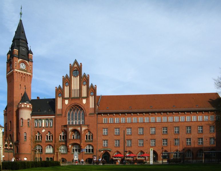
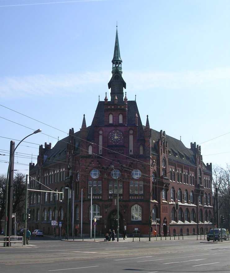
Barnim District
- District in Brandenburg, Germany
Hiking in Barnim District
Barnim, located in Brandenburg, Germany, offers a great variety of hiking opportunities, thanks to its stunning natural landscapes, forests, and historical sites. Here are some key highlights of hiking in the Barnim region:...
- Country:
- Licence Plate Code: EW; BER; BAR
- Coordinates: 52° 50' 0" N, 13° 45' 0" E
- GPS tracks (wikiloc): [Link]
- AboveSeaLevel: 32 м m
- Area: 1.49 sq km
- Population: 173193
- Web site: [Link]
Oberhavel District
- district in Brandenburg state, Germany
Hiking in Oberhavel District
Oberhavel is a beautiful district located in the state of Brandenburg, Germany, known for its picturesque landscapes, lush forests, and numerous lakes. It's a fantastic destination for hiking enthusiasts. Here are some key points to consider when hiking in Oberhavel:...
- Country:
- Licence Plate Code: OHV
- Coordinates: 52° 53' 0" N, 13° 15' 0" E
- GPS tracks (wikiloc): [Link]
- AboveSeaLevel: 67 м m
- Area: 1795.77 sq km
- Population: 202162
- Web site: [Link]
Havelland District
- District in Brandenburg state, Germany
Hiking in Havelland District
Havelland, located in the Brandenburg region of Germany, offers a rich tapestry of hiking opportunities for nature enthusiasts and outdoor adventurers. Here’s what you can expect when hiking in this picturesque district:...
- Country:
- Licence Plate Code: HVL
- Coordinates: 52° 38' 0" N, 12° 38' 0" E
- GPS tracks (wikiloc): [Link]
- AboveSeaLevel: 32 м m
- Area: 1717.00 sq km
- Population: 153294
- Web site: [Link]


Potsdam-Mittelmark District
- district in Brandenburg state, Germany
Hiking in Potsdam-Mittelmark District
Potsdam-Mittelmark, located in the state of Brandenburg, Germany, offers a rich variety of hiking opportunities amidst picturesque landscapes and historical sites. Here are some key points to consider when hiking in this beautiful region:...
- Country:
- Capital: Bad Belzig
- Postal Code: 14806
- Licence Plate Code: PM
- Coordinates: 52° 13' 10" N, 12° 40' 30" E
- GPS tracks (wikiloc): [Link]
- AboveSeaLevel: 40 м m
- Population: 204388
- Web site: [Link]


Teltow-Fläming District
- district in Brandenburg state, Germany
Hiking in Teltow-Fläming District
Teltow-Fläming is a picturesque region in Germany, located just south of Berlin. Known for its diverse landscapes, charming villages, and rich history, it offers a range of hiking opportunities suitable for varying skill levels. Here are some key aspects to consider when hiking in Teltow-Fläming:...
- Country:
- Capital: Luckenwalde
- Licence Plate Code: TF
- Coordinates: 52° 5' 0" N, 13° 18' 0" E
- GPS tracks (wikiloc): [Link]
- Population: 160448
- Web site: [Link]
Dahme-Spreewald District
- district in Brandenburg, Germany
Hiking in Dahme-Spreewald District
Dahme-Spreewald, located in Brandenburg, Germany, offers stunning landscapes, rich biodiversity, and a variety of hiking trails that cater to both casual walkers and experienced hikers. Here are some key points to consider when hiking in this beautiful region:...
- Country:
- Licence Plate Code: LDS
- Coordinates: 52° 2' 0" N, 13° 54' 0" E
- GPS tracks (wikiloc): [Link]
- AboveSeaLevel: 46 м m
- Area: 2.26 sq km
- Population: 160314
- Web site: [Link]


Oder-Spree District
- District in Brandenburg state, Germany
Hiking in Oder-Spree District
The Oder-Spree region in Germany offers a variety of hiking opportunities set in a picturesque landscape of lakes, rivers, and forests. Here are some key points about hiking in this area:...
- Country:
- Capital: Beeskow
- Licence Plate Code: LOS
- Coordinates: 52° 13' 0" N, 14° 17' 0" E
- GPS tracks (wikiloc): [Link]
- AboveSeaLevel: 60 м m
- Area: 2242.00 sq km
- Population: 177047
- Web site: [Link]
Märkisch-Oderland District
- District of Brandenburg state, Germany
Hiking in Märkisch-Oderland District
Märkisch-Oderland, located in the state of Brandenburg, Germany, offers a diverse and captivating environment for hiking enthusiasts. The region is characterized by its scenic landscapes, which include forests, lakes, rivers, and rolling hills....
- Country:
- Licence Plate Code: SRB; SEE; MOL; FRW
- Coordinates: 52° 38' 0" N, 14° 8' 0" E
- GPS tracks (wikiloc): [Link]
- AboveSeaLevel: 9 м m
- Area: 2127.99 sq km
- Population: 186925
- Web site: [Link]


Stahnsdorf
- municipality in Brandenburg, Germany
Hiking in Stahnsdorf
Stahnsdorf, located in Brandenburg, Germany, is a charming area known for its scenic beauty and proximity to Berlin. While it may not be as widely recognized as some of the larger national parks, it offers some excellent opportunities for hiking and enjoying nature....
- Country:
- Postal Code: 14532
- Local Dialing Code: 03329
- Licence Plate Code: PM
- Coordinates: 52° 23' 32" N, 13° 13' 0" E
- GPS tracks (wikiloc): [Link]
- AboveSeaLevel: 44 м m
- Area: 49.07 sq km
- Population: 15270
- Web site: [Link]