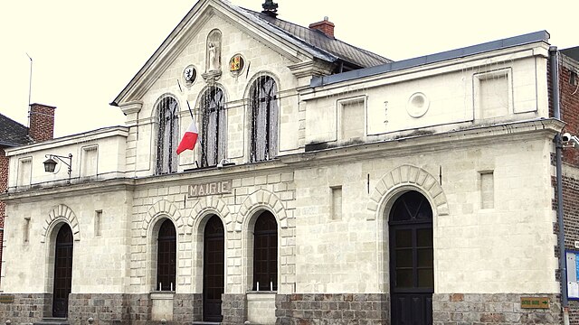
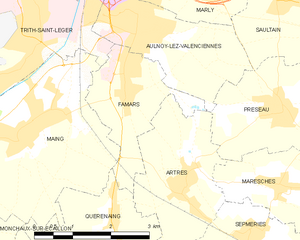
Famars (Famars)
- commune in Nord, France
- Country:

- Postal Code: 59300
- Coordinates: 50° 18' 56" N, 3° 31' 9" E


- GPS tracks (wikiloc): [Link]
- Area: 4.73 sq km
- Population: 2488
- Web site: http://www.famars.fr
- Wikipedia en: wiki(en)
- Wikipedia: wiki(fr)
- Wikidata storage: Wikidata: Q665618
- Wikipedia Commons Category: [Link]
- Freebase ID: [/m/03qfgvy]
- Freebase ID: [/m/03qfgvy]
- GeoNames ID: Alt: [3019080]
- GeoNames ID: Alt: [3019080]
- SIREN number: [215902214]
- SIREN number: [215902214]
- BnF ID: [15266796p]
- BnF ID: [15266796p]
- VIAF ID: Alt: [240047827]
- VIAF ID: Alt: [240047827]
- GND ID: Alt: [4324145-1]
- GND ID: Alt: [4324145-1]
- MusicBrainz area ID: [bdfc3b28-5b93-414b-b5af-284097f88dca]
- MusicBrainz area ID: [bdfc3b28-5b93-414b-b5af-284097f88dca]
- Digital Atlas of the Roman Empire ID: [2455]
- Digital Atlas of the Roman Empire ID: [2455]
- INSEE municipality code: 59221
- INSEE municipality code: 59221
Shares border with regions:


Aulnoy-lez-Valenciennes
- commune in Nord, France
- Country:

- Postal Code: 59300
- Coordinates: 50° 19' 53" N, 3° 31' 48" E


- GPS tracks (wikiloc): [Link]
- AboveSeaLevel: 37 м m
- Area: 6.12 sq km
- Population: 7339
- Web site: [Link]


Trith-Saint-Léger
- commune in Nord, France
- Country:

- Postal Code: 59125
- Coordinates: 50° 19' 32" N, 3° 29' 9" E


- GPS tracks (wikiloc): [Link]
- Area: 6.87 sq km
- Population: 6290
- Web site: [Link]


Maing
- commune in Nord, France
- Country:

- Postal Code: 59233
- Coordinates: 50° 18' 32" N, 3° 29' 9" E


- GPS tracks (wikiloc): [Link]
- Area: 11.68 sq km
- Population: 4063


Artres
- commune in Nord, France
- Country:

- Postal Code: 59269
- Coordinates: 50° 17' 36" N, 3° 32' 25" E


- GPS tracks (wikiloc): [Link]
- Area: 6.55 sq km
- Population: 1049


Quérénaing
- commune in Nord, France
- Country:

- Postal Code: 59269
- Coordinates: 50° 17' 13" N, 3° 30' 49" E


- GPS tracks (wikiloc): [Link]
- Area: 4.32 sq km
- Population: 925
