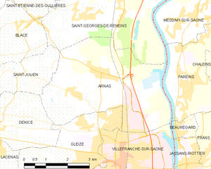
Fareins (Fareins)
- commune in Ain, France
- Country:

- Postal Code: 01480
- Coordinates: 46° 1' 10" N, 4° 45' 42" E


- GPS tracks (wikiloc): [Link]
- Area: 8.22 sq km
- Population: 2192
- Web site: http://www.fareins.com
- Wikipedia en: wiki(en)
- Wikipedia: wiki(fr)
- Wikidata storage: Wikidata: Q652837
- Wikipedia Commons Category: [Link]
- Wikipedia Commons Maps Category: [Link]
- Freebase ID: [/m/03h1mg6]
- Freebase ID: [/m/03h1mg6]
- Freebase ID: [/m/03h1mg6]
- GeoNames ID: Alt: [6424524]
- GeoNames ID: Alt: [6424524]
- GeoNames ID: Alt: [6424524]
- SIREN number: [210101572]
- SIREN number: [210101572]
- SIREN number: [210101572]
- VIAF ID: Alt: [241228200]
- VIAF ID: Alt: [241228200]
- VIAF ID: Alt: [241228200]
- PACTOLS thesaurus ID: [pcrt3EKtfLNZIg]
- PACTOLS thesaurus ID: [pcrt3EKtfLNZIg]
- PACTOLS thesaurus ID: [pcrt3EKtfLNZIg]
- INSEE municipality code: 01157
- INSEE municipality code: 01157
- INSEE municipality code: 01157
Shares border with regions:

Arnas
- commune in Rhône, France
- Country:
- Postal Code: 69400
- Coordinates: 46° 1' 25" N, 4° 42' 30" E
- GPS tracks (wikiloc): [Link]
- Area: 17.52 sq km
- Population: 3594
- Web site: [Link]

Messimy-sur-Saône
- commune in Ain, France
- Country:
- Postal Code: 01480
- Coordinates: 46° 2' 54" N, 4° 45' 53" E
- GPS tracks (wikiloc): [Link]
- Area: 5.95 sq km
- Population: 1218
- Web site: [Link]

Chaleins
- commune in Ain, France
- Country:
- Postal Code: 01480
- Coordinates: 46° 1' 50" N, 4° 48' 17" E
- GPS tracks (wikiloc): [Link]
- Area: 17 sq km
- Population: 1270
- Web site: [Link]

Beauregard
- commune in Ain, France
- Country:
- Postal Code: 01480
- Coordinates: 46° 0' 7" N, 4° 45' 5" E
- GPS tracks (wikiloc): [Link]
- Area: 0.94 sq km
- Population: 889
- Web site: [Link]


Saint-Georges-de-Reneins
- commune in Rhône, France
- Country:
- Postal Code: 69830
- Coordinates: 46° 3' 43" N, 4° 43' 18" E
- GPS tracks (wikiloc): [Link]
- Area: 27.49 sq km
- Population: 4359
- Web site: [Link]


Frans
- commune in Ain, France
- Country:
- Postal Code: 01480
- Coordinates: 45° 59' 29" N, 4° 46' 26" E
- GPS tracks (wikiloc): [Link]
- Area: 7.98 sq km
- Population: 2265
- Web site: [Link]