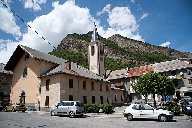
Faucon-de-Barcelonnette (Faucon-de-Barcelonnette)
- commune in Alpes-de-Haute-Provence, France
 Hiking in Faucon-de-Barcelonnette
Faucon-de-Barcelonnette is a charming village located in the Alpes-de-Haute-Provence region of France, surrounded by stunning landscapes that are perfect for hiking enthusiasts. The area features a variety of trails suitable for different skill levels, ranging from easy walks to more challenging treks, making it an excellent destination for hikers of all experiences.
Hiking Trails and Highlights
-
Scenic Views: The hikes around Faucon-de-Barcelonnette offer breathtaking views of the mountains, valleys, and the Ubaye River. Many trails provide opportunities to catch glimpses of local wildlife and diverse flora.
-
Cirque de Morgon: This is a popular hiking destination near the village. The trails lead through magnificent natural scenery, including rock formations and panoramic vistas.
-
GR5 Trail: The Grande Randonnée (GR) 5 is a long-distance hike that passes through this area. Portions of the trail are suitable for experienced hikers who enjoy multi-day trekking experiences.
-
Local Flora and Fauna: Along the hiking paths, you might encounter unique species of plants and animals native to the region, contributing to the area’s biodiversity.
-
Historical and Cultural Elements: Some trails may also lead to historical sites like old churches, chapels, or buildings that reflect the rich culture and history of the region.
Tips for Hiking in Faucon-de-Barcelonnette
-
Plan Your Route: Before heading out, familiarize yourself with the trails and plan your route according to your fitness level and the time you have available.
-
Check Weather Conditions: The weather in the mountains can be unpredictable, so it’s essential to check forecasts and prepare accordingly.
-
Bring Essentials: Carry enough water, snacks, and a first-aid kit. Good hiking shoes and appropriate clothing for varying temperatures are also crucial.
-
Respect the Environment: Follow Leave No Trace principles to protect the natural beauty of the area. Stick to marked trails to minimize your impact.
-
Local Guidance: If you're unfamiliar with the area or want to enhance your hiking experience, consider joining a guided hike with a local expert who can provide insights into the natural and cultural significance of the region.
Overall, hiking in Faucon-de-Barcelonnette can be a rewarding experience, showcasing the natural beauty of the French Alps while offering a chance to explore the charming village and its surroundings. Enjoy your hike!
- Country:

- Postal Code: 04400
- Coordinates: 44° 23' 37" N, 6° 40' 42" E


- GPS tracks (wikiloc): [Link]
- Area: 17.42 sq km
- Population: 303
- Web site: http://www.faucondebarcelonnette.fr
- Wikipedia en: wiki(en)
- Wikipedia: wiki(fr)
- Wikidata storage: Wikidata: Q1112946
- Wikipedia Commons Category: [Link]
- Freebase ID: [/m/03m7wmd]
- Freebase ID: [/m/03m7wmd]
- GeoNames ID: Alt: [3018969]
- GeoNames ID: Alt: [3018969]
- SIREN number: [210400867]
- SIREN number: [210400867]
- PACTOLS thesaurus ID: [pcrtxbHYfE3hUu]
- PACTOLS thesaurus ID: [pcrtxbHYfE3hUu]
- INSEE municipality code: 04086
- INSEE municipality code: 04086
Shares border with regions:

Saint-Pons
- commune in Alpes-de-Haute-Provence, France
Hiking in Saint-Pons
Saint-Pons, located in the Alpes-de-Haute-Provence region of France, is a fantastic destination for hiking enthusiasts. Known for its stunning natural scenery, diverse landscapes, and relatively mild climate, it offers a variety of trails suitable for different skill levels. Here are some key features and tips for hiking in this area:...
- Country:
- Postal Code: 04400
- Coordinates: 44° 23' 32" N, 6° 37' 40" E
- GPS tracks (wikiloc): [Link]
- Area: 32.06 sq km
- Population: 647
- Web site: [Link]

Enchastrayes
- commune in Alpes-de-Haute-Provence, France
Hiking in Enchastrayes
Enchastrayes is a stunning area located in the French Alps, near the town of Barcelonnette in the Alpes-de-Haute-Provence region. This area is known for its beautiful landscapes, diverse flora and fauna, and a variety of hiking trails suitable for different skill levels....
- Country:
- Postal Code: 04400
- Coordinates: 44° 22' 3" N, 6° 41' 43" E
- GPS tracks (wikiloc): [Link]
- Area: 44.19 sq km
- Population: 391

Barcelonnette
- commune in Alpes-de-Haute-Provence, France
Hiking in Barcelonnette
Barcelonnette, nestled in the Ubaye Valley in the French Alps, is known for its stunning landscapes, charming architecture, and vibrant outdoor activities, including hiking. Here’s a guide to hiking in this beautiful area:...
- Country:
- Postal Code: 04400
- Coordinates: 44° 23' 9" N, 6° 39' 9" E
- GPS tracks (wikiloc): [Link]
- Area: 16.42 sq km
- Population: 2622
- Web site: [Link]

Jausiers
- commune in Alpes-de-Haute-Provence, France
Hiking in Jausiers
Jausiers is a charming village located in the Alpes-de-Haute-Provence region of France. It's nestled in the heart of the French Alps and offers attractive hiking opportunities for outdoor enthusiasts. Here are some highlights about hiking in and around Jausiers:...
- Country:
- Postal Code: 04850
- Coordinates: 44° 25' 4" N, 6° 43' 50" E
- GPS tracks (wikiloc): [Link]
- Area: 107.73 sq km
- Population: 1133
- Web site: [Link]
La Condamine-Châtelard
- commune in Alpes-de-Haute-Provence, France
Hiking in La Condamine-Châtelard
La Condamine-Châtelard is a picturesque village located in the Alpes-Maritimes region of France, near the Italian border. It's a part of the larger area of the French Alps, known for its stunning natural landscapes and outdoor recreational opportunities, including hiking....
- Country:
- Postal Code: 04530
- Coordinates: 44° 27' 29" N, 6° 44' 45" E
- GPS tracks (wikiloc): [Link]
- AboveSeaLevel: 1305 м m
- Area: 56.08 sq km
- Population: 172