Faurilles (Faurilles)

- commune in Dordogne, France
- Country:

- Postal Code: 24560
- Coordinates: 44° 42' 12" N, 0° 41' 40" E


- GPS tracks (wikiloc): [Link]
- Area: 4.3 sq km
- Population: 35
- Wikipedia en: wiki(en)
- Wikipedia: wiki(fr)
- Wikidata storage: Wikidata: Q1079561
- Wikipedia Commons Category: [Link]
- Freebase ID: [/m/03mg62j]
- Freebase ID: [/m/03mg62j]
- GeoNames ID: Alt: [3018938]
- GeoNames ID: Alt: [3018938]
- SIREN number: [212401764]
- SIREN number: [212401764]
- BnF ID: [15251824p]
- BnF ID: [15251824p]
- INSEE municipality code: 24176
- INSEE municipality code: 24176
Shares border with regions:


Sainte-Sabine-Born
- former commune in Dordogne, France
- Country:
- Postal Code: 24440
- Coordinates: 44° 42' 0" N, 0° 45' 0" E
- GPS tracks (wikiloc): [Link]
- AboveSeaLevel: 133 м m
- Area: 23.97 sq km
- Population: 363

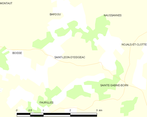
Saint-Léon-d'Issigeac
- commune in Dordogne, France
- Country:
- Postal Code: 24560
- Coordinates: 44° 43' 12" N, 0° 41' 28" E
- GPS tracks (wikiloc): [Link]
- Area: 5.68 sq km
- Population: 109

Boisse
- commune in Dordogne, France
- Country:
- Postal Code: 24560
- Coordinates: 44° 42' 57" N, 0° 39' 15" E
- GPS tracks (wikiloc): [Link]
- Area: 16.58 sq km
- Population: 248


Sainte-Radegonde
- commune in Dordogne, France
- Country:
- Postal Code: 24560
- Coordinates: 44° 41' 25" N, 0° 40' 42" E
- GPS tracks (wikiloc): [Link]
- AboveSeaLevel: 100 м m
- Area: 4.81 sq km
- Population: 62