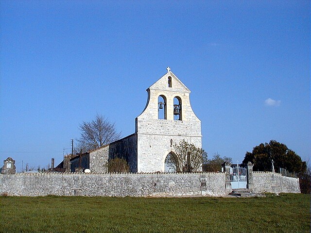
Sainte-Radegonde (Sainte-Radegonde)

- commune in Dordogne, France
- Country:

- Postal Code: 24560
- Coordinates: 44° 41' 25" N, 0° 40' 42" E


- GPS tracks (wikiloc): [Link]
- AboveSeaLevel: 100 м m
- Area: 4.81 sq km
- Population: 62
- Wikipedia en: wiki(en)
- Wikipedia: wiki(fr)
- Wikidata storage: Wikidata: Q202773
- Wikipedia Commons Category: [Link]
- Freebase ID: [/m/03mhlqr]
- Freebase ID: [/m/03mhlqr]
- GeoNames ID: Alt: [6616191]
- GeoNames ID: Alt: [6616191]
- SIREN number: [212404925]
- SIREN number: [212404925]
- BnF ID: [15252135n]
- BnF ID: [15252135n]
- INSEE municipality code: 24492
- INSEE municipality code: 24492
Shares border with regions:
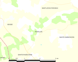
Faurilles
- commune in Dordogne, France
- Country:
- Postal Code: 24560
- Coordinates: 44° 42' 12" N, 0° 41' 40" E
- GPS tracks (wikiloc): [Link]
- Area: 4.3 sq km
- Population: 35


Mazières-Naresse
- commune in Lot-et-Garonne, France
- Country:
- Postal Code: 47210
- Coordinates: 44° 39' 11" N, 0° 42' 16" E
- GPS tracks (wikiloc): [Link]
- Area: 8.93 sq km
- Population: 130


Doudrac
- commune in Lot-et-Garonne, France
- Country:
- Postal Code: 47210
- Coordinates: 44° 39' 31" N, 0° 40' 54" E
- GPS tracks (wikiloc): [Link]
- Area: 8.61 sq km
- Population: 84


Cavarc
- commune in Lot-et-Garonne, France
- Country:
- Postal Code: 47330
- Coordinates: 44° 41' 24" N, 0° 38' 30" E
- GPS tracks (wikiloc): [Link]
- Area: 11.99 sq km
- Population: 161