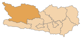
Feldkirchen District (Bezirk Feldkirchen)
- district of Austria
 Hiking in Feldkirchen District
Feldkirchen District, located in the state of Carinthia in Austria, is a beautiful area for hiking enthusiasts. The district features a diverse landscape with rolling hills, lush forests, and scenic lakes, ideal for various skill levels of hikers. Here are some key highlights and popular trails in the Feldkirchen District:
Hiking Trails
-
Nockberge Biosphere Reserve: This area is part of the Nock Mountains and offers numerous trails with stunning panoramic views of the Alps. The paths range from easy walks to challenging hikes, making it suitable for all experience levels. Keep an eye out for diverse wildlife and unique flora.
-
Millstätter See: The trails around Millstätter Lake provide breathtaking views and are great for leisurely walks. You can find paths that take you around the lake or lead to higher vantage points for a more rewarding experience.
-
Kärntner Nockalmstraße: This scenic road features access to several hiking trails where you can experience the unique landscapes and enjoy breathtaking viewpoints. The Nockalms are particularly famous for their distinctive rounded mountain shapes.
-
Selce-Cahole Nature Trail: A more accessible trail perfect for families and beginners, this trail allows hikers to immerse themselves in nature while enjoying educational signs about local flora and fauna.
Tips for Hiking in Feldkirchen District
- Local Weather: Always check the weather forecast before heading out, as conditions can change rapidly in the mountains.
- Gear: Wear appropriate footwear and carry necessary gear such as a map, water, snacks, and a first-aid kit.
- Trail Markings: Follow marked trails and signs to ensure safety. Many trails in Austria are well-marked with signs indicating the difficulty and estimated walking time.
- Local Regulations: Respect nature and local wildlife. Make sure to adhere to any specific regulations that might be in place to protect the area.
Best Time to Hike
The best time for hiking in Feldkirchen District is typically from late spring to early autumn (May to October) when the weather is milder and the trails are more accessible. However, winter hiking is also popular in certain regions for those who enjoy snowshoeing or winter trekking.
Whether you are looking for a peaceful stroll by a lake or a more challenging mountain hike, Feldkirchen District offers numerous options to explore the beautiful natural landscapes of Carinthia. Happy hiking!
- Country:

- Licence Plate Code: FE
- Coordinates: 46° 45' 0" N, 14° 2' 13" E


- GPS tracks (wikiloc): [Link]
- AboveSeaLevel: 544 м m
- Web site: http://www.verwaltung.ktn.gv.at/cgi-bin/evoweb.dll/web/akl/343_DE?
- Wikipedia en: wiki(en)
- Wikipedia: wiki(de)
- Wikidata storage: Wikidata: Q665735
- Wikipedia Commons Category: [Link]
- Freebase ID: [/m/0dm7k2]
- GeoNames ID: Alt: [6459021]
- VIAF ID: Alt: [245438083]
- GND ID: Alt: [4996734-4]
- archINFORM location ID: [14648]
Includes regions:

Gnesau
- municipality in Austria
Hiking in Gnesau
Gnesau, located in the picturesque Carinthia region of Austria, is a wonderful destination for hiking enthusiasts. This beautiful area is surrounded by stunning natural landscapes, including mountains, lakes, and dense forests. Here’s what you need to know about hiking in Gnesau:...
- Country:
- Postal Code: 9563
- Local Dialing Code: 0 42 78
- Licence Plate Code: FE
- Coordinates: 46° 46' 30" N, 13° 58' 0" E
- GPS tracks (wikiloc): [Link]
- AboveSeaLevel: 973 м m
- Area: 78.68 sq km
- Population: 1034
- Web site: [Link]

Feldkirchen in Kärnten
- municipality in Austria
Hiking in Feldkirchen in Kärnten
Feldkirchen in Kärnten, located in the Carinthia region of Austria, offers a beautiful and diverse hiking experience for outdoor enthusiasts. Nestled amidst picturesque landscapes, this area is known for its stunning natural scenery, including rolling hills, lush forests, and clear lakes....
- Country:
- Postal Code: 9560
- Local Dialing Code: 04276
- Licence Plate Code: FE
- Coordinates: 46° 43' 25" N, 14° 5' 31" E
- GPS tracks (wikiloc): [Link]
- AboveSeaLevel: 554 м m
- Area: 77.49 sq km
- Population: 14198
- Web site: [Link]

Ossiach
- municipality in Austria
Hiking in Ossiach
Ossiach, located in the Carinthia region of Austria, is a picturesque village that lies near the shores of Lake Ossiach. The area is surrounded by stunning natural landscapes, making it an ideal destination for hiking enthusiasts. Here are some highlights about hiking in Ossiach:...
- Country:
- Postal Code: 9570
- Local Dialing Code: 0 42 43
- Licence Plate Code: FE
- Coordinates: 46° 40' 30" N, 13° 58' 56" E
- GPS tracks (wikiloc): [Link]
- AboveSeaLevel: 510 м m
- Area: 17.41 sq km
- Population: 785
- Web site: [Link]

Reichenau
- municipality in Austria
Hiking in Reichenau
Reichenau is a beautiful area in Carinthia, Austria, known for its stunning landscapes, rich cultural history, and excellent hiking opportunities. The region is characterized by its picturesque lakes, rolling hills, and panoramic alpine views, making it a fantastic destination for outdoor enthusiasts....
- Country:
- Postal Code: 9564, 9565
- Local Dialing Code: 04275
- Licence Plate Code: FE
- Coordinates: 46° 51' 15" N, 13° 53' 35" E
- GPS tracks (wikiloc): [Link]
- AboveSeaLevel: 1095 м m
- Area: 113.99 sq km
- Population: 1822
- Web site: [Link]
Glanegg
- municipality in Austria
Hiking in Glanegg
Glanegg, located in Carinthia, Austria, offers a variety of stunning hiking opportunities amidst beautiful landscapes. This region is characterized by rolling hills, rich forests, and picturesque views, making it ideal for nature lovers and outdoor enthusiasts. Here are some highlights and tips for hiking in Glanegg:...
- Country:
- Postal Code: 9555
- Local Dialing Code: 04277
- Licence Plate Code: FE
- Coordinates: 46° 42' 49" N, 14° 12' 23" E
- GPS tracks (wikiloc): [Link]
- AboveSeaLevel: 490 м m
- Area: 25.17 sq km
- Population: 1869
- Web site: [Link]

Albeck
- municipality in Austria
Hiking in Albeck
Albeck, situated in Carinthia, Austria, is a charming village nestled in a picturesque landscape that offers a variety of hiking opportunities. With its beautiful rolling hills, forests, and proximity to the Nockberge mountain range, Albeck is an excellent destination for hiking enthusiasts....
- Country:
- Local Dialing Code: 04279
- Licence Plate Code: FE
- Coordinates: 46° 49' 0" N, 14° 6' 0" E
- GPS tracks (wikiloc): [Link]
- AboveSeaLevel: 837 м m
- Area: 99.32 sq km
- Population: 995
- Web site: [Link]
Sankt Urban
- municipality in Austria
Hiking in Sankt Urban
Sankt Urban is a beautiful region located in Austria, known for its stunning landscapes, lush forests, and picturesque trails. It offers a variety of hiking opportunities that cater to all skill levels, from beginners to experienced hikers. Here’s an overview of what you can expect when hiking in Sankt Urban:...
- Country:
- Postal Code: 9554
- Local Dialing Code: 0 42 77
- Licence Plate Code: FE
- Coordinates: 46° 45' 1" N, 14° 10' 9" E
- GPS tracks (wikiloc): [Link]
- AboveSeaLevel: 792 м m
- Area: 27.27 sq km
- Population: 1544
- Web site: [Link]
Steindorf am Ossiacher See
- municipality in Austria
Hiking in Steindorf am Ossiacher See
Steindorf am Ossiacher See, located by the beautiful Ossiacher Lake in Austria, offers a variety of hiking opportunities suitable for different skill levels amidst stunning natural landscapes. The region is characterized by its picturesque views, lush forests, and scenic lakeside trails....
- Country:
- Local Dialing Code: 0 42 43
- Licence Plate Code: FE
- Coordinates: 46° 41' 54" N, 14° 0' 22" E
- GPS tracks (wikiloc): [Link]
- AboveSeaLevel: 510 м m
- Area: 29.6 sq km
- Population: 3771
- Web site: [Link]

Steuerberg
- municipality in Austria
Hiking in Steuerberg
Steuerberg, located in the scenic region of Austria, offers a variety of hiking opportunities suitable for different skill levels. The area is characterized by its picturesque landscapes, lush forests, and impressive mountain views. Here are some key points to consider when hiking in Steuerberg:...
- Country:
- Postal Code: 9560
- Local Dialing Code: 04271
- Licence Plate Code: FE
- Coordinates: 46° 47' 0" N, 14° 7' 0" E
- GPS tracks (wikiloc): [Link]
- AboveSeaLevel: 782 м m
- Area: 32.77 sq km
- Population: 1662
- Web site: [Link]

Himmelberg
- municipality in Austria
Hiking in Himmelberg
Himmelberg, located in the scenic region of Carinthia, Austria, is a wonderful destination for hikers of all levels. The area is characterized by its beautiful landscapes, lush forests, and stunning mountain views. Here are some key points to consider when hiking in Himmelberg:...
- Country:
- Postal Code: 9562
- Local Dialing Code: 0 42 76
- Licence Plate Code: FE
- Coordinates: 46° 44' 54" N, 14° 2' 13" E
- GPS tracks (wikiloc): [Link]
- AboveSeaLevel: 672 м m
- Area: 56.85 sq km
- Population: 2287
- Web site: [Link]
Shares border with regions:

Spittal an der Drau District
- administrative district in Carinthia, Austria
Hiking in Spittal an der Drau District
Spittal an der Drau District, located in the Carinthia region of Austria, is a stunning destination for hiking enthusiasts. Surrounded by the dramatic landscapes of the Alps and lush valleys, this area offers a diverse range of hiking trails suitable for various skill levels, from gentle walks to challenging mountain hikes....
- Country:
- Licence Plate Code: SP
- Coordinates: 46° 49' 59" N, 13° 18' 22" E
- GPS tracks (wikiloc): [Link]
- AboveSeaLevel: 922 м m
- Area: 2764 sq km
- Population: 76248
- Web site: [Link]