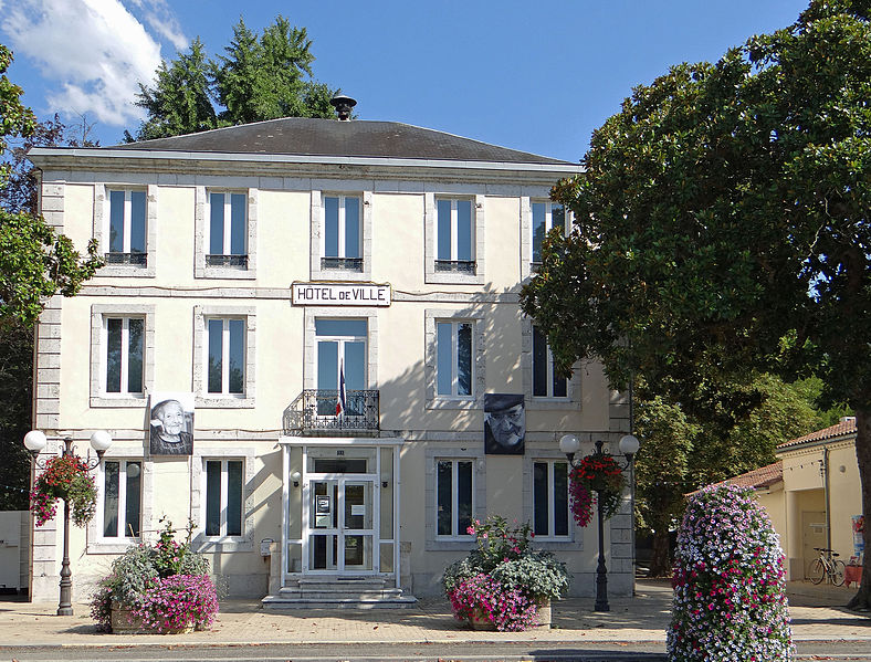
Feugarolles (Feugarolles)

- commune in Lot-et-Garonne, France
- Country:

- Postal Code: 47230
- Coordinates: 44° 13' 16" N, 0° 20' 49" E


- GPS tracks (wikiloc): [Link]
- Area: 23.82 sq km
- Population: 978
- Web site: http://www.feugarolles47.fr
- Wikipedia en: wiki(en)
- Wikipedia: wiki(fr)
- Wikidata storage: Wikidata: Q1108541
- Wikipedia Commons Category: [Link]
- Freebase ID: [/m/03qm1gd]
- GeoNames ID: Alt: [6449331]
- SIREN number: [214700973]
- BnF ID: [15261178w]
- INSEE municipality code: 47097
Shares border with regions:


Port-Sainte-Marie
- commune in Lot-et-Garonne, France
- Country:
- Postal Code: 47130
- Coordinates: 44° 15' 2" N, 0° 23' 50" E
- GPS tracks (wikiloc): [Link]
- Area: 18.94 sq km
- Population: 1936
- Web site: [Link]

Nérac
- commune in Lot-et-Garonne, France
- Country:
- Postal Code: 47600
- Coordinates: 44° 8' 10" N, 0° 20' 22" E
- GPS tracks (wikiloc): [Link]
- AboveSeaLevel: 71 м m
- Area: 62.68 sq km
- Population: 6969
- Web site: [Link]

Lavardac
- commune in Lot-et-Garonne, France
- Country:
- Postal Code: 47230
- Coordinates: 44° 10' 37" N, 0° 17' 49" E
- GPS tracks (wikiloc): [Link]
- Area: 15.1 sq km
- Population: 2230

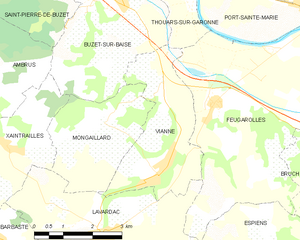
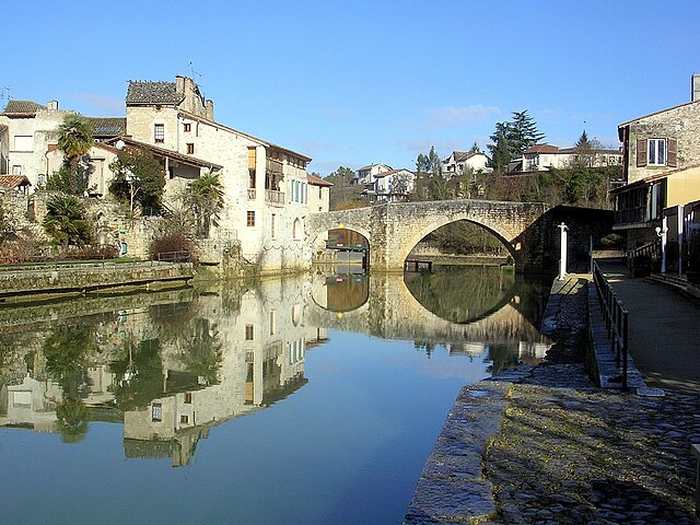
Vianne
- commune in Lot-et-Garonne, France
- Country:
- Postal Code: 47230
- Coordinates: 44° 11' 49" N, 0° 19' 16" E
- GPS tracks (wikiloc): [Link]
- Area: 9.82 sq km
- Population: 1029
- Web site: [Link]
Thouars-sur-Garonne
- commune in Lot-et-Garonne, France
- Country:
- Postal Code: 47230
- Coordinates: 44° 15' 9" N, 0° 20' 8" E
- GPS tracks (wikiloc): [Link]
- Area: 4.03 sq km
- Population: 209


Bruch
- commune in Lot-et-Garonne, France
- Country:
- Postal Code: 47130
- Coordinates: 44° 12' 19" N, 0° 24' 42" E
- GPS tracks (wikiloc): [Link]
- Area: 15.89 sq km
- Population: 762
- Web site: [Link]


Espiens
- commune in Lot-et-Garonne, France
- Country:
- Postal Code: 47600
- Coordinates: 44° 10' 8" N, 0° 22' 39" E
- GPS tracks (wikiloc): [Link]
- Area: 17.48 sq km
- Population: 382
Saint-Laurent
- commune in Lot-et-Garonne, France
- Country:
- Postal Code: 47130
- Coordinates: 44° 14' 49" N, 0° 24' 0" E
- GPS tracks (wikiloc): [Link]
- AboveSeaLevel: 31 м m
- Area: 4.4 sq km
- Population: 520