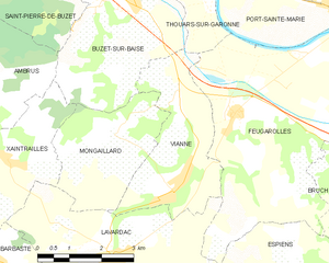
canton of Lavardac (canton de Lavardac)
- canton of France
- Country:

- Capital: Lavardac
- Coordinates: 44° 11' 0" N, 0° 18' 0" E


- GPS tracks (wikiloc): [Link]
- Population: 13554
- Wikipedia en: wiki(en)
- Wikipedia: wiki(fr)
- Wikidata storage: Wikidata: Q1485246
- Library of Congress authority ID: Alt: [nb2006000504]
- INSEE canton code: [4711]
Includes regions:


Montesquieu
- commune in Lot-et-Garonne, France
- Country:

- Postal Code: 47130
- Coordinates: 44° 12' 6" N, 0° 26' 15" E


- GPS tracks (wikiloc): [Link]
- Area: 25.53 sq km
- Population: 771


Mongaillard
- commune in Lot-et-Garonne, France
- Country:

- Postal Code: 47230
- Coordinates: 44° 12' 25" N, 0° 17' 37" E


- GPS tracks (wikiloc): [Link]
- Area: 8.53 sq km
- Population: 184


Feugarolles
- commune in Lot-et-Garonne, France
- Country:

- Postal Code: 47230
- Coordinates: 44° 13' 16" N, 0° 20' 49" E


- GPS tracks (wikiloc): [Link]
- Area: 23.82 sq km
- Population: 978
- Web site: [Link]


Pompiey
- commune in Lot-et-Garonne, France
- Country:

- Postal Code: 47230
- Coordinates: 44° 11' 33" N, 0° 13' 43" E


- GPS tracks (wikiloc): [Link]
- Area: 19.61 sq km
- Population: 232


Xaintrailles
- commune in Lot-et-Garonne, France
- Country:

- Postal Code: 47230
- Coordinates: 44° 12' 20" N, 0° 15' 30" E


- GPS tracks (wikiloc): [Link]
- Area: 10.26 sq km
- Population: 416


Lavardac
- commune in Lot-et-Garonne, France
- Country:

- Postal Code: 47230
- Coordinates: 44° 10' 37" N, 0° 17' 49" E


- GPS tracks (wikiloc): [Link]
- Area: 15.1 sq km
- Population: 2230


Vianne
- commune in Lot-et-Garonne, France
- Country:

- Postal Code: 47230
- Coordinates: 44° 11' 49" N, 0° 19' 16" E


- GPS tracks (wikiloc): [Link]
- Area: 9.82 sq km
- Population: 1029
- Web site: [Link]
Thouars-sur-Garonne
- commune in Lot-et-Garonne, France
- Country:

- Postal Code: 47230
- Coordinates: 44° 15' 9" N, 0° 20' 8" E


- GPS tracks (wikiloc): [Link]
- Area: 4.03 sq km
- Population: 209


Bruch
- commune in Lot-et-Garonne, France
- Country:

- Postal Code: 47130
- Coordinates: 44° 12' 19" N, 0° 24' 42" E


- GPS tracks (wikiloc): [Link]
- Area: 15.89 sq km
- Population: 762
- Web site: [Link]


Barbaste
- commune in Lot-et-Garonne, France
- Country:

- Postal Code: 47230
- Coordinates: 44° 10' 9" N, 0° 17' 11" E


- GPS tracks (wikiloc): [Link]
- Area: 38.7 sq km
- Population: 1495
- Web site: [Link]
Saint-Laurent
- commune in Lot-et-Garonne, France
- Country:

- Postal Code: 47130
- Coordinates: 44° 14' 49" N, 0° 24' 0" E


- GPS tracks (wikiloc): [Link]
- AboveSeaLevel: 31 м m
- Area: 4.4 sq km
- Population: 520
